Download
Preview
Add to list
More
12.1 km
~2 hrs 33 min
88 m
Out and Back
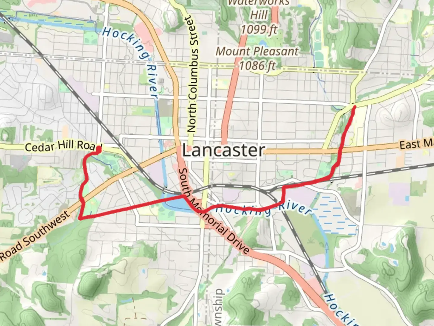
“The Lancaster Path is a scenic, easy 12 km trail through diverse landscapes and rich history in Fairfield County.”
Starting near Fairfield County, Ohio, the Lancaster Path is an inviting 12 km (approximately 7.5 miles) out-and-back trail with no significant elevation gain, making it accessible for a wide range of hikers. The trailhead is conveniently located near the intersection of State Route 33 and Coonpath Road, providing easy access whether you're arriving by car or public transport.
Getting There For those driving, ample parking is available at the trailhead. If you're using public transport, the nearest bus stop is at the Fairfield County Airport, which is about a 10-minute walk from the trailhead. From there, head south on State Route 33 and turn onto Coonpath Road to reach the starting point.
Trail Overview The Lancaster Path meanders through a mix of open fields and dense woodlands, offering a variety of landscapes to enjoy. The trail is well-marked and maintained, making navigation straightforward. For added assurance, consider using the HiiKER app to keep track of your progress and ensure you stay on course.
Points of Interest - **Fairfield County Historical Park (2 km / 1.2 miles in)**: Early into your hike, you'll pass by the Fairfield County Historical Park. This area is rich in local history, featuring several restored buildings and informative plaques that provide insight into the region's past. - **Clear Creek (4 km / 2.5 miles in)**: As you continue, you'll encounter Clear Creek, a serene spot perfect for a short break. The creek is home to various species of fish and is a popular spot for birdwatching. - **Wildflower Meadow (6 km / 3.7 miles in)**: At the halfway point, you'll find a beautiful wildflower meadow. Depending on the season, you might see a vibrant display of native flowers, attracting butterflies and other pollinators.
Flora and Fauna The trail is a haven for nature enthusiasts. In the woodlands, you'll find oak, maple, and hickory trees, providing ample shade and a cool respite during warmer months. Wildlife is abundant, with deer, rabbits, and various bird species frequently spotted along the path. Keep an eye out for red-tailed hawks and eastern bluebirds, which are common in this area.
Historical Significance Fairfield County has a rich history dating back to the early 19th century. The region was a significant agricultural hub, and remnants of old farmsteads can still be seen along the trail. Informative signs along the path provide context and stories about the early settlers and their way of life.
Preparation Tips - **Footwear**: Given the flat terrain, sturdy walking shoes or light hiking boots are sufficient. - **Water and Snacks**: There are no water sources along the trail, so bring enough water and snacks to keep you energized. - **Weather**: Check the weather forecast before heading out. The trail can become muddy after rain, so waterproof footwear might be necessary. - **Navigation**: While the trail is well-marked, using the HiiKER app can provide additional peace of mind.
Safety Considerations - **Wildlife**: While encounters with wildlife are generally safe, it's wise to keep a respectful distance from any animals you encounter. - **Trail Etiquette**: As an out-and-back trail, be mindful of other hikers, especially in narrower sections. Yield to those coming uphill and keep to the right.
The Lancaster Path offers a delightful mix of natural beauty and historical intrigue, making it a rewarding hike for those looking to explore the Fairfield County area.
What to expect?
Activity types
Comments and Reviews
User comments, reviews and discussions about the Lancaster Path, Ohio.
4.58
average rating out of 5
19 rating(s)
