Download
3D Flyover
Add to list
More
7517.4 km
~261 days
36124 m
Multi-Day
“Embark on an epic trek along the North Country Trail, a diverse American odyssey steeped in nature and history.”
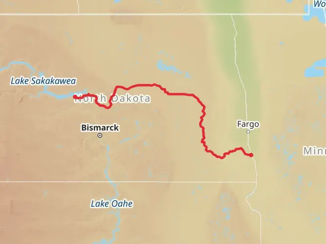
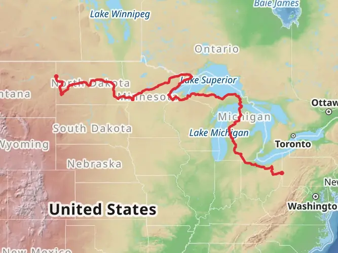
Spanning approximately 4,600 miles (7,517 kilometers) and with an elevation gain of around 118,110 feet (36,000 meters), the North Country Trail offers an epic journey through the diverse landscapes of the American Midwest and Northeast. As a point-to-point trail, it traverses eight states, starting near Mercer County, North Dakota, and stretching all the way to the eastern terminus in Crown Point, New York.
Getting to the Trailhead
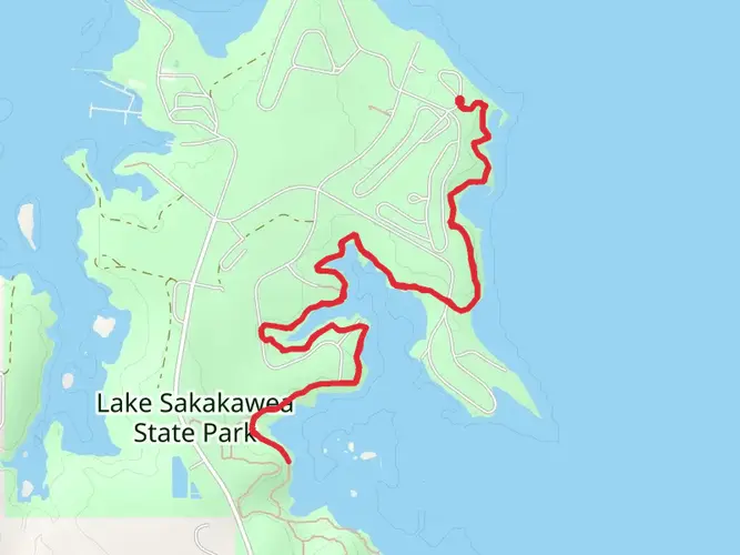
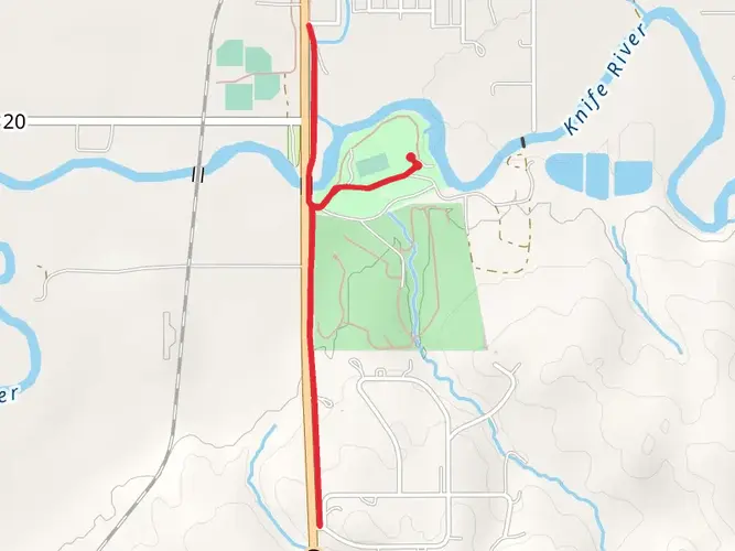
The western trailhead is accessible near the small town of Lake Sakakawea State Park, just south of Mercer County, North Dakota. Those arriving by car can navigate to the park, which serves as a significant landmark and a starting point for the trail. For those relying on public transportation, options may be limited due to the rural nature of the area, but regional bus services or shuttles from nearby cities like Bismarck could be arranged to reach the trailhead.
Trail Experience and Landmarks
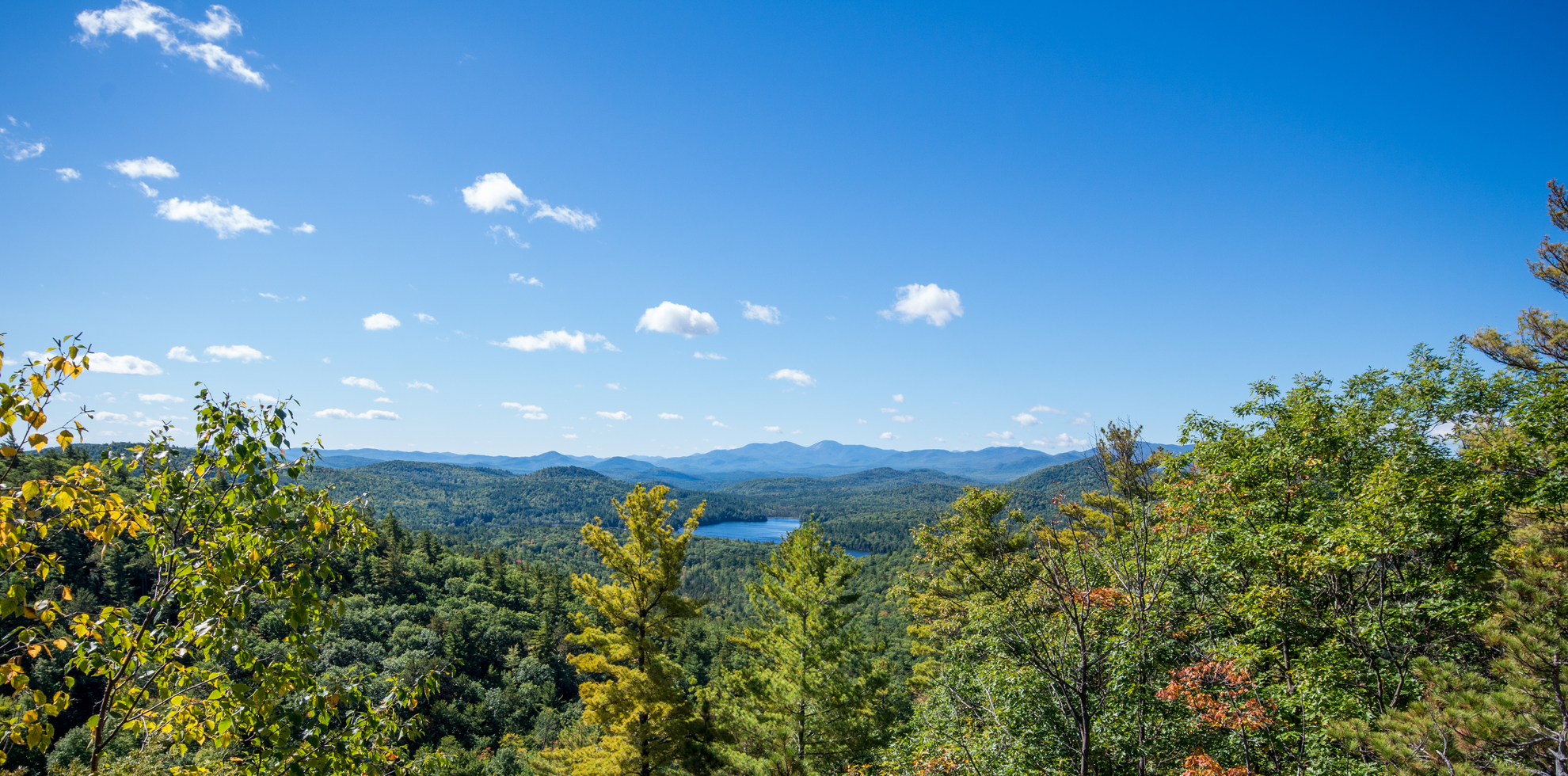
The North Country Trail offers a rich tapestry of experiences, from the rolling prairies of North Dakota to the rugged Adirondack Mountains in New York. Hikers will traverse scenic river valleys, dense forests, and expansive farmlands. Notable landmarks include the crossing of the mighty Mississippi River, the shores of the Great Lakes, and the picturesque Allegheny National Forest.
Wildlife and Nature
The trail provides an opportunity to witness a wide array of wildlife, including white-tailed deer, black bears, and a variety of bird species. The changing seasons bring about a kaleidoscope of flora, from the wildflowers of spring to the fiery foliage of autumn.
Historical Significance
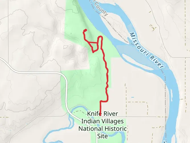
The North Country Trail passes through areas rich in American history. Hikers will encounter sites like Fort Mandan in North Dakota, where Lewis and Clark spent the winter of 1804-1805, and the remnants of the once-thriving iron industry in the Upper Peninsula of Michigan.
Navigation and Planning
Given the trail's length and complexity, thorough planning is essential. Hikers should consider using the HiiKER app for up-to-date trail information and navigation assistance. The app can help with identifying campsite locations, water sources, and resupply points along the route.
Preparation and Safety
The difficulty of the trail is estimated to be difficult, so hikers should be well-prepared with the appropriate gear and supplies. Weather conditions can vary greatly, and it's crucial to be ready for anything from intense heat to heavy snowfall, depending on the section and time of year. Always inform someone of your itinerary and check in regularly.
Trail Etiquette and Conservation
As with any trail, it's important to practice Leave No Trace principles to preserve the beauty and integrity of the environment. This includes packing out all trash, being respectful of wildlife, and being considerate of other trail users.
Whether you're a thru-hiker or a day-tripper, the North Country Trail offers a unique adventure through some of America's most beautiful and historically significant landscapes. With careful preparation and respect for the natural environment, hikers can enjoy a truly unforgettable experience on this iconic trail.

Frequently asked questions
How long is the North Country Trail from Mercer County, North Dakota to the eastern terminus?
The North Country Trail is about 7,517.37 kilometers long, or roughly 4,670 miles. From its western terminus at Lake Sakakawea State Park in Mercer County, North Dakota, it runs east across eight states to its eastern end in Vermont, making it the longest trail in the National Trails System.
Where is the western trailhead for the North Country Trail in Mercer County, North Dakota?
The western trailhead of the North Country Trail is at Lake Sakakawea State Park in Mercer County. The park is recognized as the western terminus of the trail, and the first miles connect with paths in the state park before the route continues east across North Dakota.
Is the North Country Trail in North Dakota a day hike or a thru-hike?
The North Country Trail is a multi-day point-to-point route, not a single day hike. At 7,517.37 kilometers with about 36,124 meters of total elevation gain, it is built for section hiking or long-distance backpacking, though shorter walks are possible from access points such as Lake Sakakawea State Park.
How difficult is the North Country Trail in Mercer County, North Dakota?
The North Country Trail is generally rated medium in difficulty on this Mercer County section. The challenge comes less from steep climbing at the western terminus and more from the scale of the route, changing surfaces, exposure to North Dakota weather, and the demands of a long multi-day hike.
What landmarks does the North Country Trail pass in North Dakota after leaving Mercer County?
After starting at Lake Sakakawea State Park, the North Country Trail crosses notable North Dakota landscapes including Audubon National Wildlife Refuge, Lonetree Wildlife Management Area, Lake Ashtabula Recreation Area, Fort Ransom State Park, Sheyenne State Forest, the Sheyenne River, Sheyenne National Grassland, and Fort Abercrombie State Historic Site.
Is there parking at the North Country Trail western terminus in Mercer County?
Yes. Lake Sakakawea State Park has parking and serves as the main access point for the North Country Trail western terminus. In North Dakota, some trailheads farther along the route also have parking areas used for section hikes and car shuttles, but Lake Sakakawea State Park is the key starting point in Mercer County.
Comments and Reviews
User comments, reviews and discussions about the North Country Trail, North Dakota.
4.53
average rating out of 5
107 rating(s)