Download
Preview
Add to list
More
5.6 km
~1 hrs 25 min
180 m
Out and Back
“Embark on the Lake Raleigh Southern Shore Trail for scenic views, historical sites, and diverse wildlife.”
Starting near Wake County, North Carolina, the Lake Raleigh Southern Shore Trail is an inviting 6 km (approximately 3.7 miles) out-and-back trail with an elevation gain of around 100 meters (328 feet). This trail is rated as medium difficulty, making it suitable for moderately experienced hikers.
Getting There To reach the trailhead, you can drive or use public transportation. If driving, you can park near the Lonnie Poole Golf Course, located at 1509 Main Campus Drive, Raleigh, NC 27606. For those using public transport, the nearest bus stop is at the intersection of Main Campus Drive and Varsity Drive, serviced by the GoRaleigh bus system.
Trail Navigation For navigation, it's highly recommended to use the HiiKER app, which provides detailed maps and real-time updates to ensure you stay on track.
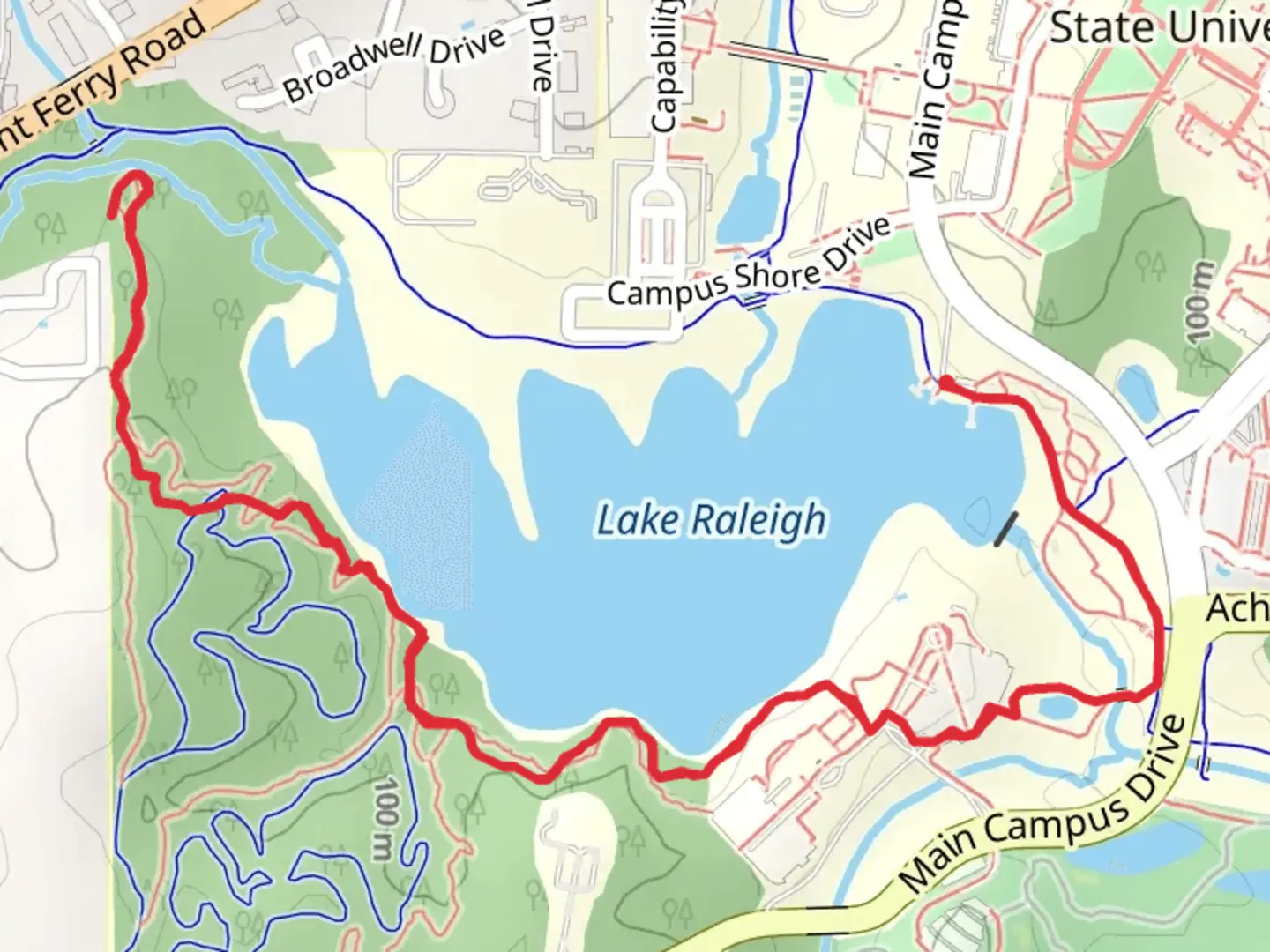
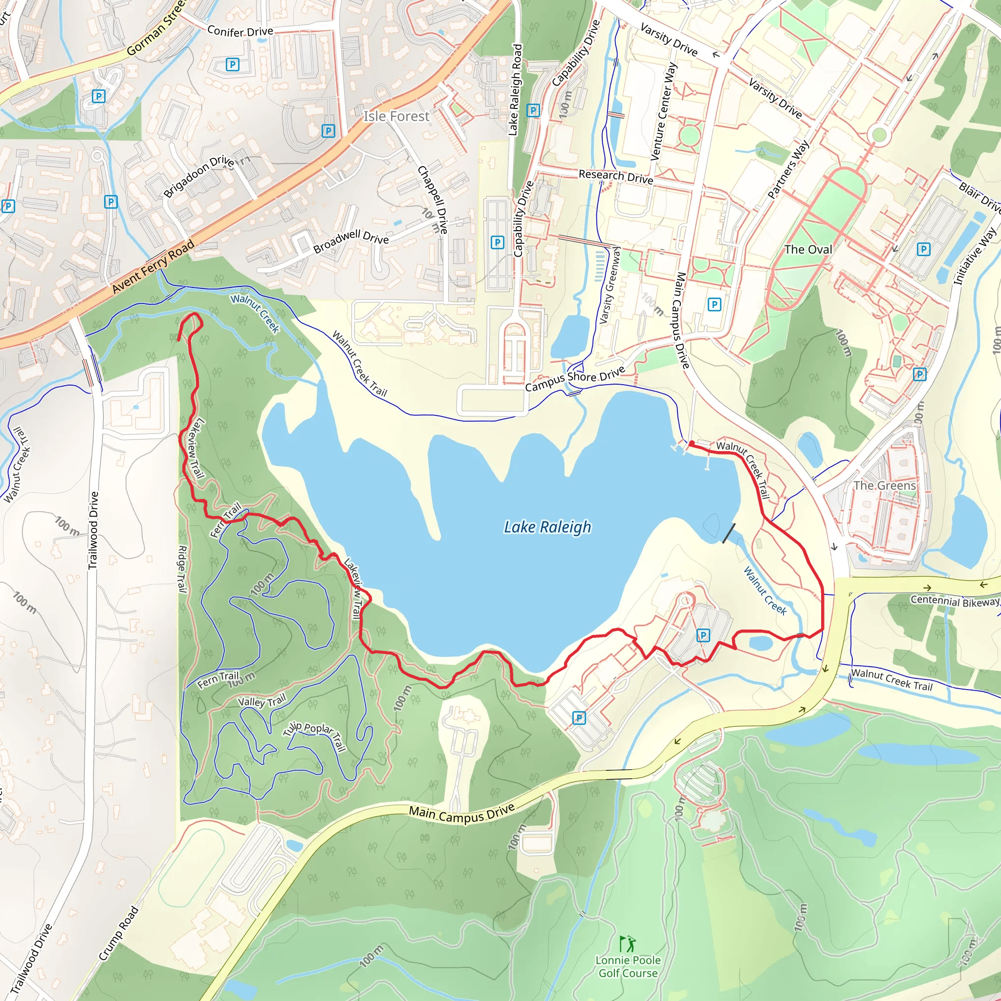
Trail Highlights As you embark on the Lake Raleigh Southern Shore Trail, you'll be greeted by a serene environment that offers a mix of natural beauty and historical significance. The trail meanders along the southern shore of Lake Raleigh, providing picturesque views of the water and surrounding woodlands.
#### Flora and Fauna The trail is rich in biodiversity. Keep an eye out for native plant species such as oak, hickory, and pine trees. In the spring and summer months, wildflowers like the Carolina Lily and Black-eyed Susan add vibrant splashes of color to the landscape. Birdwatchers will be delighted to spot species such as the Great Blue Heron, Red-tailed Hawk, and various songbirds.
#### Historical Significance The area around Lake Raleigh has a rich history. Originally inhabited by Native American tribes, it later became a significant site during the early settlement of North Carolina. The lake itself was created as part of a flood control project in the mid-20th century and has since become a recreational hub for the local community.
Key Landmarks - **Lake Raleigh Dam**: Approximately 1.5 km (0.9 miles) from the trailhead, you'll encounter the Lake Raleigh Dam. This is a great spot to take a break and enjoy the views of the lake. - **Fishing Pier**: Around 2 km (1.2 miles) into the hike, there's a fishing pier that extends into the lake. It's a popular spot for anglers and offers a peaceful place to rest. - **Wildlife Observation Deck**: At the 3 km (1.8 miles) mark, you'll find an observation deck perfect for spotting local wildlife and taking in the panoramic views of the lake and surrounding forest.
Trail Conditions The trail is well-maintained but can be muddy after rain, so waterproof hiking boots are recommended. There are a few steep sections, particularly as you approach the dam, but they are manageable with moderate effort.
Safety and Preparation - **Water and Snacks**: Ensure you bring enough water and snacks, especially during the warmer months. - **Bug Spray**: Mosquitoes and ticks can be prevalent, so bug spray is advisable. - **Weather**: Check the weather forecast before heading out, as conditions can change rapidly.
Final Stretch The return journey offers a different perspective of the trail, with the late afternoon sun casting a golden hue over the lake. As you make your way back to the trailhead, take a moment to appreciate the tranquility and natural beauty that the Lake Raleigh Southern Shore Trail has to offer.
What to expect?
Activity types
Comments and Reviews
User comments, reviews and discussions about the Lake Raleigh Southern Shore Trail, North Carolina.
4.47
average rating out of 5
15 rating(s)
