Download
Preview
Add to list
More
15.3 km
~4 hrs 33 min
901 m
Out and Back
“Journey through history and nature on the Smokemont to Newton Bald trail, a scenic, rewarding hike in the Great Smokies.”
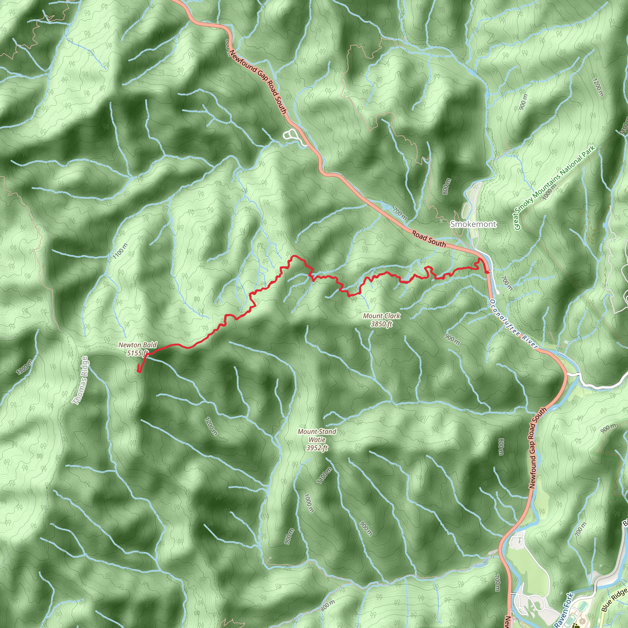
Embarking on the Smokemont to Newton Bald via the Benton MacKaye Trail (BMT) offers a moderately challenging hike that spans approximately 15 kilometers (around 9.3 miles) with an elevation gain of about 900 meters (roughly 2950 feet). The trailhead is conveniently located near Swain County, North Carolina, in the heart of the Great Smoky Mountains National Park.Getting to the TrailheadTo reach the starting point of the hike, you can drive to the Smokemont Campground, which is situated off of Newfound Gap Road (US-441). The campground is well-signed and easy to find, lying just north of the Oconaluftee Visitor Center. For those relying on public transportation, options are limited within the national park, so driving or arranging a shuttle service to the campground is recommended.The Hike ItselfThe journey begins at the Smokemont Campground, where you'll find the trailhead marked for the Bradley Fork Trail. The initial stretch of the hike follows the Bradley Fork River, offering a gentle start with the soothing sounds of flowing water. As you continue, the trail begins to ascend, and the environment transitions into a dense hardwood forest.After approximately 3.2 kilometers (2 miles), you'll reach the junction with the Chasteen Creek Trail. Keep left to stay on the Bradley Fork Trail, which will lead you to the next significant junction with the Cabin Flats Trail at around the 4.8-kilometer (3-mile) mark. Here, you'll veer right to join the Benton MacKaye Trail.Ascent to Newton BaldThe BMT will guide you through a series of switchbacks as you make your way up to Newton Bald. This section can be quite strenuous, but the forest scenery, with its diverse flora, provides a beautiful backdrop. The mixed hardwoods gradually give way to coniferous trees as you gain elevation, and you may spot wildlife such as deer, wild turkeys, and if you're lucky, the occasional black bear—always remember to keep a safe distance from wildlife.Upon reaching Newton Bald, at around the 7.5-kilometer (4.7-mile) mark, you'll be rewarded with expansive views of the surrounding mountains. The bald itself is a testament to the area's historical land use, as these open areas were created by early settlers for grazing livestock. While the balds are no longer maintained for grazing, they offer a unique habitat and a break from the dense forest.Return JourneyAfter taking in the views and perhaps enjoying a well-deserved rest, you'll retrace your steps back down the BMT, through the switchbacks, and along the Bradley Fork Trail to return to the Smokemont Campground.Preparation and PlanningBefore setting out, ensure you have a reliable navigation tool. HiiKER is an excellent resource for trail maps and can help you stay on track. Additionally, pack plenty of water, snacks, and layers of clothing to adapt to the changing temperatures at higher elevations. It's also wise to check the weather forecast and start early to avoid being caught on the trail after dark.Trail Etiquette and ConservationAs with any hike, it's crucial to practice Leave No Trace principles. Pack out all your trash, stay on designated trails to protect the fragile ecosystem, and be considerate of other hikers. The Great Smoky Mountains are a treasure trove of natural beauty and history, and it's our collective responsibility to preserve them for future generations.
Comments and Reviews
User comments, reviews and discussions about the Smokemont to Newton Bald via BMT, North Carolina.
4.57
average rating out of 5
7 rating(s)

