Download
3D Flyover
Add to list
More
1893.3 km
~68 days
14587 m
Multi-Day
“Embark on North Carolina's epic Mountains-to-Sea Trail, a historic and diverse trek from high peaks to coastal dunes.”
Spanning approximately 1175 miles (1893 km) and with an elevation gain of around 47,572 feet (14500 meters), the Mountains-to-Sea Trail is a remarkable journey from the Great Smoky Mountains to the Outer Banks of North Carolina. This point-to-point trail offers a unique cross-section of North Carolina's diverse geography, ecosystems, and communities.
Starting the Journey
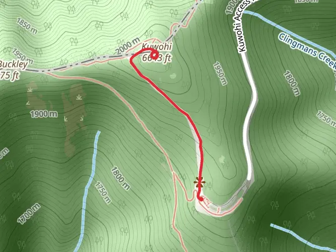
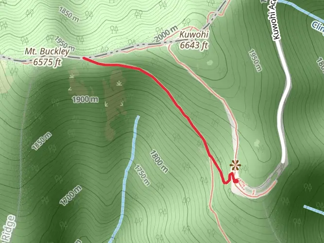
The trailhead is located near Clingmans Dome in Swain County, North Carolina, which is the highest peak in the Great Smoky Mountains National Park. To reach the starting point, hikers can drive to Clingmans Dome Road, which is accessible from Newfound Gap Road (US 441). The nearest towns with public transportation options are Cherokee and Bryson City, where you can find shuttle services to the trailhead during the tourist season.
Through the Mountains
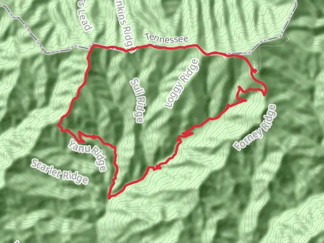
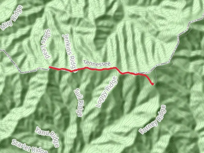
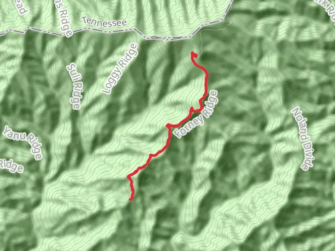
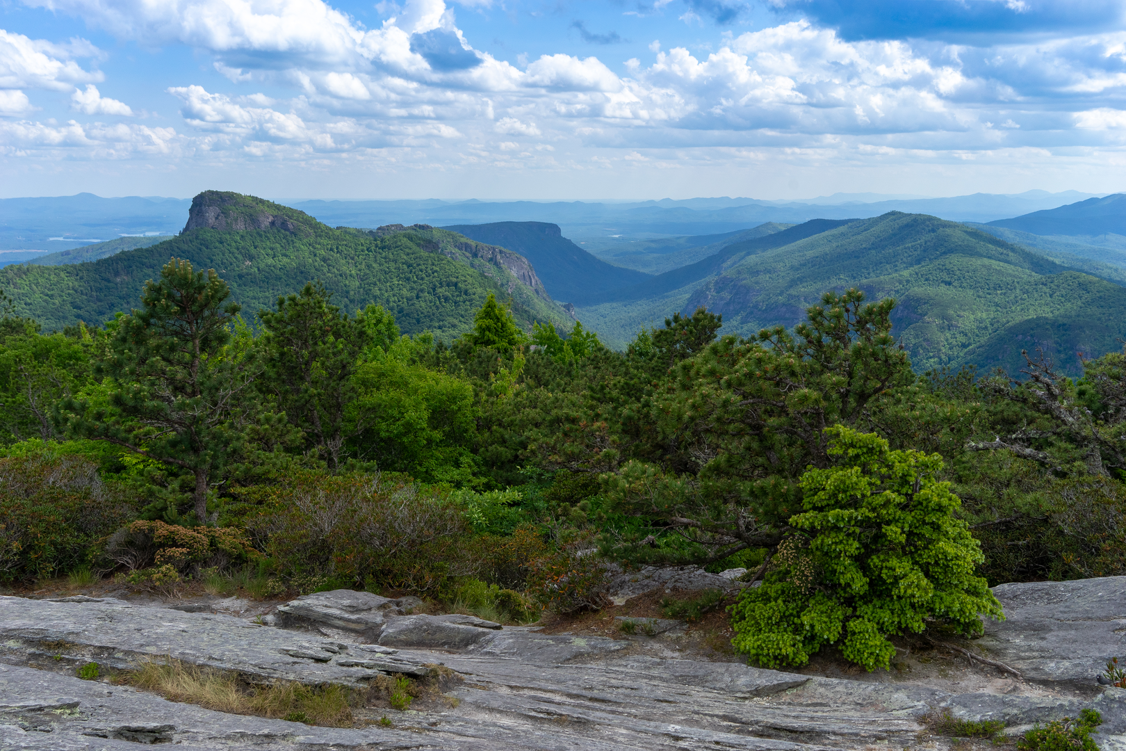
As you embark on the trail, you'll traverse the rugged terrain of the Appalachian Mountains, experiencing dense forests and panoramic views. The first section includes a challenging ascent to Mount Mitchell, the highest peak east of the Mississippi, at an elevation of 6,684 feet (2037 meters). This segment alone offers an elevation gain of several thousand feet and is a testament to the trail's overall difficulty.
Piedmont Plateau
Leaving the mountains behind, the trail descends into the Piedmont Plateau. This transition brings a change in scenery, with rolling hills and pastoral landscapes. The trail meanders through several state parks and historic sites, such as the Eno River State Park, where hikers can enjoy the serenity of the river and the charm of the surrounding woodlands.
Historical Significance
The Mountains-to-Sea Trail is steeped in history. It passes through the Blue Ridge Parkway, with its Civilian Conservation Corps-built structures, and near the historic Bennett Place, where one of the last Confederate surrenders of the Civil War took place. The trail also offers a glimpse into the state's colonial past and the evolution of its natural resource management.
Coastal Plain and Outer Banks
The final stretch of the trail flattens out as you enter the Coastal Plain. The landscape opens up to vast agricultural fields and longleaf pine savannas. Wildlife is abundant here, with opportunities to spot deer, black bears, and a variety of bird species. The trail concludes with a serene walk along the Outer Banks, a thin line of barrier islands famous for their lighthouses and the Wright Brothers National Memorial in Kill Devil Hills.
Navigation and Preparation
For navigation, HiiKER is an invaluable tool, providing detailed maps and trail information. Given the trail's length and diversity, hikers should plan their resupply points carefully and be prepared for a range of weather conditions. Water sources are generally plentiful, but purification is recommended.
Access and Transportation
The trail's endpoint is in Jockey's Ridge State Park, home to the tallest active sand dune system in the Eastern United States. The nearest address for the endpoint is 300 W Carolista Drive, Nags Head, North Carolina. To return to civilization, the town of Nags Head offers public transportation options and is connected to other parts of the state by bus services.
Whether you're a thru-hiker or a day-tripper, the Mountains-to-Sea Trail is a testament to North Carolina's natural beauty and historical richness. With careful planning and respect for the trail's varying terrain, hikers can embark on an unforgettable journey across the Tar Heel State.

Frequently asked questions
How long is the Mountains-to-Sea Trail in North Carolina and where does the Mountains-to-Sea Trail start and end?
The Mountains-to-Sea Trail is about 1,175 miles long, or 1,893.29 kilometers. The route begins near Clingmans Dome in Great Smoky Mountains National Park in western North Carolina and runs across the state to Jockey’s Ridge State Park on the Outer Banks.
How difficult is the Mountains-to-Sea Trail and how much climbing is on the Mountains-to-Sea Trail?
The Mountains-to-Sea Trail is a difficult long-distance route with about 14,587 meters of elevation gain, roughly 47,800 feet. The western mountain sections are especially demanding, with steep grades, long days between trailheads, and high-elevation terrain near Clingmans Dome and Mount Mitchell.
Can the Mountains-to-Sea Trail be hiked as a thru-hike, and how long does the Mountains-to-Sea Trail usually take?
The Mountains-to-Sea Trail is designed as a multi-day point-to-point route and can be thru-hiked from the Smokies to the coast. A full thru-hike covers roughly 1,175 miles, so most hikers break it into sections or plan for a long end-to-end trip that takes weeks to months depending on pace, road-walk strategy, and resupply stops.
When is the best time to hike the Mountains-to-Sea Trail from Clingmans Dome?
Late spring through fall is usually the most practical window for starting from Clingmans Dome. Kuwohi Road, formerly Clingmans Dome Road, is typically open from April 1 through November 29, weather permitting, and high-elevation conditions in Great Smoky Mountains National Park can still bring snow, ice, and sudden closures outside that period.
Can dogs go on the Mountains-to-Sea Trail in Great Smoky Mountains National Park?
Dogs are not allowed on most backcountry trails in Great Smoky Mountains National Park, so pets cannot accompany hikers on the Mountains-to-Sea Trail section that begins near Clingmans Dome. In the park, dogs are generally limited to campgrounds, roads, and just two dog-friendly walking trails: the Gatlinburg Trail and the Oconaluftee River Trail.
Where do hikers park for the Mountains-to-Sea Trail near Clingmans Dome?
The usual access point for the western end of the Mountains-to-Sea Trail is the Clingmans Dome area reached from Newfound Gap Road, also signed as US 441, inside Great Smoky Mountains National Park. Parking is typically at the Clingmans Dome or Kuwohi visitor area, but access depends on seasonal road openings and temporary weather closures on the spur road.
Comments and Reviews
User comments, reviews and discussions about the Mountains-to-Sea Trail, North Carolina.
4.13
average rating out of 5
8 rating(s)