Download
Preview
Add to list
More
55.1 km
~4 days
1469 m
Multi-Day
“Embark on a historic 55 km trek from Fontana Dam, encountering diverse terrains, wildlife, and remnants of bygone eras.”
Embarking on the Lakeshore Trail via Fontana Dam, hikers will traverse approximately 55 kilometers (34 miles) of diverse landscapes, with an elevation gain of around 1400 meters (4593 feet). The trailhead is conveniently located near Swain County, North Carolina, and is accessible by car. For those using public transportation, regional bus services can drop you off at nearby towns such as Bryson City, where you can arrange for a taxi or a local shuttle service to take you to Fontana Dam, the starting point of your hike.
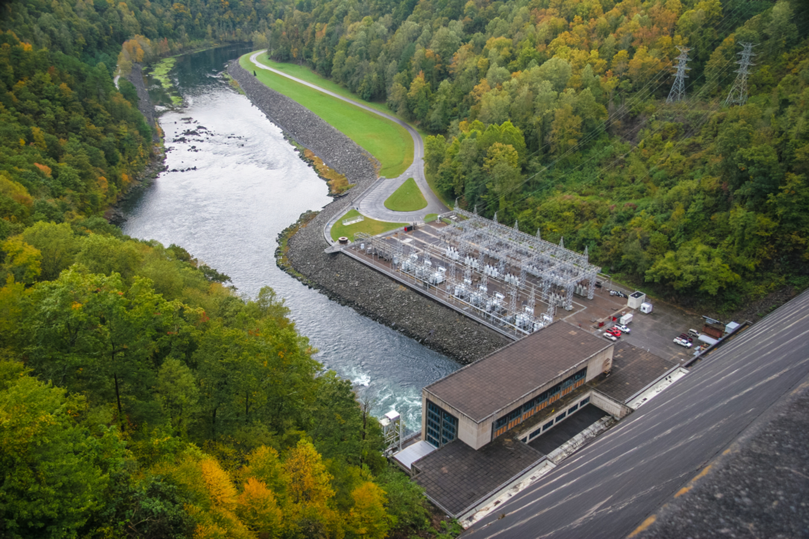
Getting Started at Fontana Dam The journey begins at the impressive Fontana Dam, the tallest dam in the Eastern United States and a marvel of human engineering. The dam itself is a significant landmark, offering panoramic views of the surrounding mountains and the deep blue waters of Fontana Lake. As you set out on the trail, you'll be following a path that is rich in history, once walked by the Cherokee and later by European settlers.
Navigating the Trail The Lakeshore Trail is a point-to-point hike, meaning you'll start and finish at different locations. It's important to plan your transportation accordingly. HiiKER can be an invaluable tool for navigation, providing detailed maps and waypoints to ensure you stay on the right path.
Landmarks and Natural Beauty As you make your way along the trail, you'll encounter a variety of landscapes, from dense forests to open ridgelines. The trail meanders along the lake's shoreline, offering frequent views of the water and the chance to spot local wildlife, including deer, black bears, and a myriad of bird species. The trail also passes through remnants of old settlements, with abandoned homesteads and cemeteries that whisper stories of the past.
Challenges and Terrain The trail is rated as medium difficulty, with some challenging sections that include steep climbs and rocky terrain. Hikers should be prepared for a workout, especially in the sections where the trail ascends to higher elevations. However, the trail is well-maintained and marked, making it accessible to hikers with a moderate level of experience.
Preparation and Safety Before setting out, ensure you have enough water, as sources along the trail may be limited, especially during the dryer months. It's also wise to pack high-energy snacks and a first-aid kit. Weather in the mountains can change rapidly, so bring layers of clothing to adapt to varying conditions. Always let someone know your hiking plan and expected return time.
End of the Trail The Lakeshore Trail concludes at the remote backcountry campsite #90, near the Little Tennessee River. From here, hikers can arrange for a pick-up or continue their adventure by connecting to other trails in the Great Smoky Mountains National Park. Remember to plan your exit strategy in advance, as cell service can be spotty in the backcountry.
By preparing adequately and respecting the natural and historical significance of the region, hikers can fully enjoy the beauty and challenges of the Lakeshore Trail via Fontana Dam.

Comments and Reviews
User comments, reviews and discussions about the Lakeshore Trail via Fontana Dam, North Carolina.
4.67
average rating out of 5
3 rating(s)