Download
Preview
Add to list
More
13.4 km
~3 hrs 39 min
585 m
Out and Back
“Explore the scenic Wayah Bald on the Appalachian Trail, a medium-difficulty hike rich in history, wildlife, and panoramic views.”
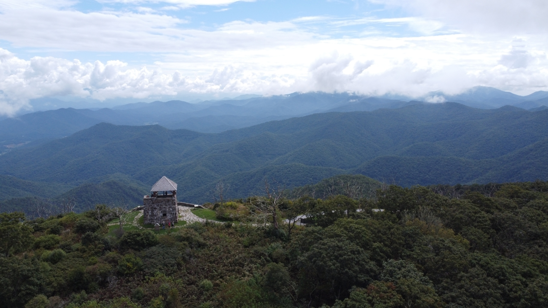
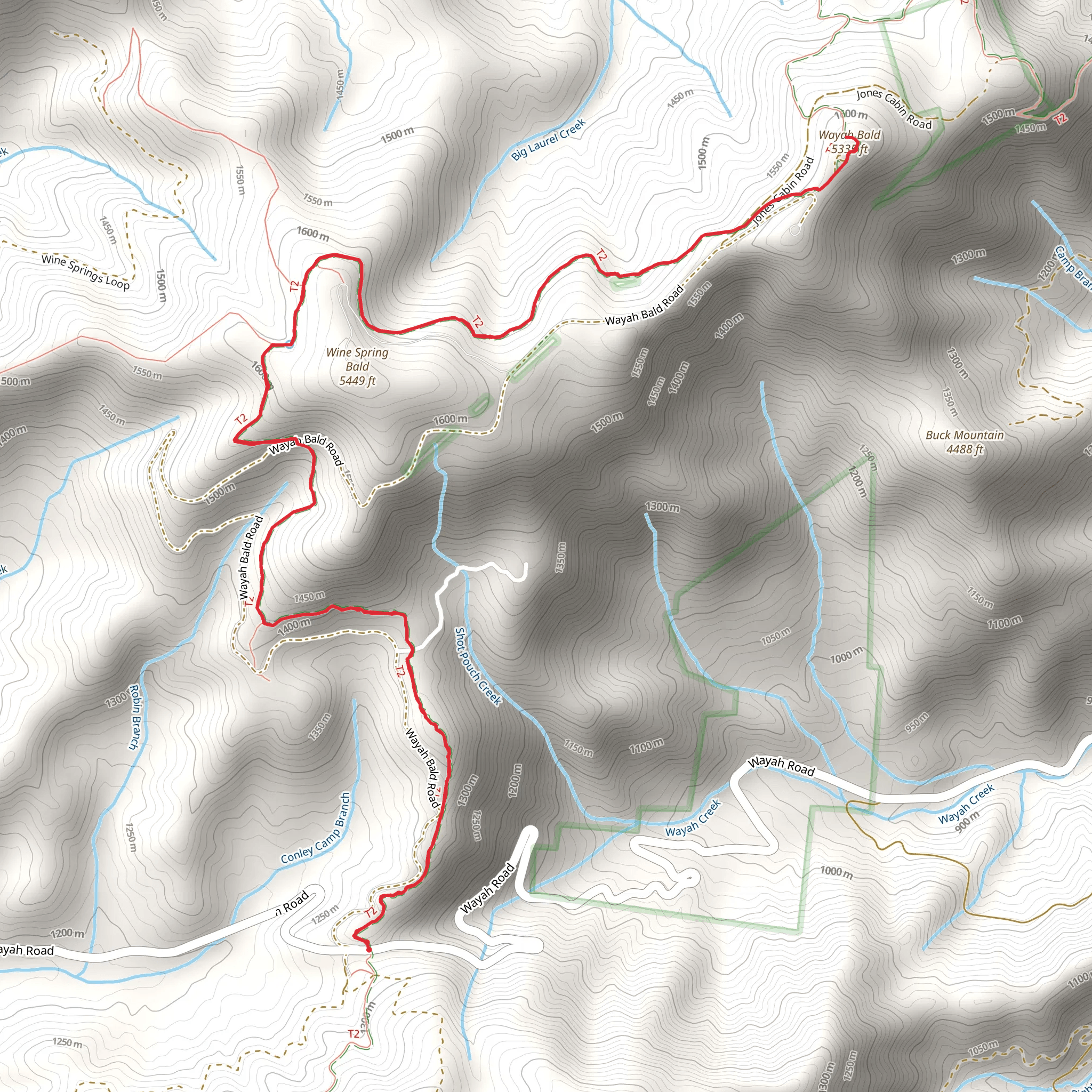
Embarking on the Wayah Bald via Appalachian Trail, hikers will find themselves on a journey through the lush landscapes of the Nantahala National Forest, starting near Macon County, North Carolina. This out-and-back trail spans approximately 13 kilometers (8 miles) and features an elevation gain of around 500 meters (1640 feet), presenting a medium difficulty level that is suitable for hikers with some experience.Getting to the TrailheadTo reach the trailhead, if you're driving, navigate towards Wayah Crest Picnic Area, off Wayah Road, which is the nearest landmark to the starting point. For those relying on public transport, options may be limited due to the remote nature of the trail, so it's advisable to check local resources for the latest information on available services.The Hike ItselfAs you set out from the trailhead, the path will lead you through a mixed hardwood forest, gradually ascending towards the peak of Wayah Bald. The initial section of the trail is a gentle climb, allowing hikers to warm up as they become enveloped by the sounds and sights of the forest.Flora and FaunaThroughout the hike, you'll be surrounded by a diverse array of plant life, including rhododendron and mountain laurel, which bloom spectacularly in late spring. Wildlife is abundant, with the possibility of spotting deer, wild turkey, and a variety of bird species. Always keep a respectful distance from wildlife and follow Leave No Trace principles to minimize your impact on their habitat.Historical SignificanceWayah Bald holds a rich history, with its name derived from the Cherokee word "wa'ya," which means "wolf." The area was once home to a population of red wolves, which are now extinct in this region. As you approach the summit, you'll encounter the historic Wayah Bald Fire Tower, a stone structure built by the Civilian Conservation Corps in the 1930s. The tower offers panoramic views of the surrounding mountains and is a perfect spot to rest and take in the scenery.Summit and ViewsUpon reaching the summit of Wayah Bald, at approximately 6.5 kilometers (4 miles) into the hike, you'll be rewarded with breathtaking 360-degree views. On a clear day, you can see the Great Smoky Mountains to the north, the rolling hills of Georgia to the south, and the Cowee Mountains to the east.NavigationFor navigation purposes, HiiKER is an excellent tool to use while on the trail. It can help you track your progress, identify key waypoints, and ensure you remain on the correct path. Remember to download the trail map on HiiKER before you set out, as cell service can be unreliable in remote areas.Preparation and SafetyBefore embarking on the hike, ensure you're well-prepared with adequate water, snacks, and layers of clothing to adapt to changing weather conditions. The elevation gain can be challenging, so pace yourself and take breaks as needed. It's also wise to inform someone of your hiking plans and expected return time.Return JourneyAfter soaking in the views and exploring the summit area, you'll retrace your steps back down the trail to the Wayah Crest Picnic Area. The descent will be easier on the legs, but remain cautious as the terrain can be uneven in places.This hike to Wayah Bald via the Appalachian Trail offers a blend of natural beauty, physical challenge, and historical intrigue, making it a memorable experience for those who venture along its path.
Comments and Reviews
User comments, reviews and discussions about the Wayah Bald via Appalachian Trail, North Carolina.
5.0
average rating out of 5
4 rating(s)

