Download
Preview
Add to list
More
35.3 km
~3 days
1118 m
Multi-Day
“Embark on New Zealand's Matemateaonga Track, a historic and biodiverse medium-difficulty hiking adventure.”
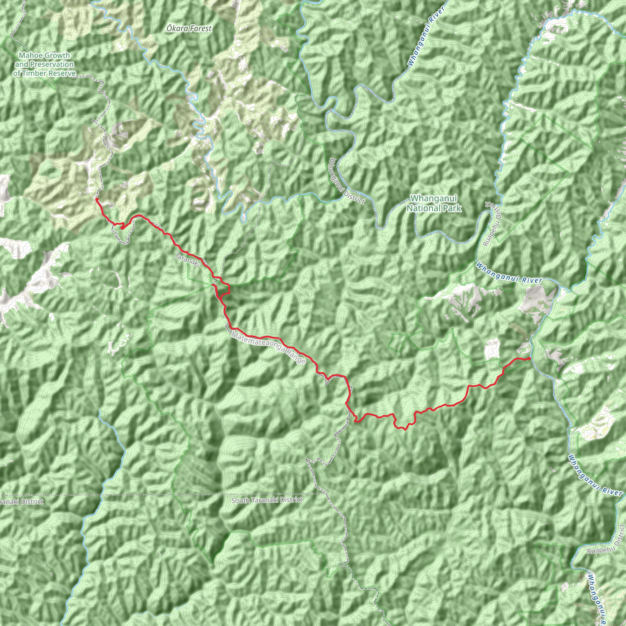
The Matemateaonga Track stretches approximately 35 kilometers (about 22 miles) and features an elevation gain of around 1100 meters (roughly 3600 feet), offering a medium difficulty level that caters to hikers with some experience. This point-to-point trail is nestled in the lush landscapes near Stratford, New Zealand, and is renowned for its rich history and stunning natural beauty.
Getting to the Trailhead
To reach the trailhead, which is situated near Stratford, hikers can drive to the end of Pembroke Road, which is the closest access point by car. For those relying on public transport, options are limited, but it's possible to take a bus to Stratford and then arrange for a local shuttle or taxi service to the trailhead.
Navigating the Trail
Hikers can utilize the HiiKER app to navigate the trail, ensuring they stay on the correct path and can anticipate upcoming changes in terrain or elevation. The app provides detailed maps and is a valuable tool for planning rest stops and campsites along the route.
Trail Highlights and Landmarks
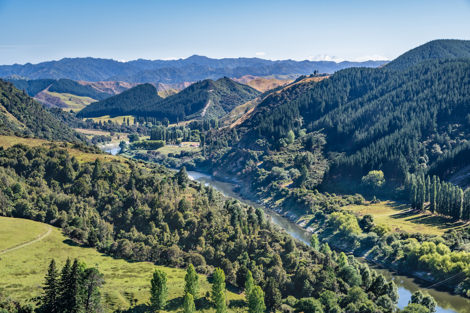
As you embark on the Matemateaonga Track, you'll be greeted by dense native forest that provides a canopy for the rich biodiversity below. The trail is a haven for birdwatchers, with the potential to spot rare species such as the North Island brown kiwi and the kererū, New Zealand's native wood pigeon.
The track follows an historic bridle path and is steeped in Maori history. Hikers will encounter remnants of past settlements and ancient Maori pa sites, offering a glimpse into the region's cultural heritage. The Whanganui River, which the track eventually leads to, has been a significant waterway for Maori and early European settlers, used for transport and trade.
Terrain and Elevation Changes
The trail's terrain varies, with some sections featuring well-maintained paths while others may be more rugged and require careful footing. The elevation gain is gradual but noticeable, especially in the sections that lead up to the highest points of the track. Hikers should be prepared for potentially muddy conditions, especially after rain.
Preparing for the Hike
Given the track's length and remote nature, it's essential to be well-prepared with adequate supplies, including food, water, and appropriate gear for overnight camping if you plan to complete the trail over multiple days. Weather can be unpredictable, so layered clothing and waterproof gear are recommended.
End of the Trail
The Matemateaonga Track concludes at the Whanganui River, where hikers can arrange for a jet boat pickup to take them to Pipiriki—a small community downriver. This unique end to the hike allows for a scenic and restful return after the journey.
By providing these details, hikers can adequately prepare for the Matemateaonga Track, ensuring a memorable and safe experience through one of New Zealand's most historically and ecologically rich landscapes.
What to expect?
Activity types
Comments and Reviews
User comments, reviews and discussions about the Matemateaonga Track, New Zealand.
4.5
average rating out of 5
4 rating(s)

