Download
Preview
Add to list
More
17.9 km
~2 days
852 m
Multi-Day
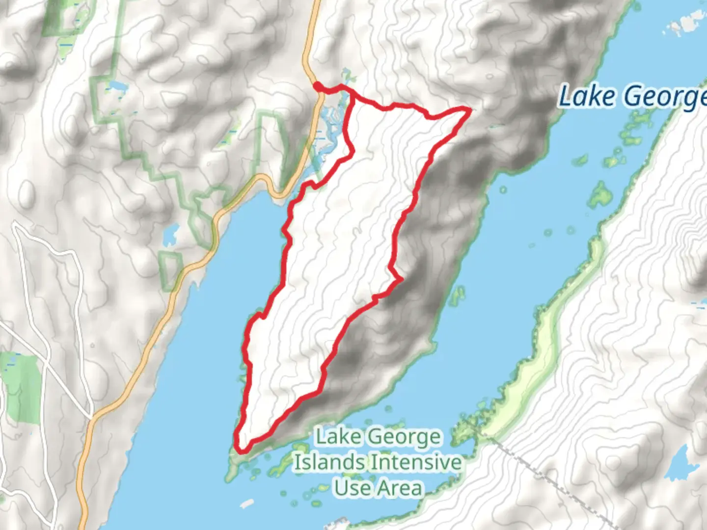
The Tongue Mountain Range Loop is a challenging and rewarding hike located near Warren County, New York. This loop trail spans approximately 18 kilometers (about 11 miles) and features an elevation gain of around 800 meters (roughly 2,625 feet), offering hikers a strenuous workout paired with stunning views of the Adirondack Mountains and Lake George.### Getting There To reach the trailhead, hikers can drive to the Clay Meadows parking area, which is situated off Route 9N, north of Bolton Landing. There is no direct public transportation to the trailhead, so a personal vehicle or taxi service is necessary to access the starting point.### Trail Description The hike begins at the Clay Meadows trailhead, where you'll find a kiosk with trail information. The loop can be tackled in either direction, but many choose to hike clockwise to face the steeper sections earlier in the day.As you embark on the trail, you'll ascend through a mixed forest, gaining elevation steadily. The path is well-marked, but it's advisable to use a navigation tool like HiiKER to track your progress and ensure you stay on the correct path.### Points of Interest and Landmarks After approximately 3.5 km (2.2 miles), you'll reach the summit of Brown Mountain, which offers the first of many panoramic views. Continuing on, the trail undulates along the ridge, providing glimpses of Lake George to the east.The next significant peak is Five Mile Mountain, roughly 8 km (5 miles) from the start. Here, you'll be treated to more expansive vistas of the surrounding landscape. The trail then descends into a col before climbing again towards French Point Mountain and First Peak, which are known for their breathtaking overlooks.Wildlife is abundant in the area, with chances to spot deer, hawks, and if you're lucky, the occasional moose. The forest is also home to timber rattlesnakes, so be vigilant and give them space if encountered.### Historical Significance The Tongue Mountain Range holds historical significance as part of the Adirondack Forest Preserve, protected since the late 19th century. The region was once a hub for logging and mining, but conservation efforts have since transformed it into a haven for outdoor enthusiasts and a testament to the success of preservation.### Trail Tips - Bring plenty of water and snacks, as there are no facilities along the trail. - Wear sturdy hiking boots, as the terrain can be rocky and uneven. - Check the weather forecast before you go; conditions can change rapidly in the mountains. - Be prepared for black flies and mosquitoes during the warmer months by bringing insect repellent. - Remember to practice Leave No Trace principles to help preserve the beauty of the Adirondacks.### Conclusion The Tongue Mountain Range Loop is a demanding hike that rewards adventurers with stunning views, diverse wildlife, and a sense of historical appreciation. With proper preparation and respect for the natural environment, hikers will find this trail to be a memorable and enriching experience.

Comments and Reviews
User comments, reviews and discussions about the Tongue Mountain Range Loop, New York.
4.6
average rating out of 5
5 rating(s)