Download
Preview
Add to list
More
29.1 km
~1 day 3 hrs
1900 m
Loop
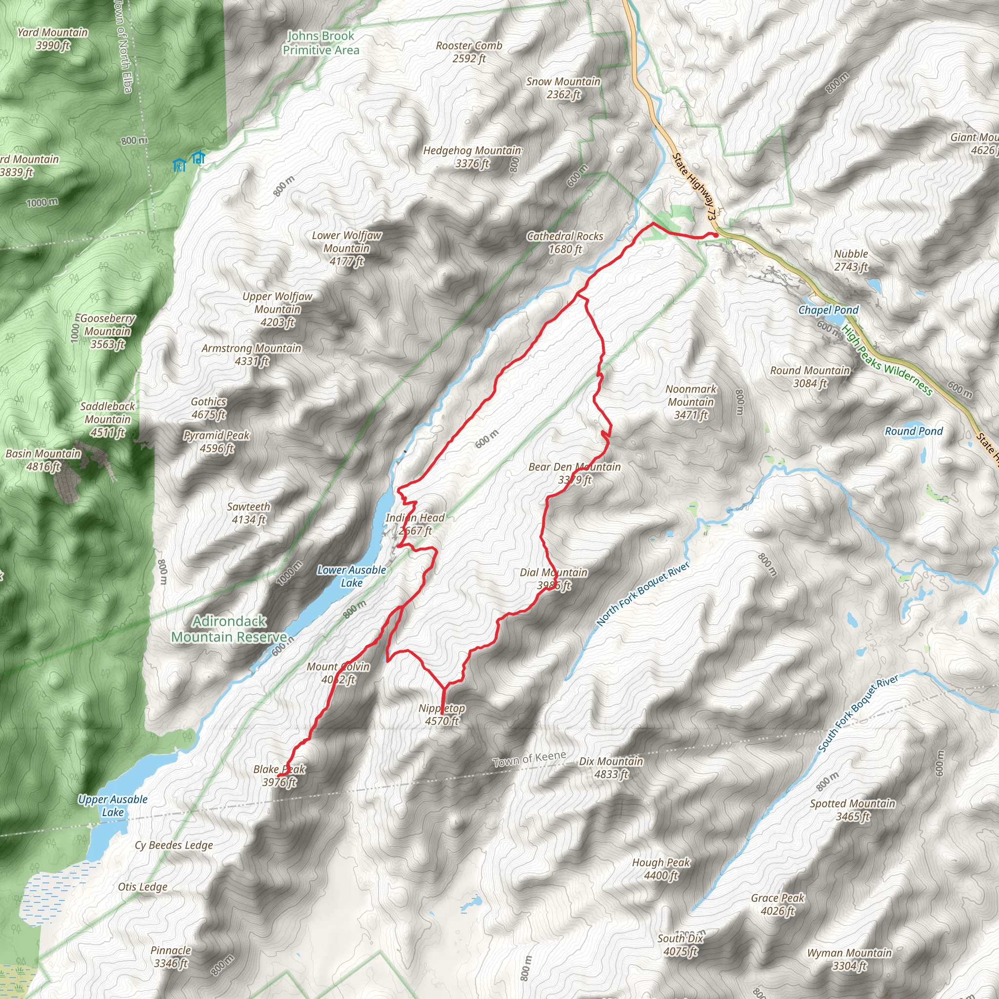
The Indian Head, Nippletop, and Dial Mountain via Gill Brook Trail Loop is a challenging yet rewarding hike located near Essex County, New York. This loop trail covers approximately 29 kilometers (18 miles) and includes an elevation gain of around 1900 meters (6234 feet), offering hikers a full day or a multi-day adventure through the heart of the Adirondack High Peaks.
Getting to the Trailhead The trailhead is accessible by car and is located off of Ausable Road, near the town of Keene Valley. From Lake Placid, take NY-73 E for about 22 kilometers (14 miles) until you reach Ausable Road on your right. Follow Ausable Road to the parking area near the Ausable Club. Parking is limited, so arriving early is advisable. Public transportation options are limited in this region, so driving is the most practical way to reach the start of the trail.
The Hike Starting from the parking area, hikers will walk along a private road for about 1.6 kilometers (1 mile) before reaching the actual trailhead. The trail begins with a moderate ascent along the Gill Brook Trail, which is known for its scenic beauty and numerous waterfalls. The brook is a constant companion for the first few kilometers, providing a serene soundtrack to the hike.
As you continue, the trail becomes steeper and more rugged. The ascent to Indian Head offers some of the most dramatic views in the Adirondacks, with a panoramic vista of Lower and Upper Ausable Lakes. This spot is approximately 5.5 kilometers (3.4 miles) from the trailhead and is a popular destination for those not continuing to Nippletop and Dial Mountain.
After enjoying the view from Indian Head, the trail to Nippletop is strenuous, with steep climbs and rocky terrain. Nippletop, at around 13 kilometers (8 miles) into the hike, stands at an elevation of 1405 meters (4610 feet) and provides expansive views of the surrounding peaks and wilderness.
From Nippletop, the trail descends slightly before climbing again towards Dial Mountain. The summit of Dial Mountain, at 1220 meters (4003 feet), offers a different perspective of the Adirondacks and is approximately 16 kilometers (10 miles) from the start of the hike.
The descent from Dial Mountain is steady and can be tough on the knees. Hikers will pass through mixed forests and over streams, eventually reconnecting with the Gill Brook Trail for the final stretch back to the trailhead.
Flora, Fauna, and Landmarks Throughout the hike, you'll encounter a variety of flora, including hardwood forests, conifer stands, and alpine vegetation at higher elevations. Wildlife sightings might include deer, black bears, and a variety of bird species, so hikers should be aware and respectful of the natural inhabitants.
Historical Significance The Adirondack High Peaks region is rich in history, with the Adirondack Park being established in the late 19th century to protect the area's natural beauty and resources. The trails and mountains have been a destination for outdoor enthusiasts for over a century, and the region played a significant role in the development of recreational hiking in the United States.
Preparation and Planning Hikers should be well-prepared with appropriate gear, including sturdy hiking boots, weather-appropriate clothing, a map, and a compass or a navigation tool like HiiKER to track their route. It's essential to carry enough water and food for the hike's duration and to be prepared for sudden weather changes, which are common in the mountains.
Given the trail's length and elevation gain, it's recommended for experienced hikers in good physical condition. Always check the weather forecast before setting out, and be sure to leave a trip itinerary with someone before embarking on your hike.
By following these guidelines and being prepared, hikers can enjoy a memorable experience on the Indian Head, Nippletop, and Dial Mountain via Gill Brook Trail Loop, taking in the stunning vistas and rugged beauty of the Adirondack High Peaks.
What to expect?
Activity types
Comments and Reviews
User comments, reviews and discussions about the Indian Head, Nippletop and Dial Mountain via Gill Brook Trail Loop, New York.
4.21
average rating out of 5
14 rating(s)

