Download
Preview
Add to list
More
10.3 km
~2 hrs 58 min
545 m
Out and Back
Bash Bish Mountain and Alander Mountain Trail
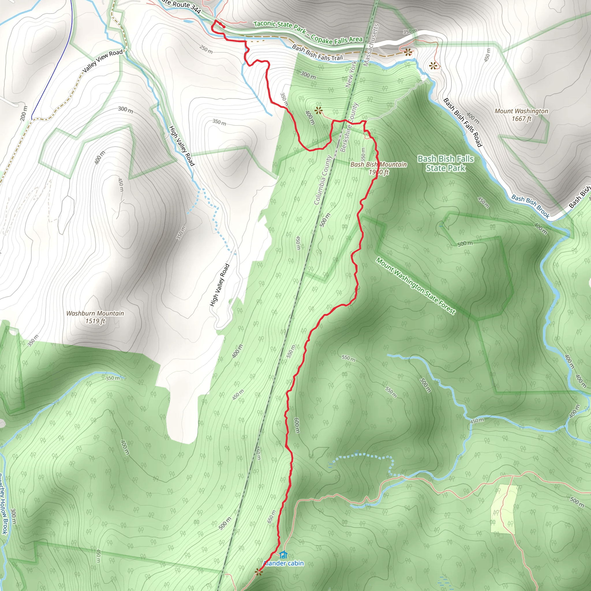
Starting Point and Access The trailhead for the Bash Bish Mountain and Alander Mountain Trail is located near Columbia County, New York. To reach the starting point by car, hikers can navigate to the Taconic State Park, which is the nearest significant landmark. For those opting for public transport, the nearest towns with bus services are Copake and Hillsdale, from where you can take a taxi to the park.
Trail Overview The combined journey to Bash Bish Mountain and Alander Mountain covers a distance of approximately 10 kilometers (6.2 miles) and includes an elevation gain of around 500 meters (1640 feet). This out-and-back trail is rated as medium difficulty, making it accessible to hikers with a reasonable level of fitness.
Route Description The trail begins with a moderate ascent through mixed hardwood forests, offering a diverse array of flora and fauna. As you progress, the canopy provides shade and coolness, which is particularly welcome during the warmer months. The path is well-marked, but hikers should always carry a navigation tool like HiiKER to ensure they stay on the correct route.
Bash Bish Falls Approximately 1.6 kilometers (1 mile) into the hike, you'll encounter the stunning Bash Bish Falls, a series of cascades that culminate in the highest single-drop waterfall in Massachusetts. The falls are a popular spot for photography and a refreshing break. Be cautious as the rocks around the falls can be slippery.
Ascent to Bash Bish Mountain Continuing from the falls, the trail becomes steeper as you approach Bash Bish Mountain. The ascent is challenging but rewards hikers with panoramic views of the surrounding Taconic Mountains and the Hudson Valley.
Alander Mountain Summit After enjoying the vistas from Bash Bish Mountain, the trail proceeds to Alander Mountain, adding an additional 3.2 kilometers (2 miles) to your journey. The summit of Alander Mountain offers expansive views that extend into three states: New York, Massachusetts, and Connecticut. On a clear day, the Catskill Mountains are visible to the west.
Historical Significance The area is rich in history, with the Taconic Range playing a significant role during the colonial era and the early development of the United States. The mountains served as a natural barrier and a strategic lookout point, with several historical trails and sites nearby.
Wildlife and Nature The region is home to a variety of wildlife, including deer, black bears, and numerous bird species. Hikers should be aware of their surroundings and keep a respectful distance from any animals they encounter. The trail also passes through several distinct ecological zones, offering a chance to observe different plant species and forest types.
Preparation and Safety Hikers should prepare for variable weather conditions and bring appropriate gear, including sturdy hiking boots, water, snacks, and layers of clothing. It's also advisable to inform someone of your hiking plans and expected return time.
Remember to practice Leave No Trace principles to preserve the beauty of the trail for future visitors. Carry out all trash, stay on designated paths, and respect wildlife habitats.
By following this guide and being prepared, hikers can enjoy a rewarding experience on the Bash Bish Mountain and Alander Mountain Trail, taking in the natural beauty and historical significance of this unique region.
What to expect?
Activity types
Comments and Reviews
User comments, reviews and discussions about the Bash Bish Mountain and Alander Mountain Trail, New York.
4.5
average rating out of 5
6 rating(s)

