Download
Preview
Add to list
More
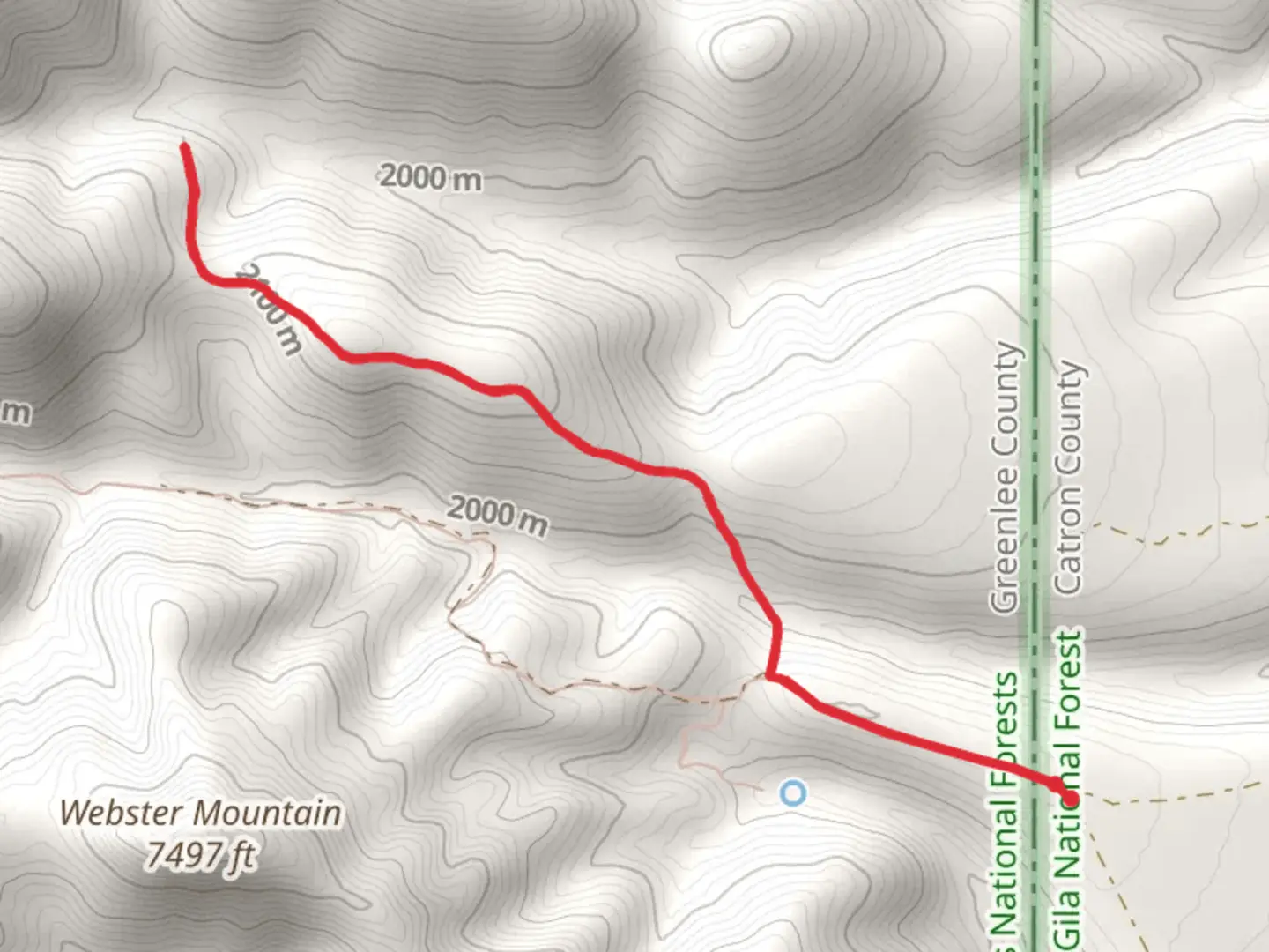
6.3 km
~1 hrs 52 min
369 m
Loop
“Embark on the Buchanan Tank Trail for a vibrant trek through New Mexico's diverse terrain and history.”
The Buchanan Tank Trail, nestled in the picturesque landscape near Catron County, New Mexico, offers hikers a moderately challenging loop that spans approximately 6 kilometers (about 3.7 miles) with an elevation gain of around 300 meters (roughly 980 feet). This trail is a delightful mix of scenic vistas and diverse ecosystems that will engage hikers of all skill levels.
Getting to the Trailhead
To reach the starting point of the Buchanan Tank Trail, hikers can drive to the vicinity of Catron County. The trailhead is accessible by car, and while public transport options may be limited, those with their own vehicles can easily navigate to the area using a GPS or a navigation app like HiiKER. Parking is typically available near the trailhead, but it's always wise to arrive early during peak hiking seasons to secure a spot.
Navigating the Trail
As you embark on the Buchanan Tank Trail, you'll traverse through a landscape that is a testament to the natural beauty of New Mexico. The trail is well-marked, but carrying a map downloaded from HiiKER is recommended to ensure you stay on the correct path. The loop can be completed in either direction, but many choose to go clockwise to tackle the steeper sections first.
Natural Features and Wildlife
The trail meanders through a variety of terrains, including open meadows, dense pine forests, and rocky outcrops. Along the way, hikers can enjoy the sight of local flora, such as wildflowers and cacti that add splashes of color to the landscape. The area is also home to an array of wildlife, including deer, rabbits, and a variety of bird species. Keep an eye out for the occasional elk or coyote that may cross your path.
Historical Significance
The region around Buchanan Tank Trail is steeped in history. The area was once inhabited by indigenous peoples, and later by settlers who were drawn to the land during the era of westward expansion. As you hike, you may come across remnants of old homesteads or other historical artifacts that speak to the area's rich past.
Landmarks and Points of Interest
Approximately halfway through the hike, you'll reach the trail's namesake, Buchanan Tank, which is a man-made watering hole that has been used by wildlife and cattle for many years. This spot is a good place to rest and perhaps enjoy a snack while taking in the serene surroundings.
Preparation and Safety
Before setting out on the Buchanan Tank Trail, ensure you are well-prepared with adequate water, sun protection, and sturdy hiking boots. The trail can be rocky in places, and the elevation gain, while not extreme, does require a moderate level of fitness. Always let someone know your hiking plans and expected return time, and check the weather forecast to avoid being caught in adverse conditions.
By following these guidelines and respecting the natural environment, your hike on the Buchanan Tank Trail is sure to be a memorable adventure through the heart of New Mexico's captivating wilderness.

Comments and Reviews
User comments, reviews and discussions about the Buchanan Tank Trail, New Mexico.
4.5
average rating out of 5
4 rating(s)