Download
Preview
Add to list
More
16.7 km
~4 hrs 44 min
841 m
Loop
“Embark on the scenic Mount Tripyramid Loop Trail for a challenging, yet picturesque hike through New Hampshire's White Mountains history and biodiversity.”
The Mount Tripyramid Loop Trail, nestled in the White Mountains of New Hampshire, offers a challenging yet rewarding experience for avid hikers. Spanning approximately 17 kilometers (10.5 miles) with an elevation gain of around 800 meters (2625 feet), this loop trail is accessible from the Kancamagus Highway, near Waterville Valley in Grafton County.
Getting to the Trailhead: To reach the trailhead, you can drive to the parking area located off the Kancamagus Highway (NH-112), which is a scenic route running through the White Mountain National Forest. The nearest significant landmark is the Sabbaday Falls Picnic Area, a short drive from the trailhead. Public transportation options are limited in this region, so arriving by car is recommended.
The Hike: The adventure begins at the Pine Bend Brook Trail, which serves as the starting point for the loop. The trail is marked by a signpost and gradually ascends through a hardwood forest. As you progress, the incline becomes steeper, and the terrain more rugged. The first few miles will have you gaining elevation steadily as you approach the base of North Tripyramid.
Navigating the Trail: Using HiiKER for navigation is advisable, as the trail can be challenging to follow in places, especially during the descent from Middle Tripyramid. The app will help you stay on track and provide real-time updates on your location.
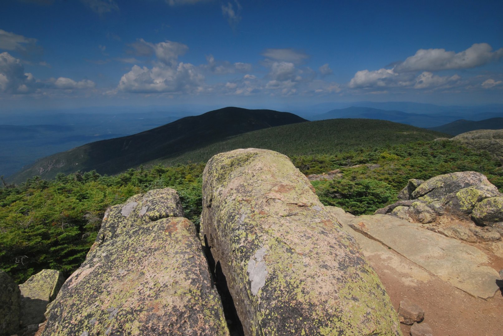
Significant Landmarks and Nature: Upon reaching the summit of North Tripyramid, approximately 4.2 kilometers (2.6 miles) from the trailhead, you'll be greeted with limited views due to the wooded summit. However, the journey between North and Middle Tripyramid peaks offers stunning vistas of the surrounding White Mountains.
Wildlife and Flora: The area is rich in biodiversity, with chances to spot wildlife such as moose, black bears, and various bird species. The trail also winds through diverse ecosystems, from beech and birch forests to alpine scrub. During the spring and summer months, the landscape is dotted with wildflowers, adding a splash of color to the greenery.
Historical Significance: The White Mountains have a storied past, with the region playing a significant role in the logging industry in the 19th and early 20th centuries. The trails you hike today were once paths used by loggers to transport timber down the mountains.
Descent and Loop Completion: After enjoying the views from Middle Tripyramid, the trail descends sharply via the Tripyramid Trail. This section, known as the "slide," is steep and can be treacherous, especially in wet conditions. It's a 1.6-kilometer (1-mile) descent that requires careful footing.
The loop is completed by connecting with the Sabbaday Brook Trail, which will lead you back to the Kancamagus Highway. This final stretch is approximately 6.4 kilometers (4 miles) and is less steep, allowing for a more relaxed pace as you complete your hike.
Preparation and Planning: Before embarking on the Mount Tripyramid Loop Trail, ensure you are well-prepared with appropriate gear, including sturdy hiking boots, water, snacks, and layers for changing weather conditions. It's also wise to check the weather forecast and trail conditions, as the weather in the White Mountains can be unpredictable.
Remember, the Mount Tripyramid Loop Trail offers a glimpse into the natural beauty and history of the White Mountains, providing a memorable experience for those who take on its challenge.

What to expect?
Activity types
Comments and Reviews
User comments, reviews and discussions about the Mount Tripyramid Loop Trail, New Hampshire.
4.58
average rating out of 5
26 rating(s)