Download
Preview
Add to list
More
21.3 km
~2 days
1481 m
Multi-Day
“Embark on the Mt Moriah Trail's rugged loop for an epic journey through history, nature, and breathtaking vistas.”
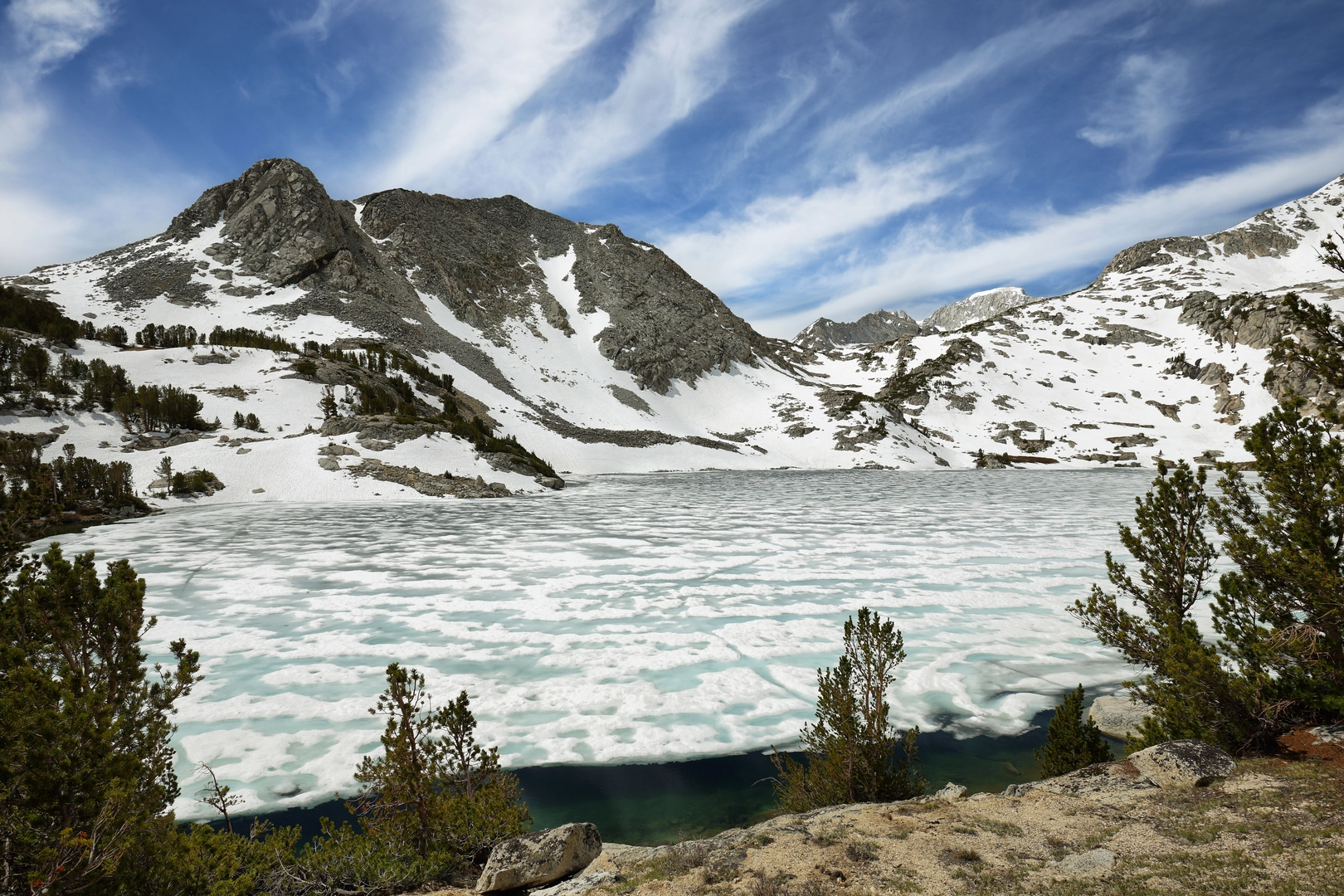
The Mt Moriah trail, nestled near White Pine County, Nevada, offers a challenging yet rewarding experience for avid hikers. Spanning approximately 21 kilometers (13 miles) and featuring an elevation gain of around 1400 meters (4593 feet), this loop trail is not for the faint-hearted, earning its rating as Extra Difficult.
Getting to the Trailhead To reach the trailhead, you can drive to the end of the unpaved road that starts near the town of Baker, Nevada. The road is typically accessible by high-clearance vehicles, and it's advisable to check local conditions before setting out. For those relying on public transport, options are limited, and the closest significant landmark is Great Basin National Park, from which you would need to arrange a private transfer or taxi service.
Navigating the Trail Once on the trail, hikers can use the HiiKER app to navigate the loop, ensuring they stay on the correct path through the varying terrain. The trail begins with a steady incline, winding through a landscape dotted with pinyon pines and junipers. As you ascend, the vegetation transitions to ancient bristlecone pines, some of the oldest living organisms on Earth.
Landmarks and Natural Features At approximately the 5-kilometer (3.1-mile) mark, you'll encounter an open area known as "The Table," a flat stretch that offers a brief respite before the next climb. The trail continues to rise, presenting panoramic views of the Snake Valley and the surrounding mountain ranges.
Historical Significance The region holds historical significance, with Mt Moriah being part of the traditional homeland of the Western Shoshone people. The area also played a role during the mining boom in the late 19th and early 20th centuries, with remnants of old mines occasionally visible along the trail.
Wildlife and Flora As you trek, keep an eye out for local wildlife, including mule deer, mountain lions, and a variety of bird species. The diverse flora and fauna make this trail a naturalist's delight, with opportunities to observe high desert and alpine ecosystems.
Preparing for the Hike Given the trail's difficulty, it's crucial to be well-prepared with adequate water, food, and layers of clothing to accommodate the changing temperatures at higher elevations. The trail is best tackled from late spring to early fall to avoid snow conditions, and always inform someone of your hiking plans due to the remote nature of the area.
Final Ascent and Descent The final ascent to the summit of Mt Moriah is the most strenuous part, with steep switchbacks leading to the peak at around the 10-kilometer (6.2-mile) halfway point. Here, hikers are rewarded with breathtaking views of the vast basin and range topography. The descent follows a similar path back to the trailhead, completing the loop and concluding an unforgettable hiking adventure.

What to expect?
Activity types
Comments and Reviews
User comments, reviews and discussions about the Mt Moriah, Nevada.
4.6
average rating out of 5
10 rating(s)