Download
Preview
Add to list
More
12.8 km
~3 hrs 55 min
817 m
Out and Back
“Explore Mount Moriah via Pack Trail for stunning views, ancient pines, and historical mining relics.”
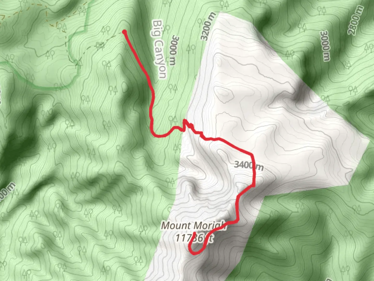
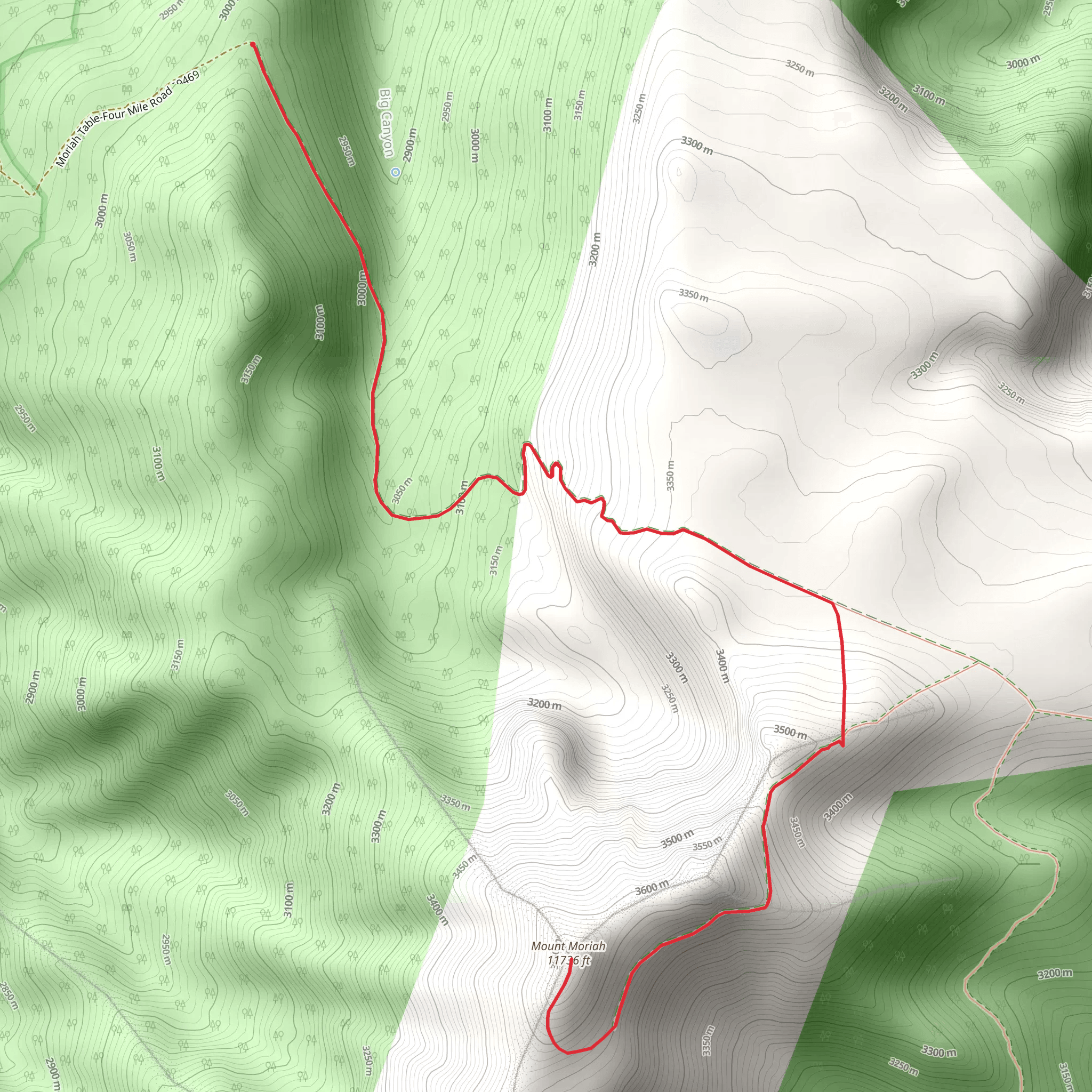
Starting your adventure near White Pine County, Nevada, the Mount Moriah via Pack Trail is an out-and-back trail that spans approximately 13 kilometers (8 miles) with an elevation gain of around 800 meters (2,625 feet). This medium-difficulty trail offers a blend of natural beauty, historical significance, and a moderate challenge for hikers.
Getting There
To reach the trailhead, you can drive or use public transport. If driving, head towards the nearest significant landmark, which is the town of Ely, Nevada. From Ely, take US-50 E for about 30 miles until you reach the turnoff for White Pine County Road 35. Follow this road for approximately 10 miles to reach the trailhead. Public transport options are limited, so renting a car from Ely is recommended.
Trail Overview
The trail begins with a gentle ascent through a mixed forest of pinyon pine and juniper. The first 2 kilometers (1.2 miles) are relatively easy, with an elevation gain of about 150 meters (492 feet). This section is a great warm-up and offers the opportunity to spot local wildlife such as mule deer and various bird species.
Mid-Trail Landmarks
As you continue, the trail becomes steeper, gaining another 300 meters (984 feet) over the next 4 kilometers (2.5 miles). Here, you'll encounter a series of switchbacks that offer stunning views of the surrounding valleys and distant mountain ranges. Keep an eye out for the ancient bristlecone pines, some of which are over 4,000 years old.
Historical Significance
Around the 6-kilometer (3.7-mile) mark, you'll come across remnants of old mining operations. These mines date back to the late 19th century when the area was a hotspot for silver and lead mining. Take a moment to explore these historical sites, but be cautious as the structures can be unstable.
Final Ascent
The final 1.5 kilometers (0.9 miles) to the summit of Mount Moriah are the most challenging, with an elevation gain of about 350 meters (1,148 feet). The trail narrows and becomes rocky, requiring careful footing. Upon reaching the summit, you'll be rewarded with panoramic views of the Snake Range and Great Basin National Park.
Wildlife and Flora
Throughout the hike, you'll encounter diverse flora and fauna. In addition to the bristlecone pines, look for wildflowers such as lupine and Indian paintbrush during the spring and summer months. Wildlife sightings may include bighorn sheep, golden eagles, and even the occasional mountain lion, though they are rare.
Navigation
For navigation, it's highly recommended to use the HiiKER app, which provides detailed maps and real-time updates. The trail is well-marked, but having a reliable navigation tool will ensure you stay on course, especially in the more remote sections.
Return Journey
The return journey follows the same path, allowing you to revisit the landmarks and enjoy the views from a different perspective. Make sure to pace yourself and take breaks as needed, especially during the steep descent.
This trail offers a rewarding experience for those prepared to tackle its challenges, combining natural beauty, historical intrigue, and a moderate physical workout.
What to expect?
Activity types
Comments and Reviews
User comments, reviews and discussions about the Mount Moriah via Pack Trail, Nevada.
4.4
average rating out of 5
40 rating(s)
