Download
Preview
Add to list
More
7.7 km
~2 hrs 19 min
470 m
Loop
“Explore diverse landscapes and historical remnants on an invigorating 8 km loop near Carson City, Nevada.”
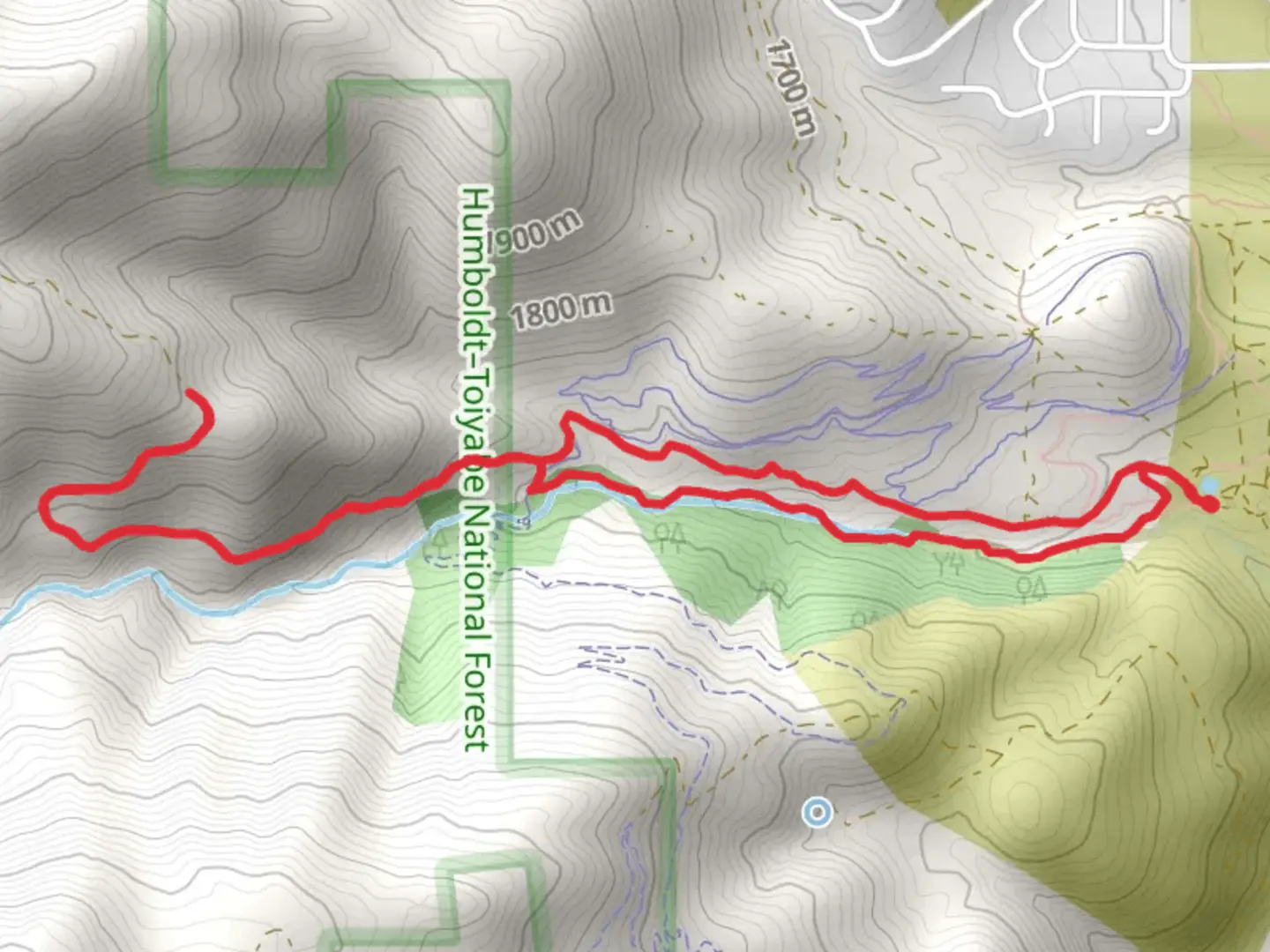
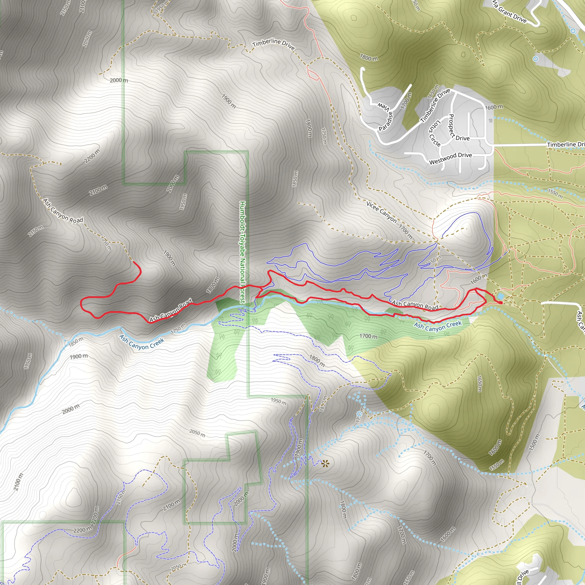
Starting near the City of Carson City, Nevada, the Creek Trail and Ash Canyon Road Loop offers an invigorating 8 km (approximately 5 miles) hike with an elevation gain of around 400 meters (1,312 feet). This loop trail is rated as medium difficulty, making it suitable for moderately experienced hikers looking for a rewarding outdoor adventure.
Getting There
To reach the trailhead, you can drive or use public transportation. If driving, head towards the western edge of Carson City. The nearest known address to the trailhead is near the intersection of Ash Canyon Road and Wellington Crescent. For those using public transport, Carson City's Jump Around Carson (JAC) bus service can get you close to the starting point, but you may need to walk a short distance from the nearest bus stop.
Trail Navigation
For navigation, it's highly recommended to use HiiKER, which provides detailed maps and real-time updates. The trail is well-marked, but having a reliable navigation tool will enhance your hiking experience.
Trail Highlights
#### Initial Ascent
The hike begins with a gradual ascent through a mix of sagebrush and juniper trees. As you climb, you'll gain approximately 200 meters (656 feet) in the first 2 km (1.2 miles). This section offers panoramic views of Carson City and the surrounding valleys, making it a great spot for early photo opportunities.
#### Creek Crossing
Around the 3 km (1.9 miles) mark, you'll encounter a small creek. Depending on the season, the water level can vary, so be prepared for a potentially wet crossing. This area is rich in riparian vegetation, including willows and cottonwoods, and is a good spot to observe local wildlife such as mule deer and various bird species.
#### Historical Significance
As you continue, you'll come across remnants of old mining operations. This region was historically significant during the silver mining boom of the late 19th century. Look out for old mining equipment and tailings, which serve as a reminder of the area's industrious past.
Midpoint and Highest Elevation
The midpoint of the trail is also the highest elevation, reaching around 2,000 meters (6,562 feet). Here, you'll be rewarded with stunning views of the Sierra Nevada mountains to the west and the Pine Nut Range to the east. This is an excellent spot for a rest and a snack before beginning your descent.
Descent and Return
The descent follows Ash Canyon Road, a well-maintained dirt road that gradually winds back down towards the trailhead. This section is less strenuous but offers equally impressive views and a chance to spot more wildlife, including hawks and possibly even a bobcat if you're lucky.
Flora and Fauna
Throughout the hike, you'll traverse diverse ecosystems ranging from arid sagebrush flats to lush creekside vegetation. Keep an eye out for wildflowers in the spring and early summer, including lupines and Indian paintbrush. The varied habitats support a wide range of wildlife, so bring binoculars if you're interested in birdwatching.
Final Stretch
The final stretch of the loop brings you back to the starting point near Ash Canyon Road and Wellington Crescent. This section is relatively flat and provides a gentle end to your hike, allowing you to cool down and reflect on the diverse landscapes and historical elements you've encountered.
This trail offers a balanced mix of natural beauty, historical intrigue, and moderate physical challenge, making it a must-visit for hikers in the Carson City area.
What to expect?
Activity types
Comments and Reviews
User comments, reviews and discussions about the Creek Trail and Ash Canyon Road Loop, Nevada.
4.46
average rating out of 5
46 rating(s)
