Download
Preview
Add to list
More
11.7 km
~3 hrs 17 min
573 m
Loop
“Embark on the Swift Reservoir Loop for a scenic, moderately challenging 12 km hike rich in natural beauty.”
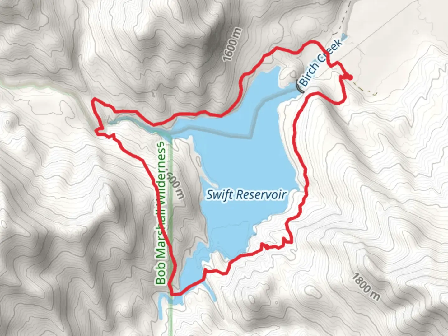
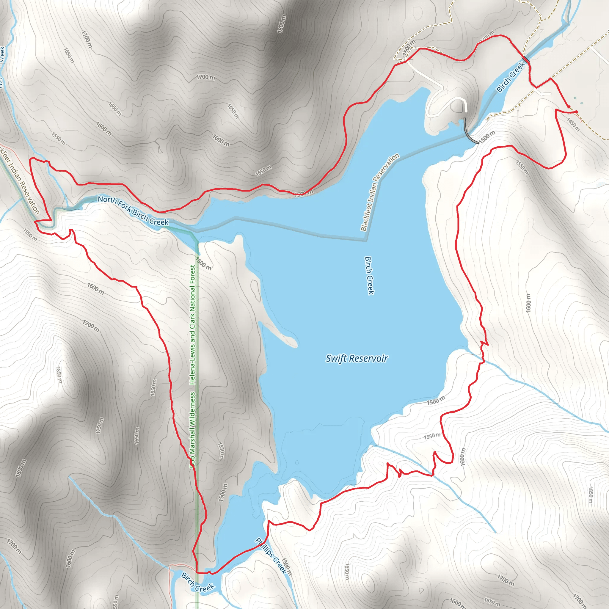
Starting your adventure near Pondera County, Montana, the Swift Reservoir Loop is a captivating 12 km (7.5 miles) trail with an elevation gain of approximately 500 meters (1,640 feet). This loop trail is rated as medium difficulty, making it suitable for moderately experienced hikers.
Getting There To reach the trailhead, you can drive or use public transport. If driving, head towards the Swift Dam Road, which is the nearest significant landmark. For those relying on public transport, the nearest bus stop is in Valier, Montana. From Valier, you can arrange a local taxi or rideshare to take you to the Swift Dam Road.
Trail Overview The trail begins near the Swift Reservoir, a serene body of water that offers a picturesque start to your hike. As you set off, you'll be greeted by a mix of dense forests and open meadows, providing a diverse range of scenery. The initial 2 km (1.2 miles) are relatively flat, allowing you to ease into the hike.
Significant Landmarks and Nature Around the 3 km (1.9 miles) mark, you'll encounter the first significant elevation gain as the trail ascends through a series of switchbacks. This section offers stunning views of the reservoir below and the surrounding mountain ranges. Keep an eye out for local wildlife such as deer, elk, and occasionally, black bears. Birdwatchers will also appreciate the variety of species, including eagles and hawks.
Historical Significance The region around Swift Reservoir has a rich history. The reservoir itself was created in the early 20th century as part of an irrigation project to support local agriculture. As you hike, you'll notice remnants of old irrigation channels and perhaps even some historical markers that provide insight into the area's past.
Mid-Trail Highlights At approximately 6 km (3.7 miles), you'll reach the highest point of the trail. Here, the elevation gain totals around 300 meters (984 feet) from the start. This vantage point offers panoramic views of the Rocky Mountains and the expansive plains to the east. It's an ideal spot for a rest and some photography.
Navigation and Safety Navigating the Swift Reservoir Loop is straightforward, but it's always wise to have a reliable navigation tool. The HiiKER app is highly recommended for this trail, providing detailed maps and real-time updates. Ensure you have downloaded the trail map before setting off, as cell service can be spotty in this remote area.
Final Stretch The descent begins after the 7 km (4.3 miles) mark, where the trail gradually winds back down towards the reservoir. This section is less strenuous but requires careful footing, especially if the ground is wet. The final 2 km (1.2 miles) bring you back along the shoreline of the reservoir, offering a tranquil end to your hike.
Wildlife and Flora Throughout the trail, you'll encounter a variety of flora, including wildflowers in the spring and summer months. The forested sections are dominated by pine and fir trees, providing ample shade and a cool respite during warmer days.
Practical Tips Given the medium difficulty rating, it's advisable to bring plenty of water, snacks, and appropriate hiking gear. Weather can change rapidly in this region, so layers are recommended. Always inform someone of your hiking plans and expected return time.
The Swift Reservoir Loop offers a rewarding experience with its mix of natural beauty, historical significance, and moderate challenge. Whether you're a seasoned hiker or looking to step up from easier trails, this loop provides a memorable adventure in the heart of Montana.
What to expect?
Activity types
Comments and Reviews
User comments, reviews and discussions about the Swift Reservoir Loop, Montana.
4.63
average rating out of 5
19 rating(s)
