Download
Preview
Add to list
More
20.5 km
~2 days
1165 m
Multi-Day
“Embark on Montana's Roderick Ridge - Independence Trail for a historic, wildlife-rich hiking escapade amid breathtaking vistas.”
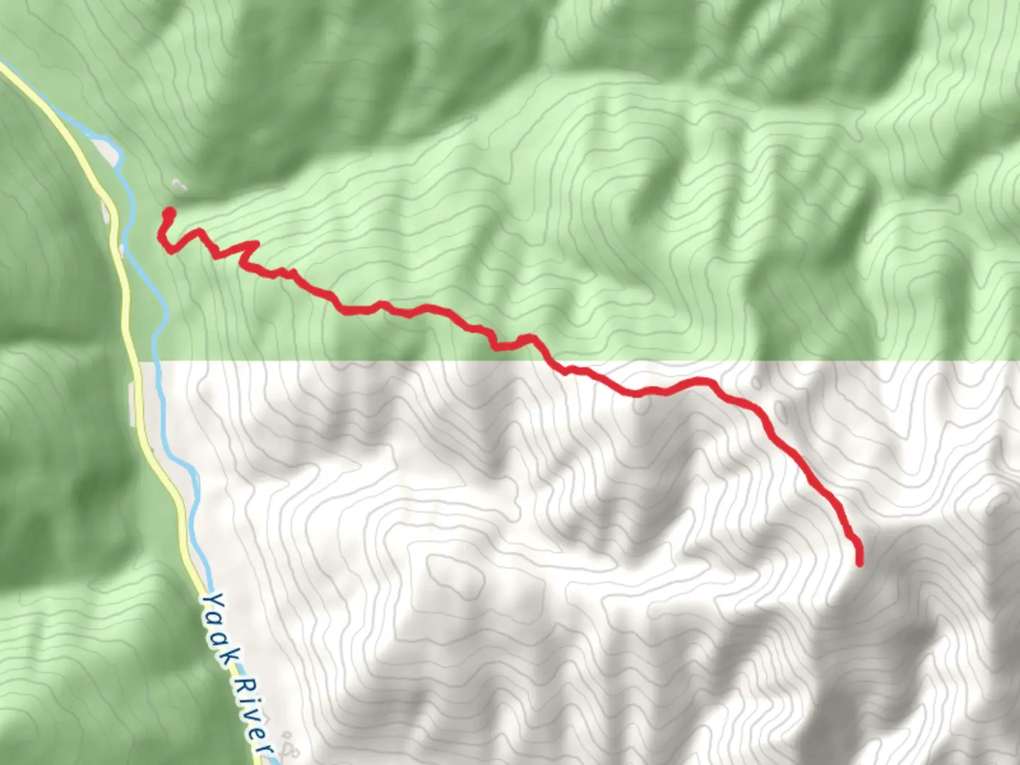
The Roderick Ridge - Independence Trail, nestled in the scenic surroundings of Lincoln County, Montana, offers an invigorating hiking experience for those looking to explore the rugged beauty of the region. Spanning approximately 20 kilometers (about 12.4 miles) with an elevation gain of around 1100 meters (roughly 3609 feet), this out-and-back trail is rated as medium difficulty, making it accessible to hikers with a reasonable level of fitness.
Getting to the Trailhead
To reach the trailhead, hikers can drive to the vicinity of Lincoln County, where the starting point is conveniently located. For those relying on public transportation, the nearest bus or shuttle services may drop you off at a nearby town, from which you can take a taxi or arrange for a local shuttle service to the trailhead. It's advisable to check local transit schedules and availability in advance to ensure a smooth start to your hiking adventure.
Navigating the Trail
As you embark on the Roderick Ridge - Independence Trail, you'll be greeted by a well-defined path that meanders through a diverse landscape. The initial segment of the trail is relatively gentle, allowing you to warm up as you become acquainted with the surrounding wilderness. To aid in navigation, hikers can utilize the HiiKER app, which provides detailed maps and waypoints to ensure you stay on the right path.
Landmarks and Scenery
The trail boasts a variety of landmarks and natural features that are sure to captivate. Approximately 5 kilometers (3.1 miles) in, you'll encounter a series of switchbacks that gradually lead you to higher elevations, offering stunning panoramic views of the valley below. As you ascend, keep an eye out for the remnants of old mining operations, a nod to the area's historical significance during the gold rush era.
Flora and Fauna
The region is home to a rich tapestry of flora and fauna. Hikers can expect to see a range of wildlife, including deer, elk, and possibly even black bears, so it's important to be bear aware and practice safe wildlife encounters. The trail is also adorned with a variety of plant life, from towering pines to delicate wildflowers that bloom in the warmer months, adding a splash of color to the landscape.
Historical Significance
The Independence Trail area is steeped in history, with its roots tracing back to the late 1800s when prospectors flocked to the region in search of fortune. As you hike, you'll be walking in the footsteps of those who once sought independence through the discovery of gold. The remnants of their endeavors can still be seen along the trail, providing a tangible connection to the past.
Preparation and Safety
Before setting out, ensure you're well-prepared with adequate water, food, and layers of clothing to adapt to changing weather conditions. The trail's elevation gain can be challenging, so pace yourself and take breaks as needed. Always let someone know your plans and expected return time, and consider carrying a physical map as a backup to your digital navigation tools.
By following these guidelines and respecting the natural environment, your hike along the Roderick Ridge - Independence Trail is sure to be a memorable adventure through the heart of Montana's wilderness.

Comments and Reviews
User comments, reviews and discussions about the Roderick Ridge - Independence Trail, Montana.
4.45
average rating out of 5
11 rating(s)