Download
Preview
Add to list
More
20.2 km
~2 days
719 m
Multi-Day
“The Snyder Ridge Trail: a secluded, undulating hike through Glacier National Park's rich history and vibrant ecosystem.”
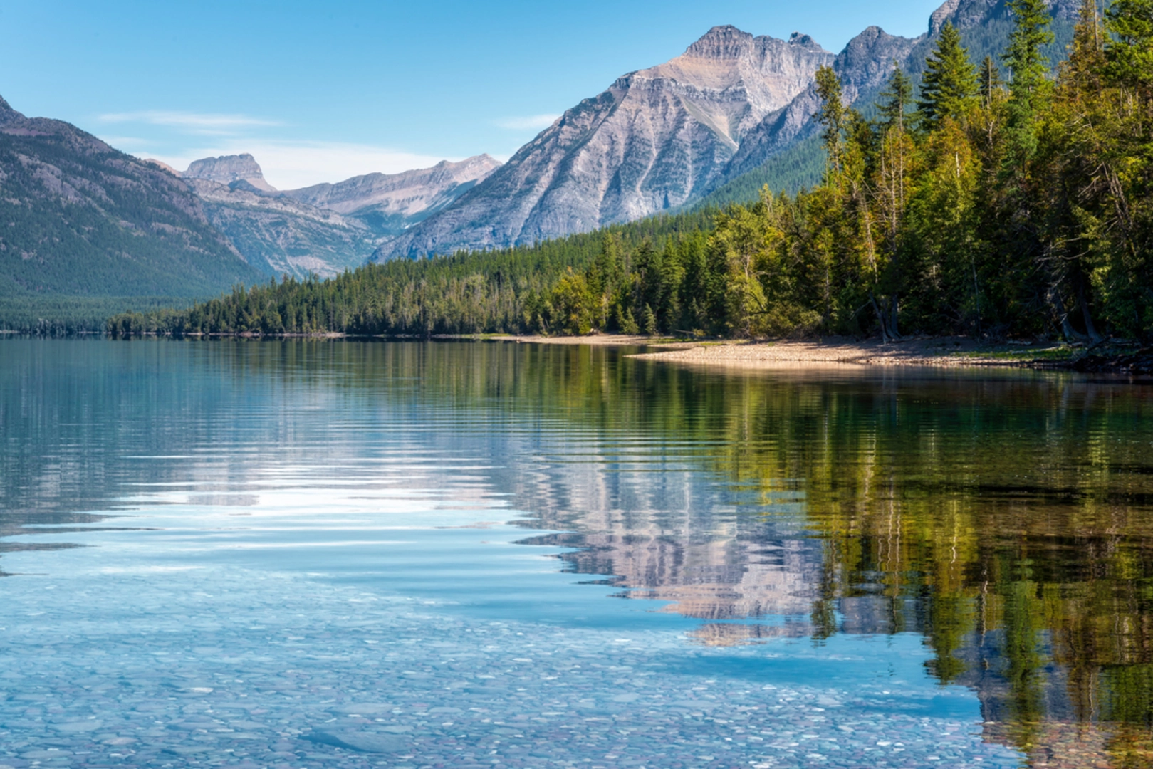
The Snyder Ridge Trail, nestled in the heart of Glacier National Park near Flathead County, Montana, offers hikers a moderately challenging journey through a diverse landscape. Spanning approximately 20 kilometers (12.4 miles) with an elevation gain of around 700 meters (2296 feet), this point-to-point trail is a hidden gem for those seeking solitude and an immersive nature experience.### Getting to the TrailheadTo reach the trailhead, you can drive or take public transportation to the Apgar Visitor Center, located on Going-to-the-Sun Road. From there, the trailhead is a short distance away, accessible by a local shuttle service during the peak season or by personal vehicle. Parking is available near the visitor center, and from there, you can follow the signs leading to the start of Snyder Ridge Trail.### The Hike ItselfAs you embark on the Snyder Ridge Trail, the path begins with a steady incline through a dense forest of cedar and hemlock. The canopy provides a cool shade, making it a pleasant start even on warmer days. Approximately 3 kilometers (1.9 miles) in, the trail starts to open up, offering glimpses of Lake McDonald and the surrounding peaks.Continuing on, the trail becomes more rugged, with a series of switchbacks that lead you higher into the heart of the ridge. The underbrush is rich with huckleberry bushes, and if you're hiking in late summer, you may find them laden with ripe berries—a treat for both hikers and the local bear population. Remember to make noise and carry bear spray as a precaution.### Flora, Fauna, and FeaturesThe Snyder Ridge Trail is a haven for wildlife enthusiasts. Common sightings include deer, mountain goats, and an array of bird species. The trail doesn't offer many open vistas, but the occasional breaks in the trees reveal stunning views of the park's rugged terrain.As you approach the halfway mark, around 10 kilometers (6.2 miles), the trail begins to level out somewhat, and you'll find yourself walking along the ridge with a more gentle undulation in the path. This section is particularly serene, with the sounds of nature uninterrupted by the bustle of more crowded trails.### Historical SignificanceGlacier National Park is steeped in history, with the Snyder Ridge Trail traversing land that was once the hunting and gathering grounds of the Blackfeet and Salish tribes. As you hike, consider the centuries of footsteps that have crossed this same landscape.### Nearing the EndThe final stretch of the trail descends gradually, bringing you closer to the end point. You'll pass through areas recovering from past wildfires, which offer a stark contrast to the earlier sections of the hike and a reminder of the natural cycles of growth and regeneration in the forest.### NavigationFor navigation purposes, HiiKER is an excellent tool to use while traversing the Snyder Ridge Trail. It can help you keep track of your progress and ensure you remain on the correct path, as some sections may have less distinct markings.### Preparation and PlanningBefore setting out, ensure you have adequate water, food, and layers of clothing to adapt to changing weather conditions. The trail can be completed in a single long day by a fit hiker, but some may choose to camp at designated backcountry sites along the way (permits required). Always check the latest trail conditions and bear activity reports at the Apgar Visitor Center or online before your hike.By preparing accordingly and respecting the natural environment, your hike along the Snyder Ridge Trail will be a memorable journey through the quieter side of Glacier National Park.

Comments and Reviews
User comments, reviews and discussions about the Snyder Ridge Trail, Montana.
4.29
average rating out of 5
7 rating(s)