Download
3D Flyover
Add to list
More
65.2 km
~3 days
213 m
Multi-Day
“Traverse the historic Longleaf Trace Trail, a scenic Mississippi journey through time and nature's splendor.”
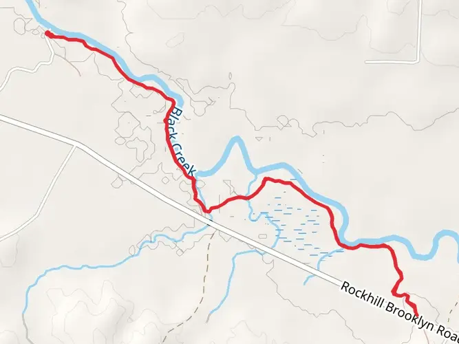
The Longleaf Trace Trail stretches approximately 65 kilometers (around 40 miles) and features a gentle elevation gain of about 200 meters (roughly 650 feet), making it a moderately challenging route suitable for hikers of various skill levels. This point-to-point trail is nestled in the scenic area near Forrest County, Mississippi, and is well-known for its historical significance and natural beauty.
Getting to the Trailhead
To reach the starting point of the Longleaf Trace Trail, hikers can drive to the trailhead located just outside of Hattiesburg, Mississippi. For those relying on public transportation, options may be limited, but regional bus services can get you close to Hattiesburg, where you might need to arrange a taxi or a ride-share service to the trailhead itself.
Navigating the Trail
Hikers can utilize the HiiKER app to navigate the trail, ensuring they stay on the correct path and can easily locate points of interest along the way. The trail is well-marked, and its relatively flat terrain makes for a straightforward hike.
Landmarks and Scenery
As you embark on the Longleaf Trace Trail, you'll be walking along a converted railroad line that once played a crucial role in the region's transportation and industry. The trail is lined with longleaf pine forests, a unique ecosystem that supports a diverse range of wildlife, including the endangered red-cockaded woodpecker and gopher tortoise.
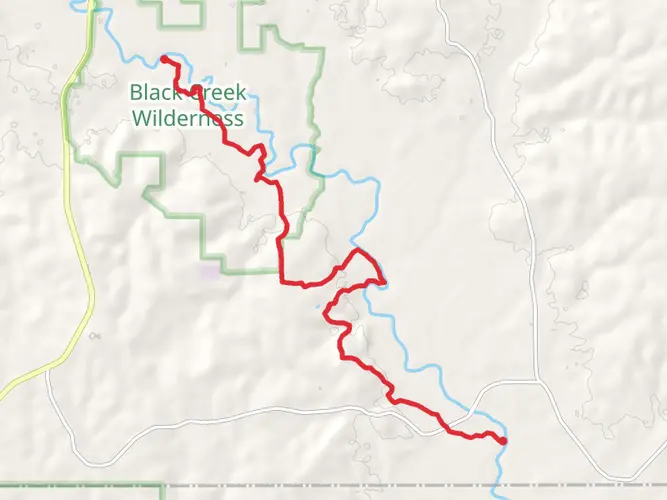
Approximately 10 kilometers (6 miles) into the hike, you'll pass through the quaint town of Sumrall, which offers a glimpse into the area's past with its historic buildings and small-town charm. Further along, at the 32-kilometer (20-mile) mark, the trail meanders through the De Soto National Forest, an expansive protected area that offers a serene backdrop for your hike.
Flora and Fauna
The trail's namesake longleaf pines tower above, while the understory is dotted with flowering plants and shrubs that provide a habitat for butterflies and birds. Keep an eye out for the vibrant flashes of the Mississippi state bird, the mockingbird, as it flits between the trees.
Historical Significance
The Longleaf Trace Trail is steeped in history, with the rail line it follows having been integral to the timber industry that once thrived in the area. Hikers will be walking a path that echoes with the stories of the past, from the early 1900s when the railroad was a lifeline for local communities, to its transformation into a recreational trail that preserves the region's heritage.
Trail Amenities and Considerations
Rest stops and facilities are spaced out along the trail, providing hikers with opportunities to rest and refuel. It's advisable to carry sufficient water and snacks, as some stretches between amenities can be quite long. The trail is also popular with cyclists, so be mindful of sharing the path.
Wildlife Precautions
While the trail is relatively safe, it's important to remember that you are sharing the space with local wildlife. Be aware of your surroundings, especially during dawn and dusk when animals are more active. It's recommended to carry a first aid kit and know how to respond to any potential encounters with wildlife.
Seasonal Considerations
The Longleaf Trace Trail can be enjoyed year-round, but the best times to hike are during the spring and fall when the weather is mild and the foliage offers a spectacular display. Summers can be hot and humid, so if hiking during this season, start early in the day to avoid the heat.
By preparing adequately and respecting the natural and historical significance of the Longleaf Trace Trail, hikers can look forward to an enriching experience that combines the beauty of the Mississippi landscape with the echoes of its storied past.

Comments and Reviews
User comments, reviews and discussions about the Longleaf Trace Trail, Mississippi.
4.52
average rating out of 5
99 rating(s)