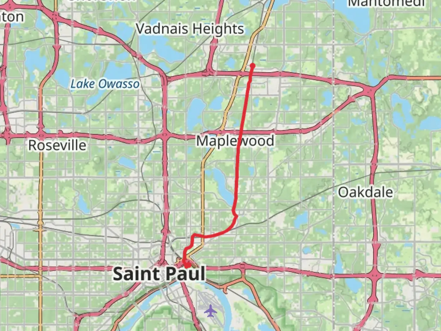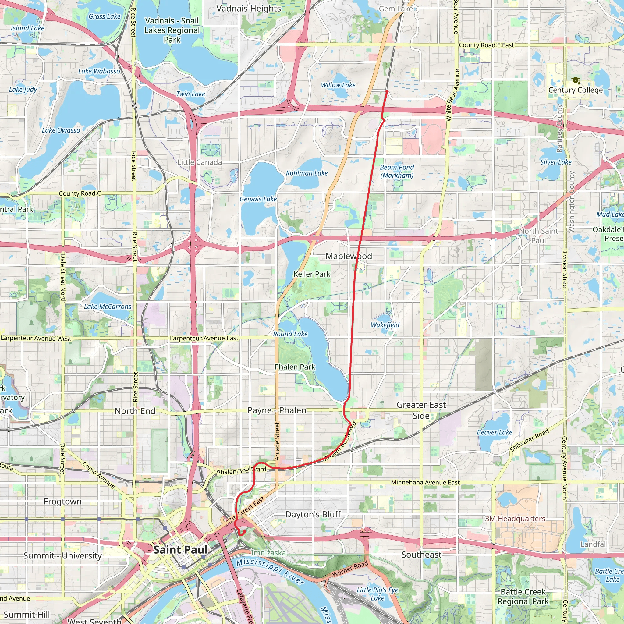
Sam Morgan Regional Trail from Bruce Vento Nature Sanctuary
Download
Preview
Add to list
More
12.2 km
~2 hrs 37 min
103 m
Point-to-Point
“Explore the scenic Sam Morgan Regional Trail, rich in history and nature, perfect for moderate hikers.”
Starting near the Ramsey County area in Minnesota, the Sam Morgan Regional Trail from Bruce Vento Nature Sanctuary offers a delightful 12 km (approximately 7.5 miles) point-to-point hike with an elevation gain of around 100 meters (328 feet). This trail is rated as medium difficulty, making it suitable for moderately experienced hikers.
Getting There To reach the trailhead, you can either drive or use public transportation. If you're driving, set your GPS to the Bruce Vento Nature Sanctuary, located near 4th Street East and Commercial Street in Saint Paul, MN. There is ample parking available at the sanctuary. For those using public transport, the nearest bus stop is at the intersection of 4th Street East and Commercial Street, serviced by several local bus routes.
Trail Overview The trail begins at the Bruce Vento Nature Sanctuary, a site rich in both natural beauty and historical significance. This sanctuary was once a bustling industrial area but has since been transformed into a haven for wildlife and native plants. As you start your hike, you'll notice the remnants of old railroad tracks and industrial structures, a nod to the area's past.
Key Landmarks and Points of Interest - **Bruce Vento Nature Sanctuary (0 km / 0 miles):** The starting point of your hike, this sanctuary is home to diverse flora and fauna. Keep an eye out for native bird species and wetland plants. - **Mississippi River (2 km / 1.2 miles):** As you progress, the trail runs parallel to the Mississippi River, offering stunning views of the waterway. This section is relatively flat, making it a good spot to catch your breath and enjoy the scenery. - **Harriet Island Regional Park (5 km / 3.1 miles):** Midway through your hike, you'll reach Harriet Island, a popular spot for picnics and riverboat cruises. The park features beautiful gardens and open spaces, perfect for a short rest. - **Lilydale Regional Park (8 km / 5 miles):** Continuing along the trail, you'll enter Lilydale Regional Park. This area is known for its fossil grounds and birdwatching opportunities. The terrain here becomes slightly more challenging with a few gentle inclines. - **Kaposia Landing (12 km / 7.5 miles):** The trail concludes at Kaposia Landing, a large park with sports fields and picnic areas. This is a great place to relax and reflect on your hike.
Nature and Wildlife Throughout the trail, you'll encounter a variety of ecosystems, from wetlands and riverbanks to woodlands and open fields. The diverse habitats support a wide range of wildlife, including deer, foxes, and numerous bird species. Spring and fall are particularly good times for birdwatching, as many migratory species pass through the area.
Historical Significance The trail passes through areas that were historically significant to the Dakota people and later became industrial hubs during the 19th and early 20th centuries. Informational plaques along the trail provide insights into the region's history, including its transformation from industrial use to natural restoration.
Navigation and Safety For navigation, it's highly recommended to use the HiiKER app, which provides detailed maps and real-time updates. The trail is well-marked, but having a reliable navigation tool will ensure you stay on track. Be sure to carry enough water, wear sturdy hiking boots, and check the weather forecast before setting out.
This trail offers a unique blend of natural beauty, historical context, and moderate physical challenge, making it a rewarding experience for those looking to explore the scenic and historical landscapes of Minnesota.
What to expect?
Activity types
Comments and Reviews
User comments, reviews and discussions about the Sam Morgan Regional Trail from Bruce Vento Nature Sanctuary, Minnesota.
4.33
average rating out of 5
30 rating(s)
