Download
Preview
Add to list
More
6.8 km
~1 hrs 27 min
59 m
Loop
“Explore diverse landscapes on the 7 km Pine, Lone Oak, Big Bluestem, and Pond Loop, accessible for most hikers.”
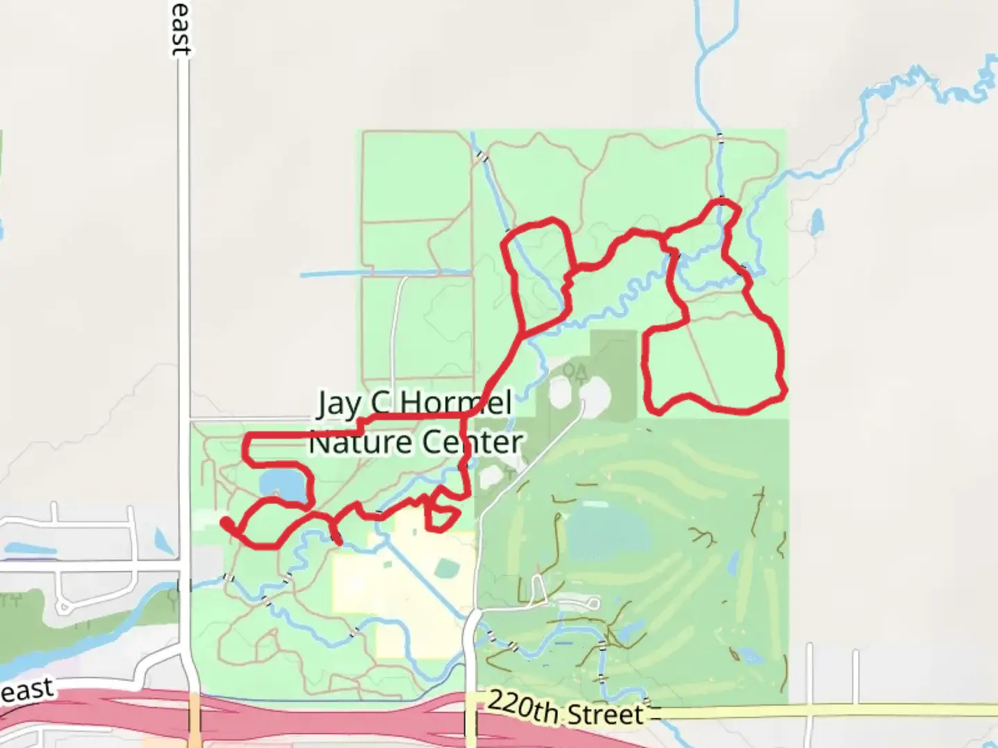
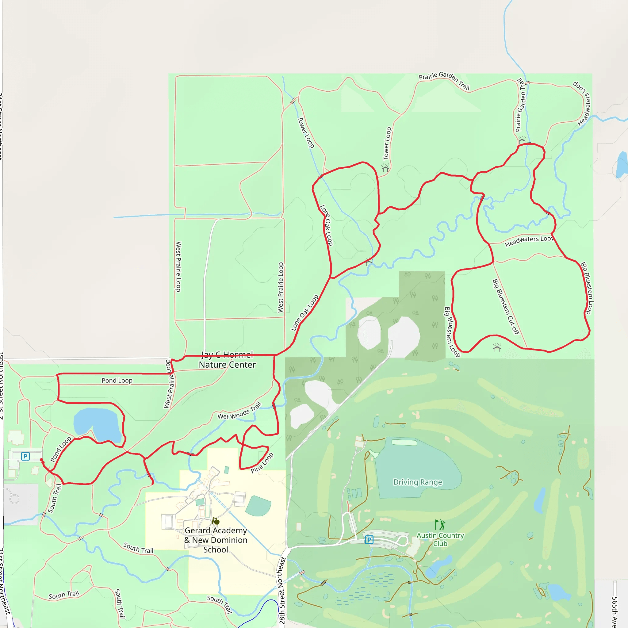
Starting near Mower County, Minnesota, the Pine, Lone Oak, Big Bluestem, and Pond Loop is a delightful 7 km (approximately 4.35 miles) loop trail with no significant elevation gain, making it accessible for a wide range of hikers. The trailhead is conveniently located near the intersection of County Road 2 and 540th Avenue, providing easy access whether you're arriving by car or public transport.
Getting There For those driving, parking is available at the trailhead near the intersection of County Road 2 and 540th Avenue. If you're using public transport, the nearest bus stop is in Austin, Minnesota, about 15 miles (24 km) away. From Austin, you can take a taxi or rideshare service to reach the trailhead.
Trail Overview The trail is a loop, so you can start in either direction. The terrain is relatively flat, with an elevation gain of 0 meters, making it a comfortable hike for most people. The trail is rated as medium difficulty due to its length and some uneven surfaces.
Key Sections and Landmarks
#### Pine Section The first section of the trail takes you through a dense pine forest. The scent of pine needles and the soft forest floor make this part of the hike particularly enjoyable. Keep an eye out for deer and various bird species that frequent this area. Approximately 1 km (0.62 miles) into the hike, you'll come across a small clearing with a bench, perfect for a short rest.
#### Lone Oak Section As you continue, you'll transition into the Lone Oak section, named after a solitary oak tree that stands majestically in an open meadow. This section is about 2 km (1.24 miles) from the start. The oak tree is a great spot for photos and a brief pause to appreciate the landscape. The meadow is often filled with wildflowers in the spring and summer, attracting butterflies and bees.
#### Big Bluestem Section Next, you'll enter the Big Bluestem section, characterized by tall grasses and prairie flowers. This part of the trail is around 3.5 km (2.17 miles) from the trailhead. The Big Bluestem grass can grow up to 2 meters (6.5 feet) tall, creating a unique and immersive experience. This area is also home to various small mammals and ground-nesting birds.
#### Pond Loop The final section of the trail loops around a serene pond, approximately 5 km (3.1 miles) into the hike. The pond is a great spot for birdwatching, with ducks, herons, and occasionally even a bald eagle making an appearance. There are a couple of picnic tables here, making it an ideal spot for a lunch break. The loop around the pond is about 1 km (0.62 miles) long, bringing you back to the main trail.
Historical Significance The area around Mower County has a rich history, with Native American tribes such as the Dakota Sioux originally inhabiting the region. The landscape you hike through has been shaped by centuries of natural and human activity, from the tallgrass prairies maintained by indigenous fire practices to the agricultural development by European settlers in the 19th century.
Navigation and Safety For navigation, it's recommended to use the HiiKER app, which provides detailed maps and real-time GPS tracking to ensure you stay on the correct path. The trail is well-marked, but having a reliable navigation tool can enhance your hiking experience.
Wildlife and Flora Throughout the hike, you'll encounter a variety of wildlife, including deer, rabbits, and numerous bird species. The flora is equally diverse, with pine trees, oak trees, Big Bluestem grass, and seasonal wildflowers creating a vibrant and ever-changing landscape.
This trail offers a wonderful mix of forest, meadow, and wetland environments, making it a rewarding hike for nature enthusiasts and casual hikers alike.
What to expect?
Activity types
Comments and Reviews
User comments, reviews and discussions about the Pine, Lone Oak, Big Bluestem and Pond Loop, Minnesota.
4.59
average rating out of 5
27 rating(s)
