Download
3D Flyover
Add to list
More
63.0 km
~3 days
637 m
Multi-Day
“Embark on a wild, scenic trek along Minnesota's rugged Kekekabic Trail, a true backcountry odyssey.”
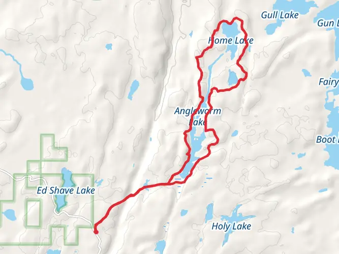
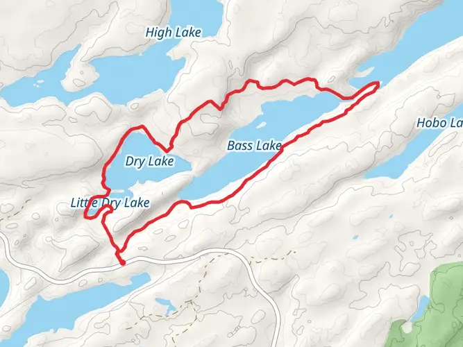
The Kekekabic Trail, winding through the heart of the Boundary Waters Canoe Area Wilderness in northeastern Minnesota, offers a rugged and remote hiking experience. Spanning approximately 63 kilometers (39 miles), with an elevation gain of around 600 meters (nearly 2000 feet), this point-to-point trail is a true wilderness adventure.
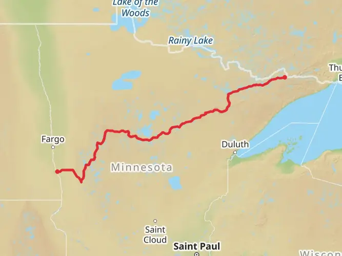
Getting There: To reach the trailhead, hikers can drive to the western terminus near the Gunflint Trail (County Road 12) close to Lake County, Minnesota. The eastern end of the trail is accessible via the Fernberg Road (County Road 18) near Ely. There is no direct public transportation to the trailheads, so hikers typically arrange for a shuttle or leave a vehicle at one end if they plan to complete the entire trail.
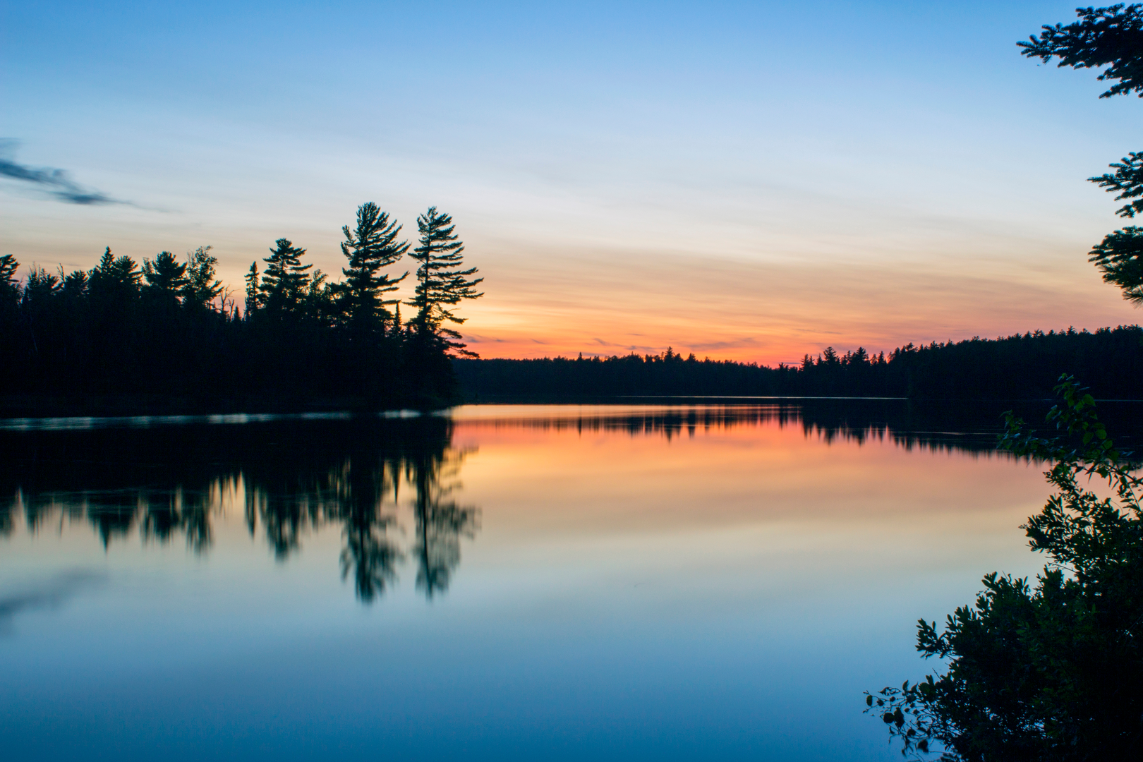
Trail Experience: As you embark on the Kekekabic Trail, you'll traverse a variety of landscapes, including dense boreal forests, rocky ridges, and numerous lakes and streams. The trail is well-marked with blue blazes, but due to its remote nature, it's essential to carry a reliable navigation tool like HiiKER to stay on course.
Landmarks and Nature: One of the highlights of the trail is the panoramic view from atop the Kekekabic Cliffs, offering a breathtaking overlook of the surrounding wilderness. Approximately 20 kilometers (12 miles) from the western trailhead, this is a perfect spot to rest and take in the scenery.
Wildlife is abundant, with chances to spot moose, black bears, and a variety of bird species, including the iconic loon. The trail also passes through areas affected by the 2006 Cavity Lake Fire and the 1999 Blowdown, providing a unique look at nature's resilience and the cycle of forest regeneration.
Historical Significance: The Kekekabic Trail runs through a region rich in history. The Boundary Waters area was once the land of the Ojibwe people and later became a route for fur traders. Logging was also a significant part of the region's history, and hikers can see remnants of the old logging days along the trail.
Preparation and Planning: Given the trail's medium difficulty rating, hikers should be prepared for uneven terrain and potentially challenging conditions. It's recommended to carry a water filtration system, as there are many water sources along the route that require treatment before consumption.
The best times to hike the Kekekabic Trail are from late spring to early fall when the weather is more stable, and the bugs are less prevalent. Always check the weather forecast before setting out and be prepared for sudden changes in conditions.
Remember to practice Leave No Trace principles to preserve the wilderness for future hikers. Due to the remote nature of the trail, it's crucial to be self-sufficient and prepared for emergencies. Always let someone know your itinerary and expected return time.
Whether you're looking for solitude, a challenging hike, or an opportunity to immerse yourself in the natural beauty of the Boundary Waters, the Kekekabic Trail is a journey that offers a true sense of wilderness adventure.

What to expect?
Activity types
Frequently asked questions
How long does it take to hike the Kekekabic Trail in Minnesota?
The Kekekabic Trail is 63.02 km, or about 39 miles, as a point-to-point route through the Boundary Waters Canoe Area Wilderness. Most backpackers take 3 to 5 days to cover the full trail, depending on pace, campsite choices, and how much time is spent on rough, rocky sections and lake crossings.
Where are the trailheads for the Kekekabic Trail and where can hikers park?
The Kekekabic Trail has two main ends: a western trailhead off the Gunflint Trail and an eastern end reached from the Fernberg Road side near Ely. The east trailhead is shared with the Centennial Trail, and the route is commonly done as a shuttle because it is not a loop. Parking is typically at the trailheads, but vehicles cannot be left where they block traffic or damage vegetation.
Do hikers need a permit for the Kekekabic Trail in the Boundary Waters Canoe Area Wilderness?
Yes. Because most of the Kekekabic Trail lies inside the Boundary Waters Canoe Area Wilderness, permits are required for both day and overnight visits year-round. During the quota season from May 1 through September 30, overnight hikers need the correct BWCAW entry permit, and hikers crossing the Gunflint Trail corridor may need to account for separate entry rules.
Are dogs allowed on the Kekekabic Trail?
Dogs are allowed on the Kekekabic Trail because pets are permitted in the Boundary Waters Canoe Area Wilderness. Since the route is remote and primitive, dogs need to be under control around campsites, wildlife, and other visitors, especially in narrow, rocky sections of trail and near lakeshores.
How difficult is the Kekekabic Trail and what is the terrain like?
The Kekekabic Trail is listed at 63.02 km with 637 m of elevation gain, but the bigger challenge is its primitive wilderness terrain rather than steep climbing. The route crosses boreal forest, rocky ridges, wet ground, lakes, and streams, and the Forest Service describes it as a primitive trail with no cell coverage and limited access for emergencies.
Is the Kekekabic Trail good for a multi-day backpacking trip?
Yes. The Kekekabic Trail is a true multi-day backpacking route that runs for roughly 39 miles across remote northeastern Minnesota. It is one of the long hiking trails inside the BWCAW, so it suits hikers looking for a point-to-point wilderness trip rather than a short front-country walk.
What are the main landmarks and views on the Kekekabic Trail?
One of the best-known viewpoints on the Kekekabic Trail is the Kekekabic Cliffs, which offer broad views over the surrounding Boundary Waters wilderness. The trail also passes through classic Superior National Forest scenery, including dense boreal woods, rocky high ground, and a chain of lakes and streams between the Gunflint Trail side and the Ely area.
Comments and Reviews
User comments, reviews and discussions about the Kekekabic Trail, Minnesota.
4.42
average rating out of 5
19 rating(s)