Download
Preview
Add to list
More
62.8 km
~3 days
164 m
Multi-Day
“Traverse Michigan's scenic and historic Kal-Haven Trail, where nature meets heritage on a gentle 63-kilometer path.”
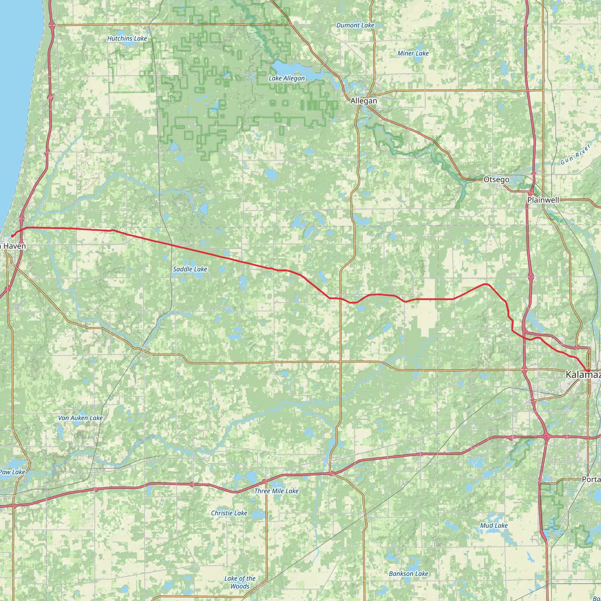
Spanning approximately 63 kilometers (about 39 miles) with a minimal elevation gain of around 100 meters (328 feet), the Kal-Haven Trail offers an easy, accessible hiking experience. This point-to-point trail connects the area near South Haven on Lake Michigan to the outskirts of Kalamazoo, traversing through Van Buren and Kalamazoo counties in Michigan.
Getting to the Trailhead
The trailhead near Van Buren County can be reached by car, with parking available at the trail's western terminus in South Haven. For those using public transportation, options may be limited, but regional bus services can get you close to the trailheads, where you might need to arrange a taxi or rideshare for the final leg of the journey.
Trail Experience
As you embark on the Kal-Haven Trail, you'll be walking on a primarily crushed limestone and slag surface, which makes for a smooth and steady hike. The trail is well-suited for both casual walkers and long-distance hikers, as well as cyclists and horseback riders in certain sections.
The trail is rich in natural beauty, passing through dense hardwood forests, open fields, and alongside streams and rivers. Wildlife is abundant, with opportunities to spot deer, wild turkeys, and various bird species. The changing seasons offer a dynamic backdrop, from the lush greens of summer to the vibrant colors of fall.
Historical Significance
The Kal-Haven Trail is built on the former Kalamazoo and South Haven Railroad bed. As you traverse the trail, you'll encounter remnants of Michigan's past, including historical markers that detail the region's significance in the timber industry and the role the railroad played in the development of these communities.
Landmarks and Points of Interest
Approximately halfway along the trail, near the town of Bloomingdale, is a restored railroad depot that serves as a museum and information center. This is a great spot to take a break and learn more about the area's history.
Navigation and Planning
To navigate the trail, HiiKER is an excellent tool for planning your hike, offering detailed maps and waypoints. It's advisable to download the trail map on your device before setting out, as cell service can be spotty in some areas.
Preparation and Amenities
There are several towns along the route where you can resupply, rest, or find accommodations if you're planning a multi-day hike. The trail also features picnic areas and restrooms at various points. It's important to carry enough water and snacks, as not all sections have amenities close to the trail.
Accessibility
The trail is accessible year-round, but the best times to hike are from spring to fall when the weather is milder and the trail is clear of snow. Winter offers a different experience, with opportunities for snowshoeing and cross-country skiing.
Remember to check the weather forecast before your hike and dress appropriately for the conditions. The Kal-Haven Trail is a testament to Michigan's natural beauty and historical richness, offering an enjoyable experience for hikers of all levels.
What to expect?
Activity types
Comments and Reviews
User comments, reviews and discussions about the Kal-Haven Trail, Michigan.
3.8
average rating out of 5
5 rating(s)

