Download
Preview
Add to list
More
29.5 km
~2 days
77 m
Multi-Day
“Experience the Leelanau Trail's easy, picturesque journey through Michigan's natural and historic landscapes.”
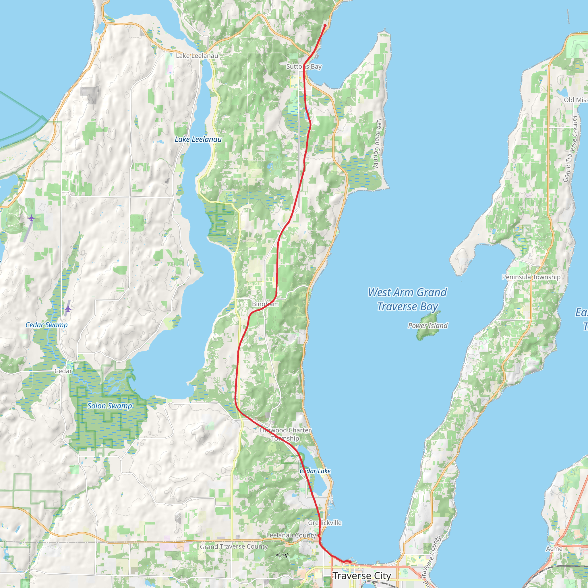
The Leelanau Trail offers a serene and scenic journey through the heart of Michigan's Leelanau Peninsula. Stretching approximately 29 kilometers (18 miles) and boasting virtually no elevation gain, this point-to-point trail is accessible to hikers of all skill levels. The trailhead is conveniently located near Leelanau County, where you can begin your adventure.
Getting to the Trailhead
To reach the starting point of the Leelanau Trail, you can drive to the trailhead located just outside of Traverse City. If you're relying on public transportation, check local transit schedules for the nearest routes that approach the area. Parking is available near the trailhead for those who choose to drive.
Trail Experience
As you embark on the Leelanau Trail, you'll be greeted by a paved pathway that meanders through lush forests, open meadows, and rolling farmlands. The trail is well-maintained and is popular among cyclists and walkers, so expect a friendly and shared use environment.
Natural Beauty and Wildlife
The trail provides an excellent opportunity to observe the local flora and fauna. Keep an eye out for various bird species, deer, and small mammals that inhabit the region. The changing seasons bring a dynamic landscape, with wildflowers blooming in the spring and summer, and a spectacular display of fall colors.
Historical Significance
The Leelanau Peninsula has a rich history, and the trail itself is a testament to the area's past. It follows a portion of the former Traverse City to Charlevoix railroad corridor, giving hikers a glimpse into the region's transportation heritage.
Landmarks and Points of Interest
Approximately halfway along the trail, you'll pass through the charming town of Suttons Bay, which is a perfect spot to take a break and explore local shops, restaurants, and the historic Suttons Bay Depot. This quaint village is a highlight for many hikers, offering a taste of small-town hospitality.
Navigation and Planning
For those looking to navigate the trail, HiiKER is an excellent tool to help plan your hike, providing detailed maps and waypoints along the Leelanau Trail. Be sure to download the map for offline use, as cell service can be spotty in some areas.
Preparation and Amenities
The trail is considered easy due to its flat terrain, but it's still important to come prepared with water, snacks, and appropriate clothing for the weather. There are several restrooms and picnic areas along the route, making it convenient for those planning a leisurely hike.
Accessibility
The Leelanau Trail is also wheelchair-friendly, ensuring that it's inclusive for hikers with different mobility needs. Its smooth surface and gentle grade make it a pleasure to traverse for individuals of all abilities.
Whether you're looking for a full-day hike or a short stroll, the Leelanau Trail is a delightful choice that showcases the natural beauty and historical charm of northern Michigan.
What to expect?
Comments and Reviews
User comments, reviews and discussions about the Leelanau Trail, Michigan.
4.3
average rating out of 5
10 rating(s)

