Download
Preview
Add to list
More
967.0 km
~45 days
4563 m
Multi-Day
“Embark on a 600-mile trek through Michigan's lush forests and historic landscapes on the scenic North Country Trail.”
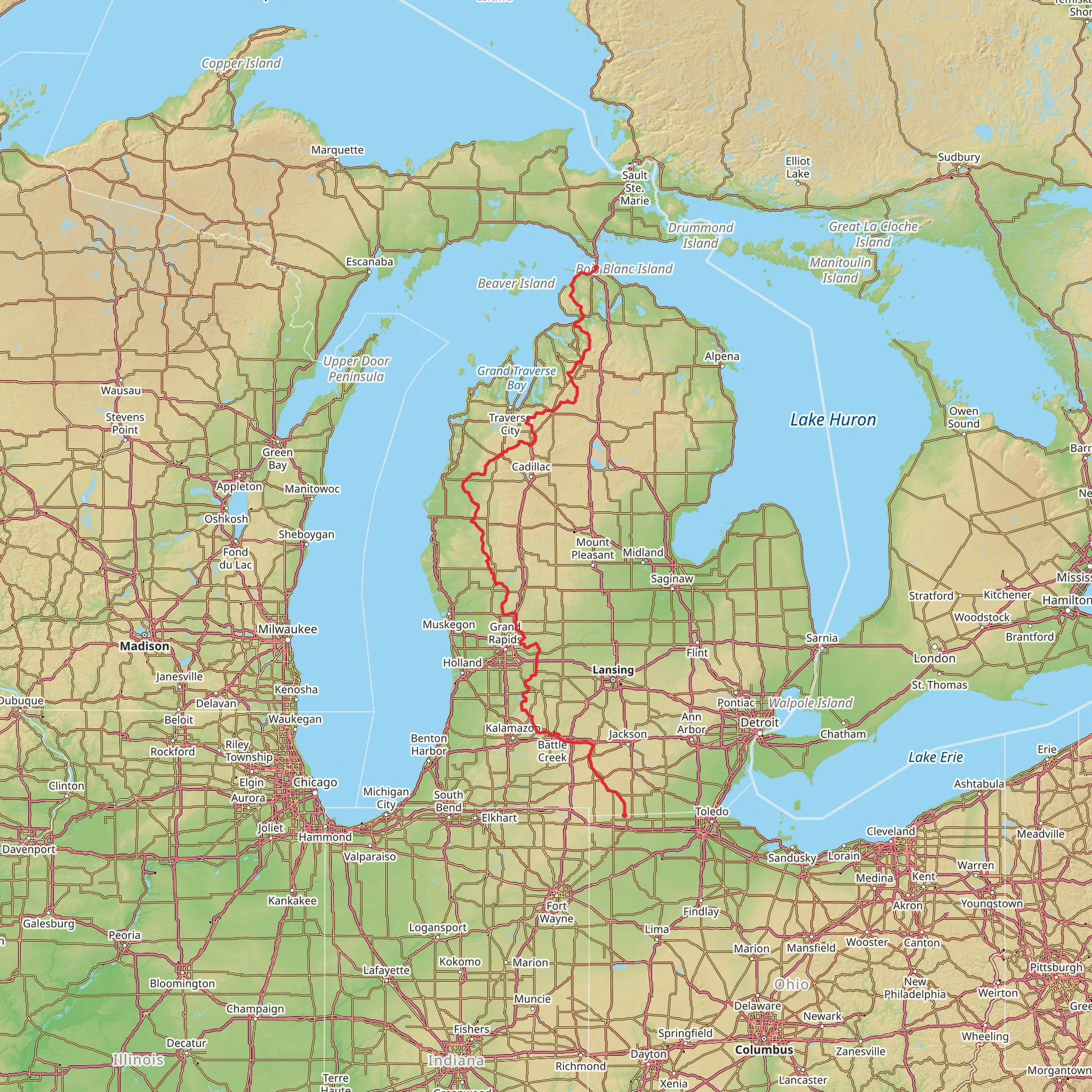
Spanning approximately 600 miles (around 967 km) with an elevation gain of around 14,764 feet (around 4500 meters), the North Country Trail in Michigan's Southeast region offers a diverse and enriching hiking experience. This point-to-point trail begins near Emmet County, Michigan, and winds through a variety of landscapes, including dense forests, serene lakes, and rolling hills.
Getting to the Trailhead
To reach the starting point of the trail near Emmet County, hikers can drive to the vicinity of Petoskey, a city well-known for its vibrant summer tourism. If you're coming from afar, the nearest major airport is Cherry Capital Airport in Traverse City. From there, you can rent a car and drive approximately 1.5 hours to reach the trailhead. Public transportation options are limited in this rural area, so a personal vehicle is recommended for convenience.
Trail Experience
As you embark on your journey, you'll traverse through the lush Manistee National Forest, where towering trees provide a canopy of shade and the sounds of nature envelop you. The trail meanders along the banks of the Manistee River, offering picturesque views and opportunities for water-based activities.
Continuing south, the trail passes through the Huron-Manistee National Forests, which are rich in biodiversity. Keep an eye out for white-tailed deer, wild turkeys, and the occasional black bear, while birdwatchers can delight in spotting a variety of songbirds and raptors.
Historical Significance
The North Country Trail runs through areas steeped in history. As you hike, you'll encounter remnants of Michigan's logging era, old railroads, and historic towns that played significant roles during the westward expansion. The trail also intersects with paths used by Native American tribes, offering a glimpse into the region's rich cultural past.
Landmarks and Highlights
One of the highlights along the trail is the Mackinac Bridge, visible as you approach the Straits of Mackinac. This engineering marvel connects Michigan's Upper and Lower Peninsulas and is a sight to behold.
Further along, the trail crosses the 45th parallel north, marking the halfway point between the Equator and the North Pole. This is a unique spot for a memorable photo opportunity.
Navigation and Planning
When planning your hike, it's essential to use reliable navigation tools. HiiKER is an excellent resource for detailed maps and trail information. It's advisable to download offline maps in advance, as cell service can be spotty in remote areas.
Preparing for the Hike
The trail's difficulty is rated as medium, but it's important to prepare for variable weather conditions and terrain. Pack appropriate gear for both warm and cool temperatures, and ensure you have a sturdy pair of hiking boots. Water sources are available, but it's wise to carry a water filter or purification tablets.
Conclusion
The North Country Trail in Michigan's Southeast is a journey through natural beauty and historical landscapes. With proper preparation and a sense of adventure, hikers can immerse themselves in the wonders of this long-distance trail.
What to expect?
Activity types
Comments and Reviews
User comments, reviews and discussions about the North Country Trail - Michigan Southeast, Michigan.
4.56
average rating out of 5
9 rating(s)

