Download
3D Flyover
Add to list
More
196.3 km
~8 days
5341 m
Multi-Day
“Embark on the M&M Trail, a historical trek through New England's diverse terrains and rich heritage.”
The Metacomet-Monadnock Trail, often referred to as the M&M Trail, is a long-distance footpath that spans approximately 122 miles (196 km) and ascends roughly 17,400 feet (5300 meters) in elevation. This trail offers a medium difficulty level, making it accessible to hikers with a moderate level of experience.
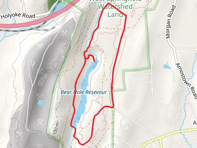
Starting Point and Access The trailhead is located near Hampden County in Massachusetts. For those arriving by car, the starting point can be accessed by taking local roads that lead to the vicinity of Rising Corner, close to the Connecticut-Massachusetts border. Public transportation options are limited in this area, so hikers may need to arrange for a taxi or rideshare service from the nearest bus or train stations in the surrounding towns.
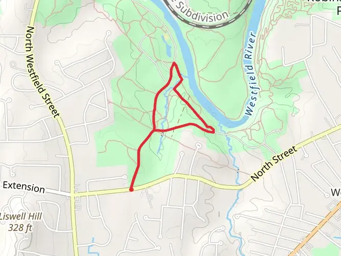
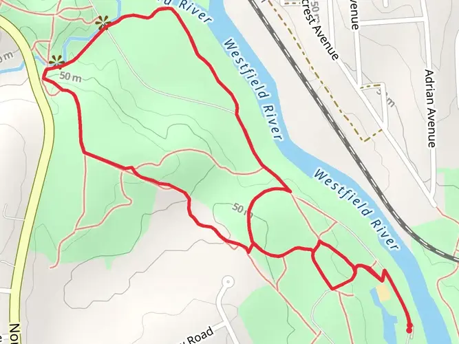
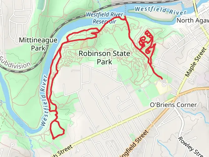
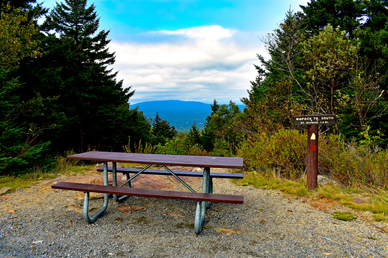
Trail Overview As you embark on the M&M Trail, you'll traverse a diverse landscape that includes rugged mountain ridges, dense forests, and serene river valleys. The trail is well-marked with white blazes, and hikers can rely on the HiiKER app for detailed navigation assistance.
Notable Sections and Landmarks One of the early highlights is the ascent of Mount Tom, which offers panoramic views of the Pioneer Valley. This section is roughly 22 miles (35 km) into the hike and includes an elevation gain of about 1,200 feet (365 meters).
Continuing north, the trail crosses the Holyoke Range, featuring the iconic Seven Sisters, a series of undulating peaks that provide a challenging and rewarding experience. This segment adds another 1,000 feet (305 meters) of elevation gain over a distance of about 12 miles (19 km).
As you progress, the trail intersects with the historic town of Amherst, home to the well-known Amherst College. Hikers can take a detour to explore the town's cultural offerings or resupply for the journey ahead.
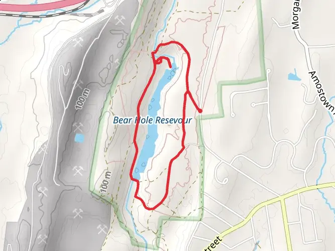
Wildlife and Nature The M&M Trail is rich in biodiversity. Hikers may encounter a variety of wildlife, including white-tailed deer, black bears, and numerous bird species. The trail also winds through several important ecological areas, such as the Montague Plains Wildlife Management Area, which is known for its unique pitch pine and scrub oak barrens.
Historical Significance The trail passes through regions steeped in history, including areas that were significant during the early colonial period and the Revolutionary War. The trail's namesake mountains, Metacomet and Monadnock, are named after indigenous leaders and hold cultural importance.
Preparation and Safety Hikers should be prepared for variable weather conditions and carry appropriate gear for overnight camping if planning a multi-day trek. Water sources are available along the trail, but purification is recommended before consumption.
Conclusion The Metacomet-Monadnock Trail is a journey through both natural beauty and historical landscapes. With its medium difficulty rating, it offers an engaging experience for those looking to explore the heart of New England on foot.

What to expect?
Activity types
Frequently asked questions
How long does it take to hike the Metacomet-monadnock Trail end to end?
The Metacomet-monadnock Trail is 196.28 km, or about 122 miles, with 5,341 m of climbing, so most end-to-end hikes take well over a week. Strong thru-hikers often plan roughly 8 to 14 days, while section hikers usually break it into shorter trips across the Mount Tom Range, Holyoke Range, and the northern sections toward Mount Monadnock.
Where does the Metacomet-monadnock Trail start and finish?
The southern end of the Metacomet-monadnock Trail begins at the Massachusetts-Connecticut state line near Rising Corner in Southwick. From there it runs north through the Mount Tom Range and Holyoke Range, then continues into central Massachusetts and southern New Hampshire, finishing on Mount Monadnock, whose summit reaches 3,165 feet.
Is the Metacomet-monadnock Trail difficult?
Yes. The Metacomet-monadnock Trail is rated difficult, and the challenge comes from both its 196.28 km length and its 5,341 m of total ascent. Some stretches are moderate, but the ridge walking over places like Mount Tom and the Seven Sisters in the Holyoke Range includes repeated steep climbs, rocky footing, and exposed viewpoints.
Are dogs allowed on the Metacomet-monadnock Trail?
Dogs are generally allowed on the Metacomet-monadnock Trail, but they need to be leashed on the New England Trail corridor in Massachusetts. Rules can also vary by park or reservation along the route, so the most restrictive local regulation applies in places such as state parks and protected ridgeline sections.
Can you camp on the Metacomet-monadnock Trail?
Camping on the Metacomet-monadnock Trail is limited to designated overnight sites rather than open dispersed camping. That matters on a 196.28 km multi-day route, because the trail crosses a mix of public land, protected areas, and private land, so overnight stops need to be planned around official tent sites, shelters, or other permitted lodging options.
What are the main highlights on the Metacomet-monadnock Trail in Massachusetts?
The best-known Massachusetts highlights on the Metacomet-monadnock Trail include the traprock cliffs of the Mount Tom Range, the Seven Sisters traverse in the Holyoke Range, and historic spots such as the Mount Holyoke Summit House and the Eyrie House ruins on Mount Nonotuck. The route also passes dramatic ridgelines above the Connecticut River Valley with broad views over the Pioneer Valley.
How is the Metacomet-monadnock Trail marked?
In Massachusetts, the Metacomet-monadnock Trail is marked with white blazes. That is especially useful on the longer ridge sections and on relocated parts of the route, where the trail can cross a mix of forest, roads, and conservation land between Southwick and the northern sections leading toward Mount Monadnock.
Comments and Reviews
User comments, reviews and discussions about the Metacomet-monadnock Trail, Massachusetts.
4.88
average rating out of 5
8 rating(s)