Download
Preview
Add to list
More
12.3 km
~3 hrs 32 min
656 m
Point-to-Point
“Embark on a historic, medium-difficulty hike through Massachusetts' verdant forests to Negus Mountain's panoramic summit.”
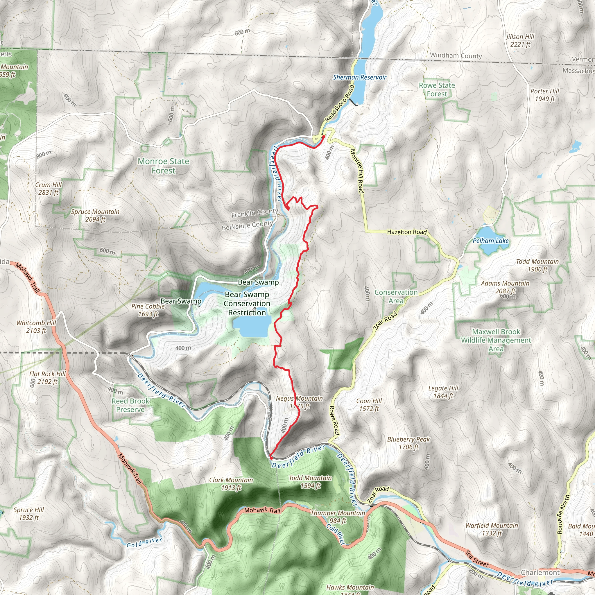
Nestled in the scenic landscape of Franklin County, Massachusetts, the Negus Mountain and Monroe Bridge trail offers an invigorating point-to-point hike that spans approximately 12 kilometers (about 7.5 miles) with an elevation gain of around 600 meters (nearly 2000 feet). This trail is rated as medium difficulty, making it accessible to hikers with some experience looking for a moderately challenging day hike.
Getting to the Trailhead
To reach the trailhead, hikers can drive to the starting point near the rural community of Rowe, Massachusetts. For those relying on public transportation, the nearest significant town with bus services is North Adams, from which you can take a taxi or a local shuttle service to the trailhead. Parking is available near the trailhead, which is typically accessed via Zoar Road or Monroe Bridge.
Navigating the Trail
As you embark on your hike, you'll find that the trail is well-marked, but carrying a reliable navigation tool like HiiKER is recommended to ensure you stay on the correct path. The trail begins with a steady ascent through a mixed hardwood forest, offering a canopy of oak, maple, and birch trees. The first few kilometers will get your heart pumping as you navigate the switchbacks that lead up to the ridge.
Historical Significance and Landmarks
The region is steeped in history, with the nearby Deerfield River being a significant landmark. The Monroe Bridge area is known for the historic Monroe Bridge, which was once a critical crossing point and is now a popular spot for whitewater rafting. As you hike, you may also encounter remnants of old settlements and stone walls that hark back to the 18th and 19th centuries when the area was first being developed.
Flora and Fauna
Throughout the hike, keep an eye out for the diverse wildlife that inhabits the area. You might spot white-tailed deer, black bears, and a variety of bird species, including hawks and woodpeckers. The trail also offers a rich array of flora, with seasonal wildflowers and ferns lining the path, especially in the spring and summer months.
Reaching the Summit
As you approach the summit of Negus Mountain, the trail becomes rockier, and the incline increases. The effort is rewarded with panoramic views of the surrounding Berkshire Hills and the Green Mountains of Vermont. The summit area is a great place for a rest and a snack while you take in the breathtaking vistas.
Descent and Conclusion
The descent towards Monroe Bridge is less steep and provides a different perspective of the landscape, with occasional openings in the forest revealing the river below. The trail concludes near the historic Monroe Bridge, where you can reflect on the journey and the natural beauty you've encountered along the way.
Preparation and Safety
Before setting out, ensure you have adequate water, snacks, and layers of clothing to adapt to changing weather conditions. It's also wise to inform someone of your hiking plans and expected return time. Always check the weather forecast and trail conditions prior to your hike, and be prepared for the trail's rocky and uneven sections by wearing sturdy hiking boots.
By following these guidelines and respecting the natural environment, your hike on the Negus Mountain and Monroe Bridge trail will be a memorable adventure through one of Massachusetts' picturesque landscapes.
What to expect?
Activity types
Comments and Reviews
User comments, reviews and discussions about the Negus Mountain and Monroe Bridge, Massachusetts.
4.67
average rating out of 5
9 rating(s)
