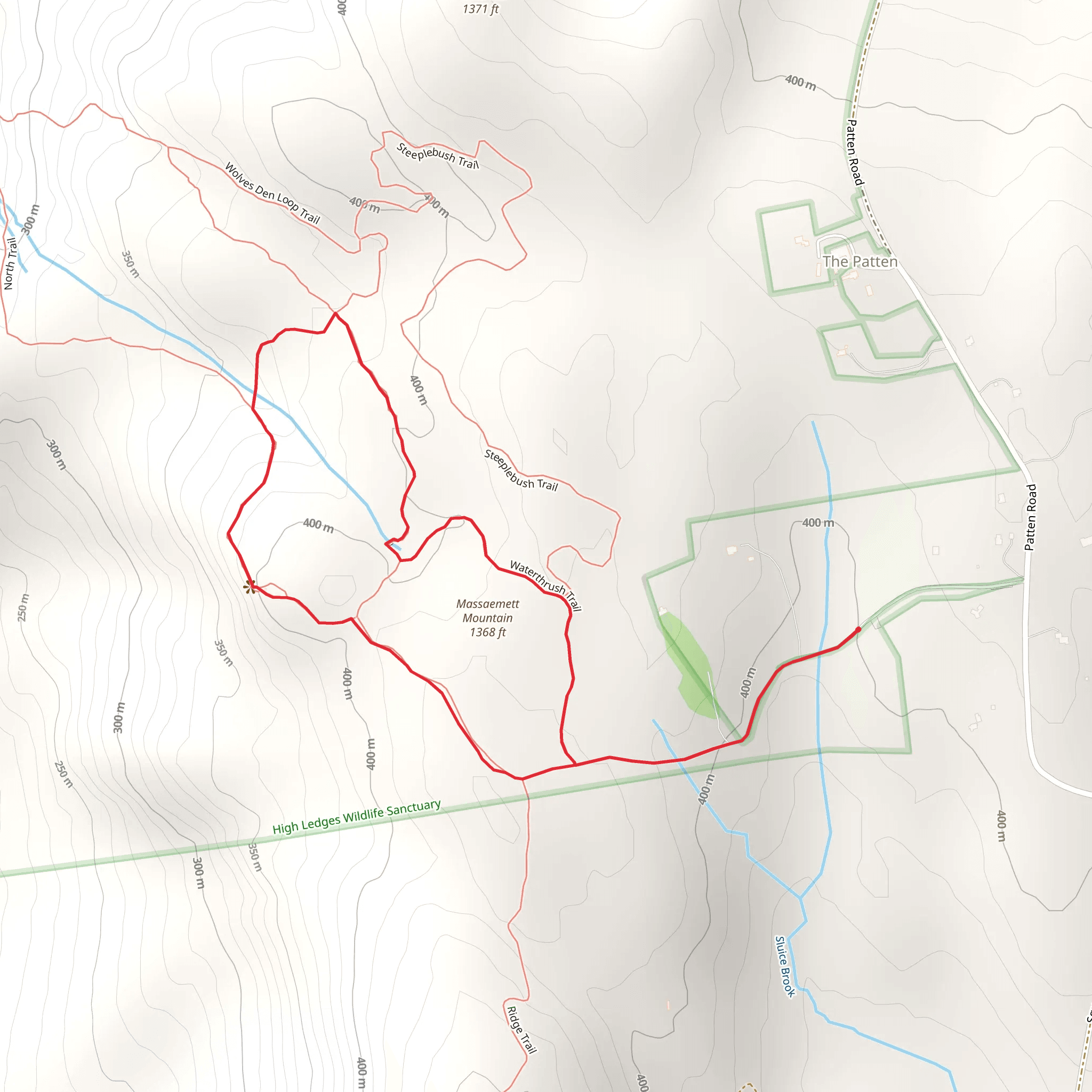
Massaemett Mountain and Dutch and Mary Barnard Trail Loop
Download
Preview
Add to list
More
3.5 km
~54 min
117 m
Loop
“Embark on a historic 4km hike through forests and meadows for panoramic views atop Massachusetts' Massaemett Mountain.”
Nestled in the scenic region of Franklin County, Massachusetts, the Massaemett Mountain and Dutch and Mary Barnard Trail Loop offers an invigorating hike that spans approximately 4 kilometers (about 2.5 miles) with an elevation gain of roughly 100 meters (328 feet). This loop trail is considered to have a medium difficulty rating, providing a balanced adventure for both novice and experienced hikers.
Getting There
To reach the trailhead, hikers can drive to the starting point located near the town of Shelburne Falls. If you're coming from afar, the nearest major city is Springfield, Massachusetts, from which you can take Interstate 91 North to Greenfield and then follow Route 2 West towards Shelburne Falls. Parking is available near the trailhead, which is situated off Route 2, making it easily accessible for those with a vehicle.
For those opting for public transportation, regional bus services may offer routes to Shelburne Falls, from where you can take a taxi or a local shuttle to the trailhead. It's advisable to check the latest schedules and plan accordingly as services may be limited.
Trail Experience
As you embark on the trail, you'll be greeted by a mixed hardwood forest that gradually ascends towards the summit of Massaemett Mountain. The path is well-marked, but having the HiiKER app can be helpful for navigation and to track your progress. The initial ascent is steady, and as you climb, you'll notice the underbrush giving way to larger rock formations and outcroppings.
Historical Significance
The area is steeped in history, with Massaemett Mountain itself being a significant landmark. The mountain and surrounding areas were once inhabited by Native American tribes, and later, European settlers utilized the land for agriculture and industry. As you hike, imagine the past inhabitants traversing these same paths.
Wildlife and Flora
Keep an eye out for the diverse wildlife that inhabits the area, including white-tailed deer, red foxes, and a variety of bird species. The trail is also a haven for wildflowers in the spring and a kaleidoscope of foliage colors in the fall.
Summit and Views
Upon reaching the summit, you'll be rewarded with panoramic views of the Deerfield River Valley and the surrounding hills. The elevation at this point is the highest of the hike, offering a perfect spot for a rest and some photographs.
Descending the Loop
As you continue on the loop, the trail descends gradually. You'll pass by the Dutch and Mary Barnard Trail, named after early settlers in the area. This section of the trail is less steep and will lead you through serene meadows and past old stone walls, remnants of the region's agricultural past.
Preparation Tips
Before setting out, ensure you have adequate water, snacks, and weather-appropriate clothing. The trail can be rocky in places, so sturdy hiking boots are recommended. Also, be prepared for changes in weather, as the summit can be cooler and windier than the base.
Conclusion
The Massaemett Mountain and Dutch and Mary Barnard Trail Loop is a delightful hike that offers a mix of natural beauty, wildlife, and a glimpse into the historical tapestry of Franklin County. Whether you're looking for a challenging workout or a peaceful nature walk, this trail delivers an enriching outdoor experience.
What to expect?
Activity types
Comments and Reviews
User comments, reviews and discussions about the Massaemett Mountain and Dutch and Mary Barnard Trail Loop, Massachusetts.
4.69
average rating out of 5
26 rating(s)
