Download
Preview
Add to list
More
4.7 km
~1 hrs 5 min
99 m
Loop
“Explore history and nature on the accessible 5 km Antietam Battlefield loop trail in Maryland.”
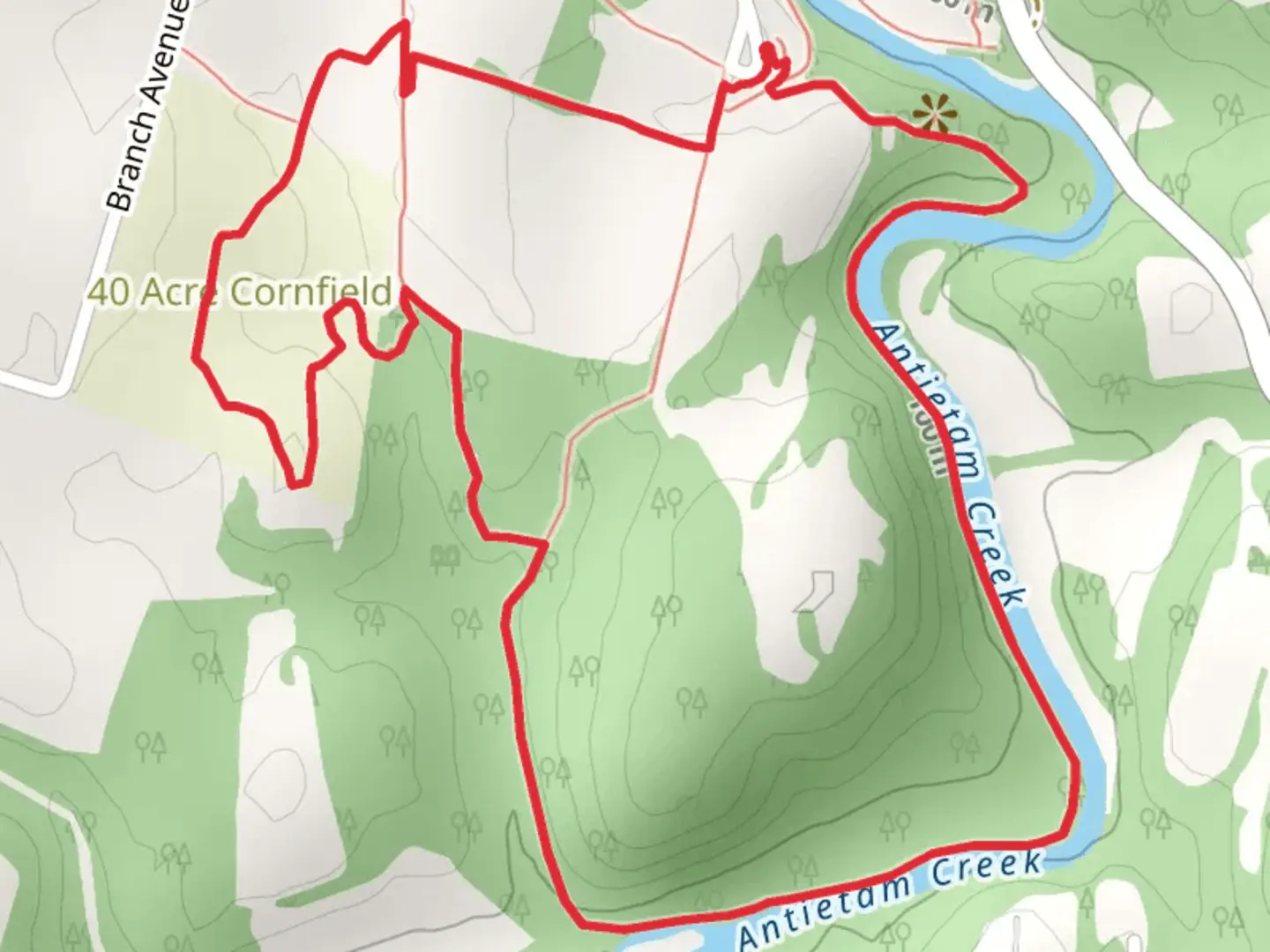
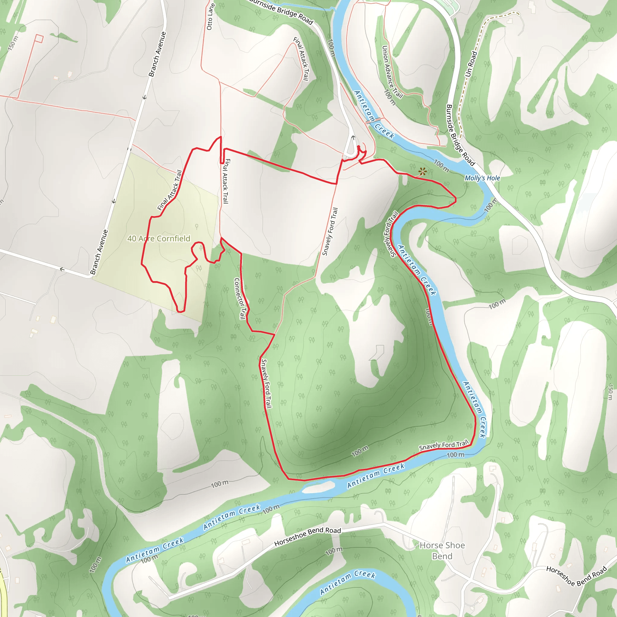
Starting your hike near Washington County, Maryland, the Final Attack Trail and Snavely Ford Loop Trail offers a captivating journey through history and nature. This 5 km (3.1 miles) loop trail is relatively flat with no significant elevation gain, making it accessible for hikers of varying skill levels. The trailhead is conveniently located near the Antietam National Battlefield, a site of immense historical significance.
Getting There To reach the trailhead, you can drive or use public transportation. If driving, set your GPS to Antietam National Battlefield Visitor Center, located at 5831 Dunker Church Rd, Sharpsburg, MD 21782. Ample parking is available at the visitor center. For those using public transport, the nearest major city is Hagerstown, MD, which is about 10 miles (16 km) away. From Hagerstown, you can take a taxi or rideshare service to the battlefield.
Historical Significance The trail traverses the grounds of the Battle of Antietam, one of the most pivotal battles of the American Civil War. As you hike, you'll encounter numerous interpretive signs and monuments that provide context and detail about the events that unfolded here on September 17, 1862. The Final Attack Trail specifically highlights the Union Army's final assault, while the Snavely Ford Loop takes you along Antietam Creek, where troops crossed during the battle.
Trail Highlights - **Antietam National Battlefield Visitor Center**: Start your hike here to gather maps and information. The visitor center also features exhibits and a short film about the battle. - **Bloody Lane**: Approximately 1.5 km (0.9 miles) into the hike, you'll reach Bloody Lane, a sunken road that became a focal point of intense fighting. The lane is now a somber reminder of the battle's heavy toll. - **Burnside Bridge**: Around the 3 km (1.9 miles) mark, you'll come across Burnside Bridge, another critical site where Union forces attempted to cross Antietam Creek under heavy Confederate fire. The bridge is a picturesque spot, perfect for a brief rest and reflection. - **Snavely Ford**: As you loop back, you'll follow the serene path along Antietam Creek, passing through Snavely Ford. This area is rich in wildlife, including deer, various bird species, and occasionally, foxes.
Nature and Wildlife The trail meanders through a mix of open fields, woodlands, and riparian habitats along Antietam Creek. Keep an eye out for white-tailed deer, red foxes, and a variety of bird species such as woodpeckers, hawks, and songbirds. The creek itself is home to fish and amphibians, adding to the biodiversity of the area.
Navigation and Safety While the trail is well-marked, it's always a good idea to have a reliable navigation tool. Download the HiiKER app for detailed maps and real-time navigation assistance. Wear sturdy hiking boots, as some sections can be muddy, especially after rain. Carry water, snacks, and a basic first-aid kit.
Final Tips - **Best Time to Visit**: Spring and fall offer the most pleasant weather and vibrant foliage. Summer can be hot and humid, while winter may bring icy conditions. - **Facilities**: Restrooms and water fountains are available at the visitor center. There are no facilities along the trail, so plan accordingly. - **Leave No Trace**: Respect the historical significance of the area by staying on marked trails and not disturbing monuments or artifacts. Pack out all trash and leave the environment as you found it.
This hike offers a unique blend of historical education and natural beauty, making it a rewarding experience for history buffs and nature enthusiasts alike.
What to expect?
Activity types
Comments and Reviews
User comments, reviews and discussions about the Final Attack Trail and Snavely Ford Loop Trail, Maryland.
4.42
average rating out of 5
26 rating(s)
