Download
Preview
Add to list
More
15.7 km
~1 day 0 hrs
1132 m
Loop
“Trek the Marston Trail to conquer the Brothers' peaks, amidst Baxter's wild, with respect and readiness.”
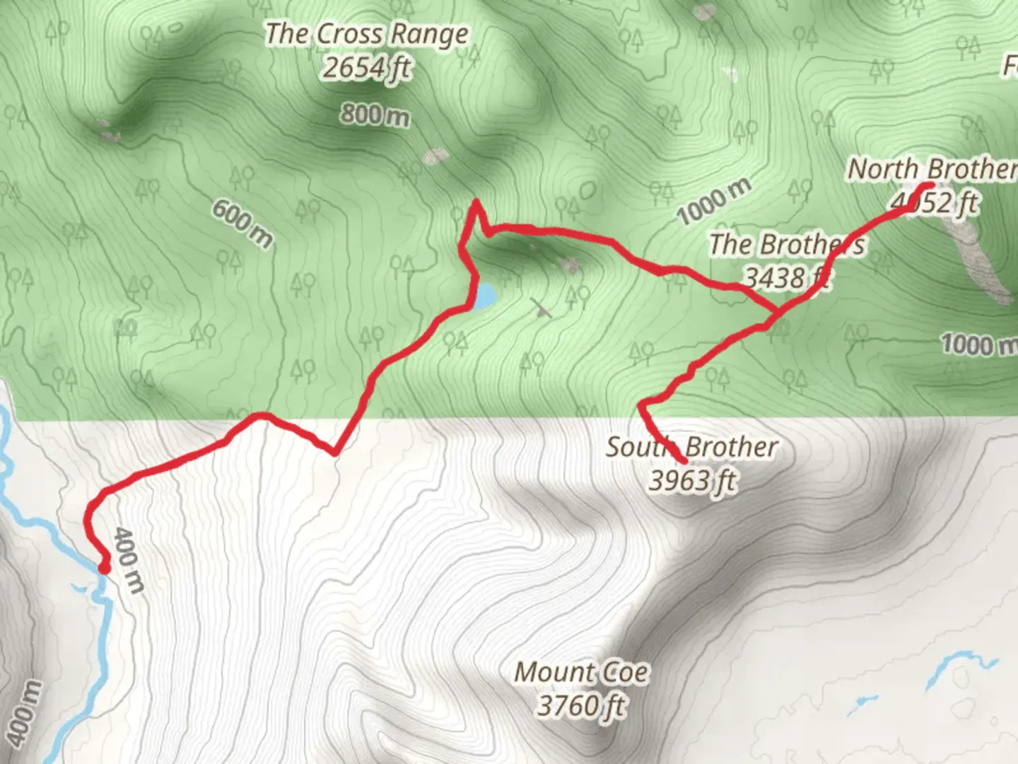
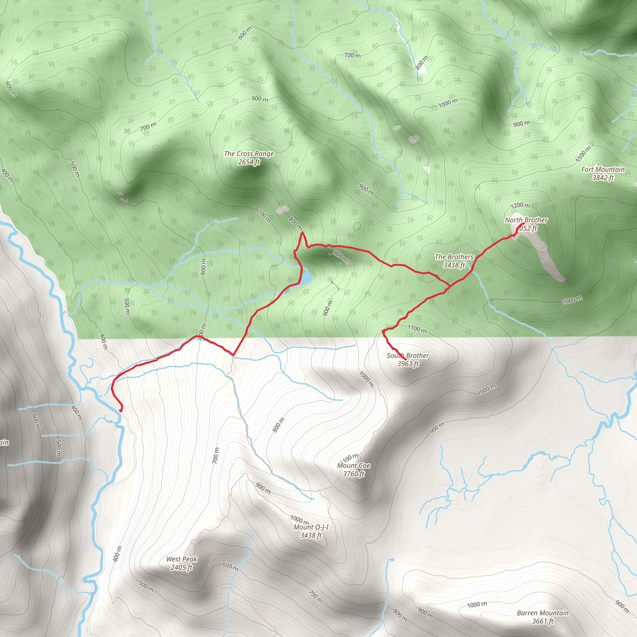
Embarking on the South Brother and North Brother via Marston Trail, hikers will find themselves exploring the rugged terrain of Baxter State Park in Piscataquis County, Maine. This approximately 16 km (10 miles) loop trail, with an elevation gain of around 1100 meters (3600 feet), offers a medium difficulty rating and is a rewarding challenge for those with some hiking experience.
Getting to the Trailhead
The trailhead is accessible by car, located near the scientific forest management area of Baxter State Park. From Millinocket, take the Baxter Park Road to the Togue Pond Gate. After entering the park, follow the signs to the Marston Trail parking area. Public transport options are limited in this remote area, so driving is the most feasible option for reaching the start of the hike.
The Hike Itself
The journey begins on relatively flat terrain, meandering through a dense forest of spruce and fir. As you progress, the trail becomes steeper, and the ascent of South Brother starts to present itself. The climb is steady, and hikers should be prepared for rocky and root-filled paths. After approximately 4 km (2.5 miles), you'll reach the summit of South Brother, offering expansive views of the surrounding wilderness, including Mount Katahdin.
Continuing the trek, the trail descends into a col before ascending again towards North Brother. This section can be particularly challenging, with some steep and rocky portions. The summit of North Brother, reached after about 6 km (3.7 miles), provides a vantage point for viewing the deep wilderness of the North Maine Woods and, on a clear day, the distant peaks of the Traveler Mountains.
Flora, Fauna, and Landmarks
Throughout the hike, keep an eye out for the diverse wildlife that inhabits the area, including moose, black bears, and a variety of bird species. The trail also passes through areas rich in alpine flora, such as delicate mountain avens and rare, high-elevation plants.
One of the most notable landmarks along the trail is the wreckage of a small plane near the summit of North Brother, a somber reminder of a tragic crash that occurred in the 1960s. This site has historical significance and serves as a memorial for those who lost their lives.
Navigation and Preparation
Hikers should be well-prepared with appropriate gear, including sturdy hiking boots, weather-appropriate clothing, and sufficient water and food. The use of a navigation tool like HiiKER can help in planning the hike and staying on the correct path, as the trail can be challenging to follow in places, especially in inclement weather or low visibility.
Seasonal Considerations
The best time to hike this trail is from late spring to early fall when the snow has melted, and the paths are clearer. However, hikers should be aware that weather conditions can change rapidly in the mountains, and it's essential to check the forecast before setting out.
Environmental Stewardship
As always, it's crucial to practice Leave No Trace principles to preserve the natural beauty of the area. Pack out all trash, stay on designated trails to protect fragile vegetation, and be respectful of wildlife by observing from a distance.
By preparing adequately and respecting the natural environment, hikers can enjoy a memorable experience on the South Brother and North Brother via Marston Trail, taking in the stunning vistas and rugged beauty of Maine's wilderness.
What to expect?
Activity types
Comments and Reviews
User comments, reviews and discussions about the South Brother and North Brother via Marston Trail, Maine.
4.46
average rating out of 5
28 rating(s)
