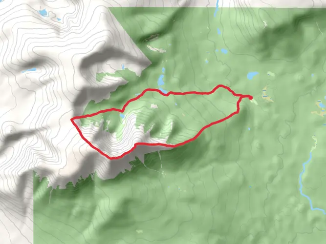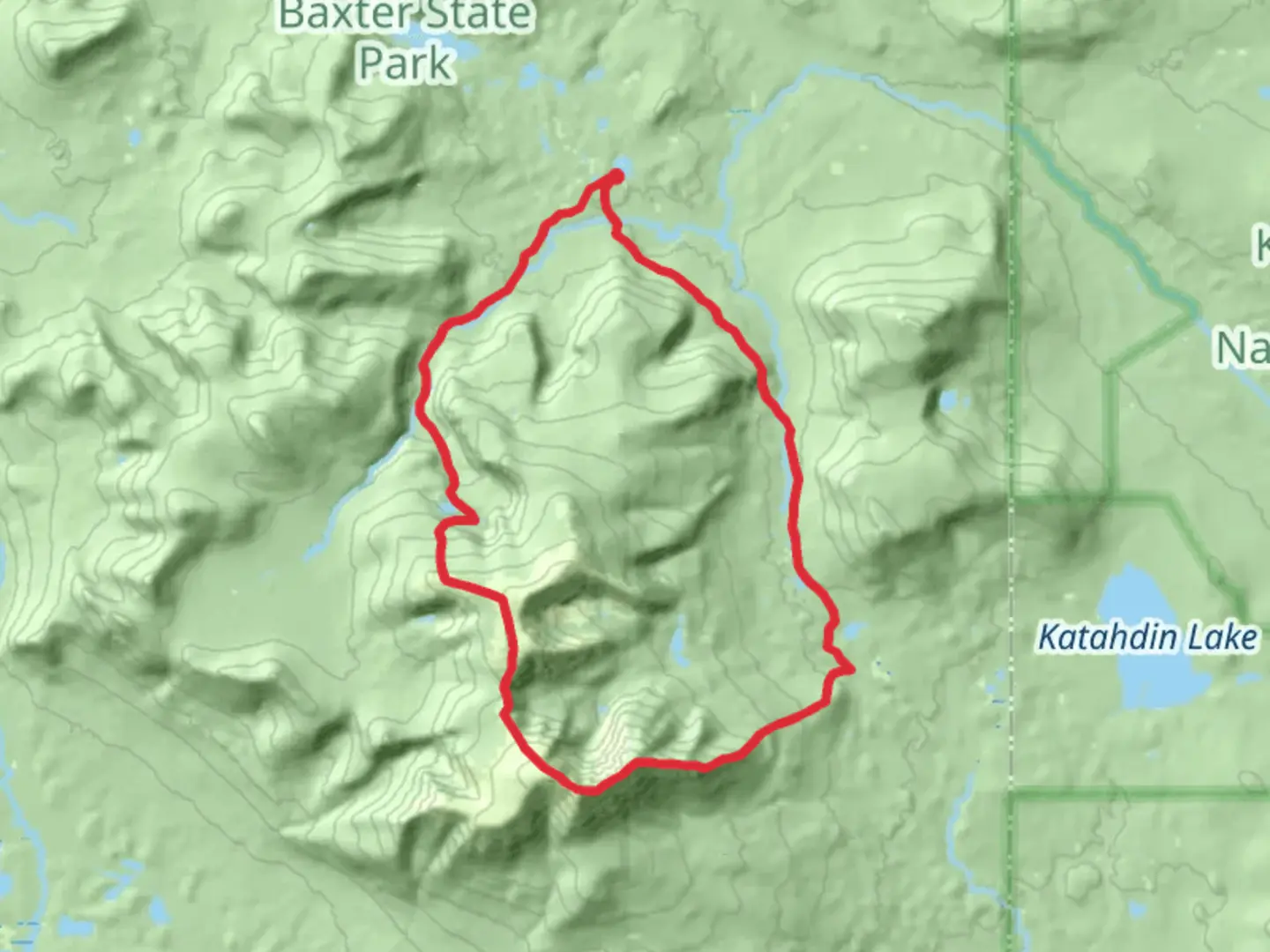
Northwest Basin, Helen Taylor, and Russell Pond Loop
Download
3D Flyover
Add to list
More
31.2 km
~2 days
1483 m
Multi-Day
“Traverse Baxter State Park's rugged beauty on a 31 km loop, ascending peaks, and encountering diverse wildlife and historic sites.”
Embarking on the Northwest Basin, Helen Taylor, and Russell Pond Loop, hikers will traverse a challenging and rewarding circuit through the heart of Baxter State Park. This approximately 31 km (19 miles) loop with an elevation gain of around 1400 meters (4593 feet) offers a diverse and immersive wilderness experience.
Getting to the Trailhead The trailhead is accessible near Piscataquis County, Maine, close to the park's Togue Pond Gate. For those driving, parking is available at the Roaring Brook Campground, which serves as a common starting point for various hikes within the park. Public transportation options are limited, so most visitors opt to drive. It's essential to arrive early, especially during peak season, as parking spots fill up quickly.
Navigating the Trail The loop can be tackled in either direction, but many choose to hike counter-clockwise, starting with the Helen Taylor Trail. Hikers can use the HiiKER app to navigate the trail, ensuring they stay on the correct path and can monitor their progress.
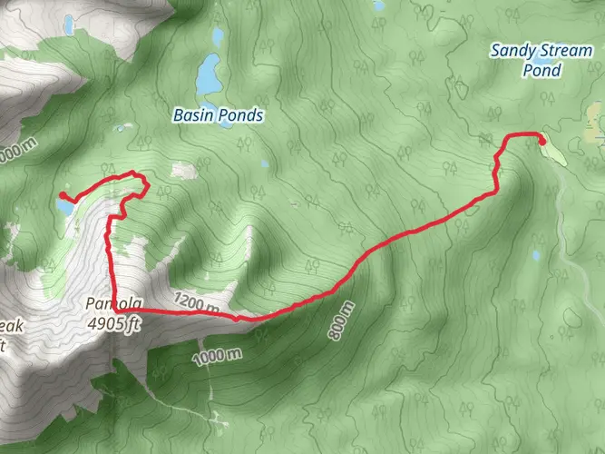
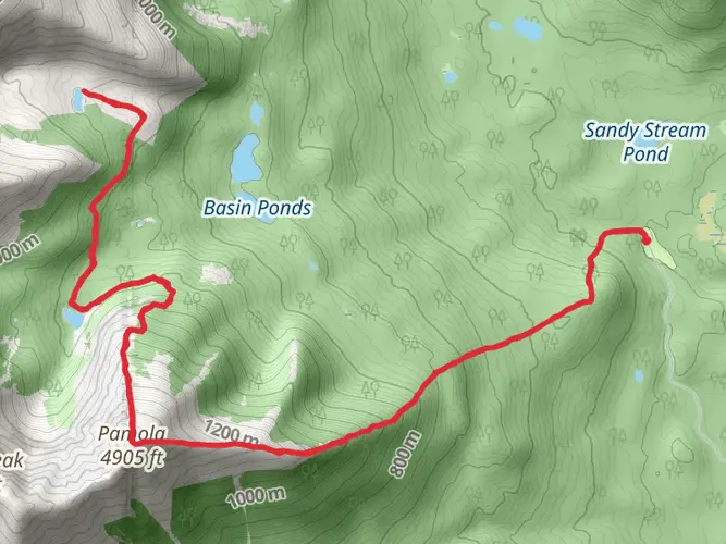
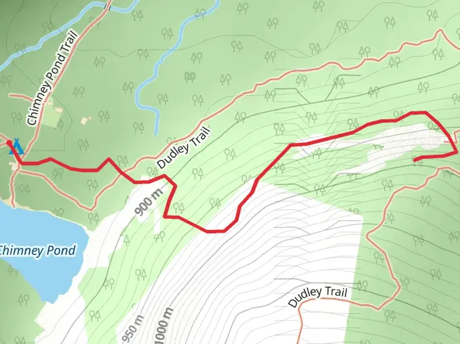
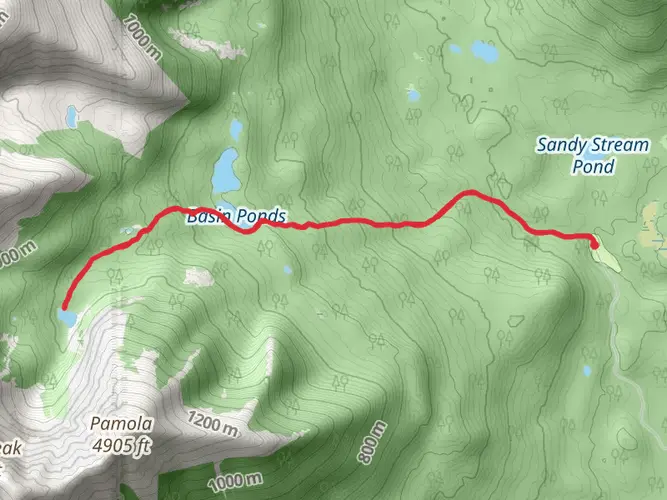
Helen Taylor Trail to Northwest Basin The initial ascent on the Helen Taylor Trail is steep and strenuous, leading to Pamola Peak. This section offers breathtaking views of the surrounding landscape, including the prominent Knife Edge, a narrow ridge leading to Baxter Peak. The trail then descends into the Northwest Basin, a remote and less-traveled area of the park, where the terrain becomes more rugged and the sense of solitude deepens.
Wildlife and Natural Beauty Throughout the hike, adventurers will be treated to a variety of ecosystems, from dense forests to alpine plateaus. Wildlife sightings may include moose, black bears, and a range of bird species. The flora is equally diverse, with wildflowers blooming in the spring and summer, and spectacular foliage displays in the fall.
Russell Pond and Historical Significance As the loop continues, hikers will reach Russell Pond, a serene body of water surrounded by towering pines. This area is steeped in history, with remnants of old logging operations visible along the trail. The pond itself is a reminder of the region's glacial past, having been carved out by ice thousands of years ago.
Completing the Loop The final leg of the loop returns to the Roaring Brook Campground. This section is relatively easier, with a gradual descent that allows hikers to reflect on the journey. The sound of the brook accompanies trekkers as they complete the circuit, marking the end of an epic journey through one of Maine's most majestic landscapes.
Preparation and Planning Given the trail's difficulty, hikers should be well-prepared with appropriate gear, including sturdy hiking boots, weather-appropriate clothing, and sufficient food and water. It's also wise to carry a map, compass, and a fully charged phone with the HiiKER app downloaded for navigation. Due to the remote nature of the trail, it's crucial to inform someone of your hiking plans and expected return time.
Seasonal Considerations The best time to hike this loop is from late spring to early fall when the trails are mostly snow-free. However, weather in the mountains can be unpredictable, so it's essential to check the forecast and prepare for changing conditions. Baxter State Park may have specific regulations and seasonal closures, so hikers should check the park's website for the latest information before setting out.

Comments and Reviews
User comments, reviews and discussions about the Northwest Basin, Helen Taylor, and Russell Pond Loop, Maine.
4.55
average rating out of 5
11 rating(s)