Download
3D Flyover
Add to list
More
54.2 km
~3 days
3233 m
Multi-Day
“Embark on the Grafton Notch Loop, a rugged, history-rich Maine trek with breathtaking vistas and diverse wildlife.”
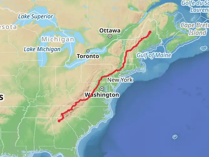
The Grafton Notch Loop is a challenging and rewarding trek that spans approximately 54 kilometers (about 33.5 miles) with an elevation gain of roughly 3200 meters (approximately 10,500 feet). This loop trail, situated near Oxford County, Maine, is known for its rugged terrain and stunning vistas, making it a must-visit for serious hikers seeking a demanding adventure.
Getting to the Trailhead
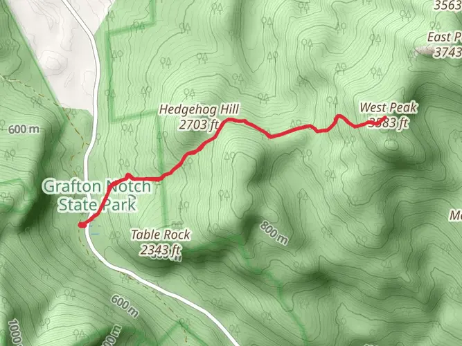
To reach the trailhead, you can drive to Grafton Notch State Park, which is located on Route 26 in Newry, Maine. The park is a significant landmark in the area and serves as a gateway to the trail. For those relying on public transportation, options are limited, and it's generally recommended to rent a car from the nearest major city, such as Portland, Maine, which is about 115 kilometers (roughly 71 miles) away.
Navigating the Trail
Once at the trailhead, hikers can use HiiKER to navigate the loop. The trail is well-marked, but due to its complexity and the remote nature of the area, having a reliable navigation tool is crucial. The loop can be hiked in either direction, though many choose to tackle the steeper sections first.
Landmarks and Natural Features
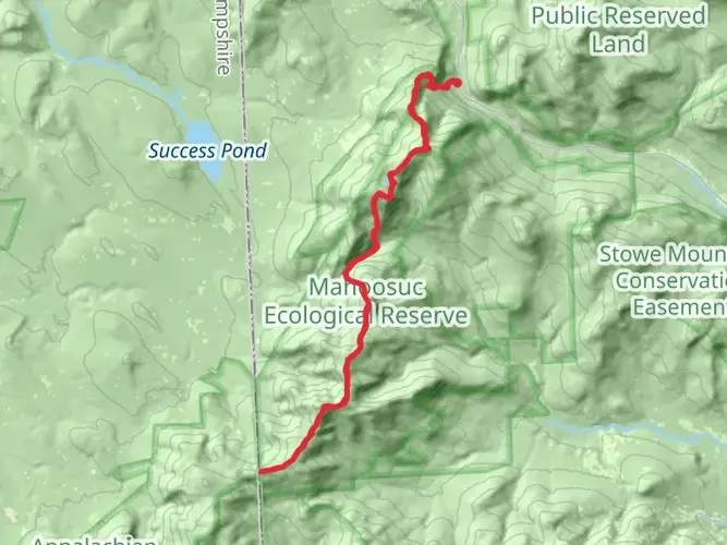
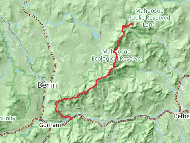
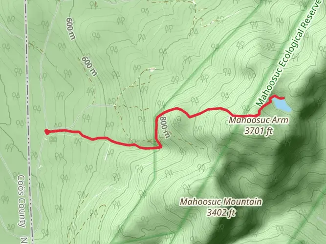
As you embark on the Grafton Notch Loop, you'll encounter a variety of natural landmarks. One of the first significant features is Old Speck Mountain, which offers an observation tower at its peak, providing panoramic views of the Mahoosuc Range. This climb alone accounts for a substantial portion of the trail's elevation gain.
Further along, you'll come across the Eyebrow Loop Trail, which presents a steep ascent with fixed ladders and iron rungs for assistance. This section is not for the faint of heart but rewards hikers with unique perspectives of the notch.
Flora and Fauna
The trail traverses through diverse ecosystems, from hardwood forests to alpine vegetation. Hikers can expect to see a variety of wildlife, including moose, black bears, and numerous bird species. The dense forests are home to a rich array of plant life, with wildflowers blooming in the spring and summer, and spectacular foliage displays in the fall.
Historical Significance
The region around Grafton Notch is steeped in history, with Native American tribes such as the Abenaki having inhabited the area long before European settlers arrived. The notch itself has played a role in local logging history and has been a focal point for conservation efforts.
Preparation and Safety
Given the trail's difficulty rating of Extra Difficult, hikers should be well-prepared with proper gear, including sturdy hiking boots, weather-appropriate clothing, and sufficient food and water. It's also wise to carry a first aid kit and emergency shelter. Due to the remote nature of the trail, cell service may be unreliable, so leave a trip plan with someone before you set out.
Seasonal Considerations
The best time to hike the Grafton Notch Loop is from late spring to early fall when the snow has melted, and the trail is more accessible. Winter hiking is only recommended for those with significant experience and the appropriate gear for extreme cold and snow conditions.
Remember, the Grafton Notch Loop is a true backcountry experience, offering solitude and a deep connection with nature. With careful planning and respect for the trail's challenges, hikers can enjoy one of Maine's most exhilarating outdoor adventures.

What to expect?
Activity types
Frequently asked questions
How long does the Grafton Notch hike take to complete as a multi-day route?
Grafton Notch is a 54.16 km multi-day hike with 3,233 m of elevation gain, so it is usually treated as a strenuous backpacking trip rather than a day hike. Strong hikers sometimes move faster, but the combination of distance, steep climbing, and rugged Mahoosuc terrain means many parties break it into two to four days.
How difficult is the Grafton Notch hike in Maine?
Grafton Notch is rated Difficult, and the numbers explain why: 54.16 km of hiking with 3,233 m of ascent is a serious effort. The route is associated with steep Appalachian Trail terrain around the Mahoosuc Range, including the climb to Old Speck Mountain at 4,180 feet, so it suits experienced hikers with solid fitness and mountain judgment.
Where do you start the Grafton Notch hike and where can you park?
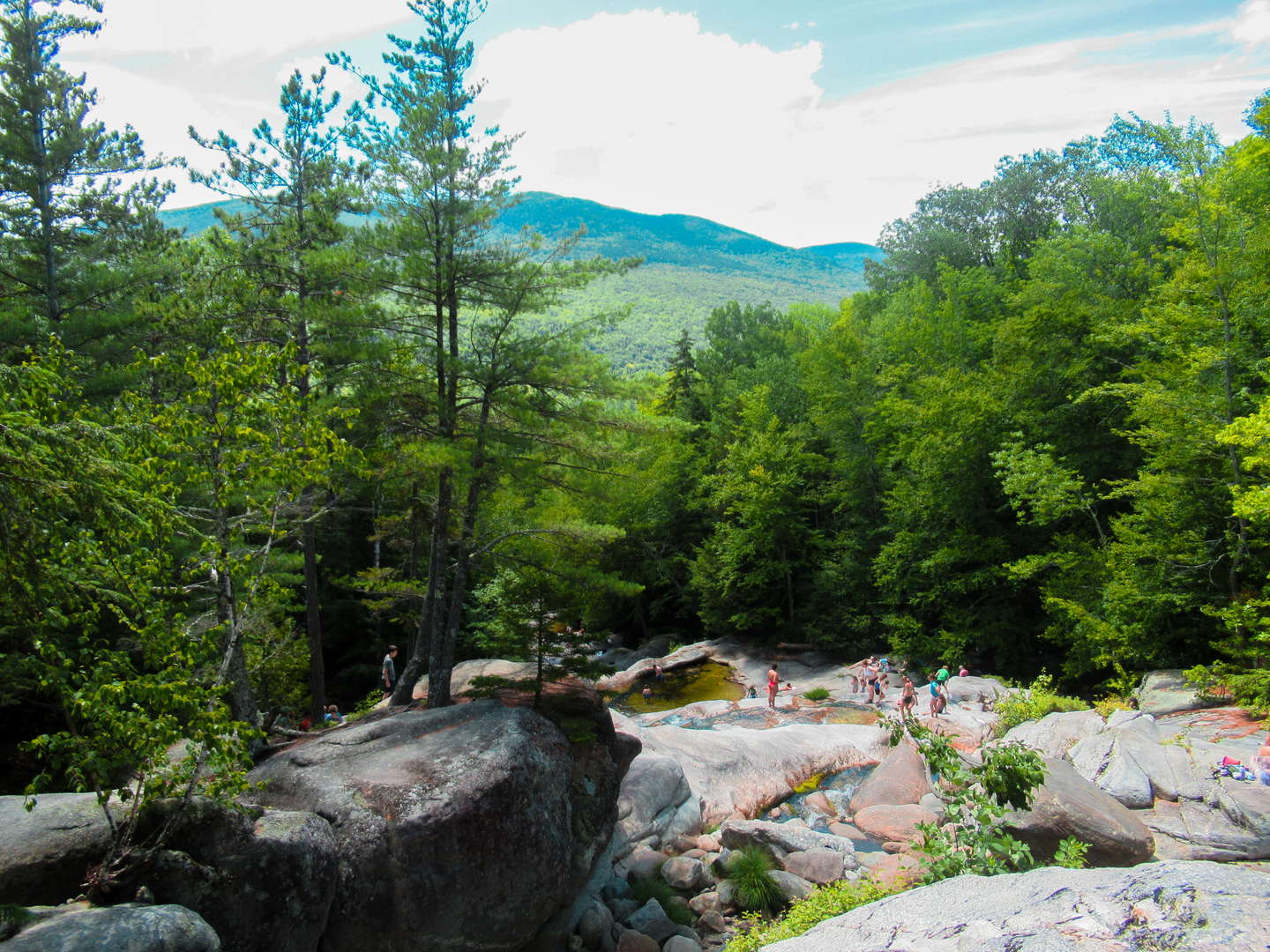
The usual access is from Grafton Notch State Park on Route 26 in Newry, Maine. State park access points and parking areas along Route 26 serve major trail connections in the notch, including the north end access used for the Old Speck and Eyebrow area, and the park also includes well-known stops such as Screw Auger Falls, Moose Cave, and Spruce Meadow.
Are dogs allowed on the Grafton Notch hike?
Dogs are generally allowed in Grafton Notch State Park, but pets must be leashed, attended, and cleaned up after in developed areas. That makes Grafton Notch workable for hikers bringing a dog, though the route’s length, steep grades, and rough footing make it better suited to trail-experienced dogs than casual walkers.
What are the main landmarks on the Grafton Notch hike?
One of the standout landmarks on Grafton Notch is Old Speck Mountain, which has an observation tower with broad views over the Mahoosuc Range. The state park corridor along Route 26 is also known for natural attractions including Screw Auger Falls, Moose Cave, Spruce Meadow, and Mother Walker Falls, all of which help define the notch.
Is the Grafton Notch hike suitable for beginners or kids?
Grafton Notch is not a beginner-friendly backpacking route. At 54.16 km with 3,233 m of climbing and a Difficult rating, it is a demanding mountain hike that is better for experienced hikers than for young children or first-time backpackers, even though shorter walks to roadside features in Grafton Notch State Park are much more accessible.
What is the best time of year to hike Grafton Notch?
The most popular hiking season for Grafton Notch is typically late summer through fall, when trail conditions are generally more manageable and western Maine foliage is a major draw along Route 26. Weather at higher elevations around Old Speck and the Mahoosucs can change quickly, so shoulder-season trips can feel much more serious than the mileage alone suggests.
Can you do the Grafton Notch hike without a car?
Reaching Grafton Notch without a car is difficult. The hike is accessed from Grafton Notch State Park on Route 26 near Newry, and public transportation options into the notch are very limited, so most hikers arrive by private vehicle or shuttle arrangement from larger hubs such as the Portland area.
Comments and Reviews
User comments, reviews and discussions about the Grafton Notch, Maine.
4.45
average rating out of 5
11 rating(s)