Download
Preview
Add to list
More
83.7 km
~4 days
719 m
Multi-Day
“Embark on a historic and scenic 84-kilometer trek through Maine's Aroostook County, brimming with wildlife and serenity.”
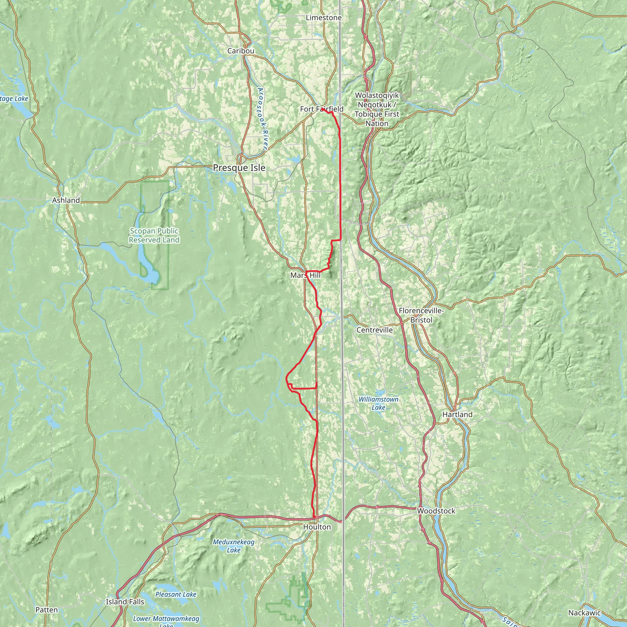
Spanning approximately 84 kilometers (about 52 miles) with an elevation gain of around 700 meters (roughly 2300 feet), the Houlton - Fort Fairfield trail is a point-to-point route that offers a moderate challenge for hikers. This trail, nestled in the scenic Aroostook County of Maine, provides a blend of natural beauty, historical significance, and a chance to experience the tranquility of the northeastern United States.
Getting to the Trailhead
The trailhead is located near Houlton, a town that serves as a gateway to the region. For those arriving by car, Houlton is accessible via Interstate 95. If you're using public transportation, options may be limited, but the Cyr Bus Line operates services that can get you to Houlton, from where you can arrange a taxi or a local shuttle to the trailhead.
The Journey Begins
Starting near Houlton, the trail meanders through a landscape characterized by rolling hills, dense forests, and the occasional open field. The first section of the trail is relatively flat, allowing hikers to warm up as they become acquainted with the serene surroundings.
Historical Significance
As you progress along the trail, you'll be walking a path steeped in history. This area was once a bustling hub during the early settlement days and played a significant role in the Aroostook War, a boundary dispute between the United States and the British Canadian provinces. Keep an eye out for historical markers that tell the tales of the past.
Flora and Fauna
The trail offers an opportunity to observe a diverse range of wildlife. It's not uncommon to spot white-tailed deer, moose, and a variety of bird species, including the majestic bald eagle. The dense canopy of mixed hardwood and coniferous trees provides a habitat for these animals and a picturesque backdrop for your hike.
Navigating the Trail
As you navigate the trail, you'll find that the elevation gain is gradual, with the more challenging ascents occurring in the latter half of the journey. Using HiiKER to track your progress is advisable, as it will help you stay on course and manage your pace.
Landmarks and Points of Interest
Around the midway point, near the 42-kilometer (26-mile) mark, you'll encounter a series of small streams and brooks. These water features are not only beautiful but also serve as important landmarks for navigation.
As you approach Fort Fairfield, the trail offers expansive views of the region's agricultural heritage, with potato fields stretching out towards the horizon. Fort Fairfield itself is a historical landmark, and upon reaching the town, you can explore the remnants of the old fortifications that once stood guard over the area.
Preparing for the Hike
Before embarking on this journey, ensure you have adequate supplies, including water, food, and layers to accommodate changing weather conditions. The trail is best tackled from late spring to early fall to avoid the harsh winter weather typical of northern Maine.
Remember, the Houlton - Fort Fairfield trail is a point-to-point hike, so you'll need to arrange transportation back to your starting point or have a vehicle waiting for you at the end of the trail in Fort Fairfield.
What to expect?
Activity types
Comments and Reviews
User comments, reviews and discussions about the Houlton - Fort Fairfield, Maine.
4.43
average rating out of 5
7 rating(s)

