Download
Preview
Add to list
More
6.2 km
~1 hrs 41 min
272 m
Out and Back
“Explore the Walcut and Indian Fort Trail: a scenic, moderately challenging 6 km journey through Kentucky’s rich history and nature.”
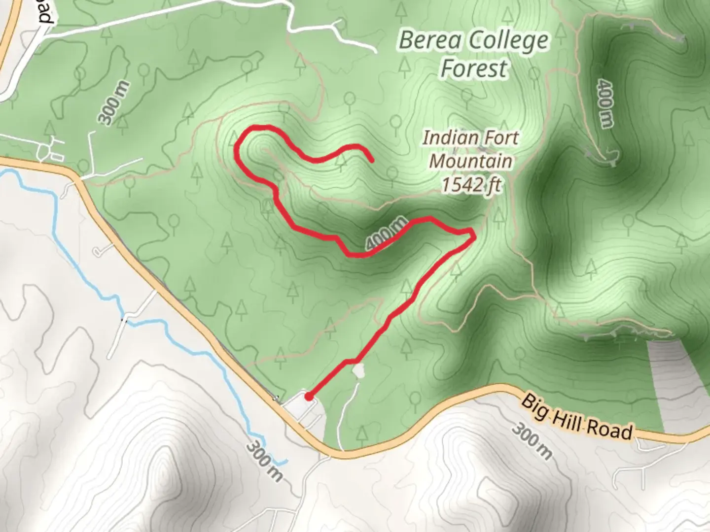
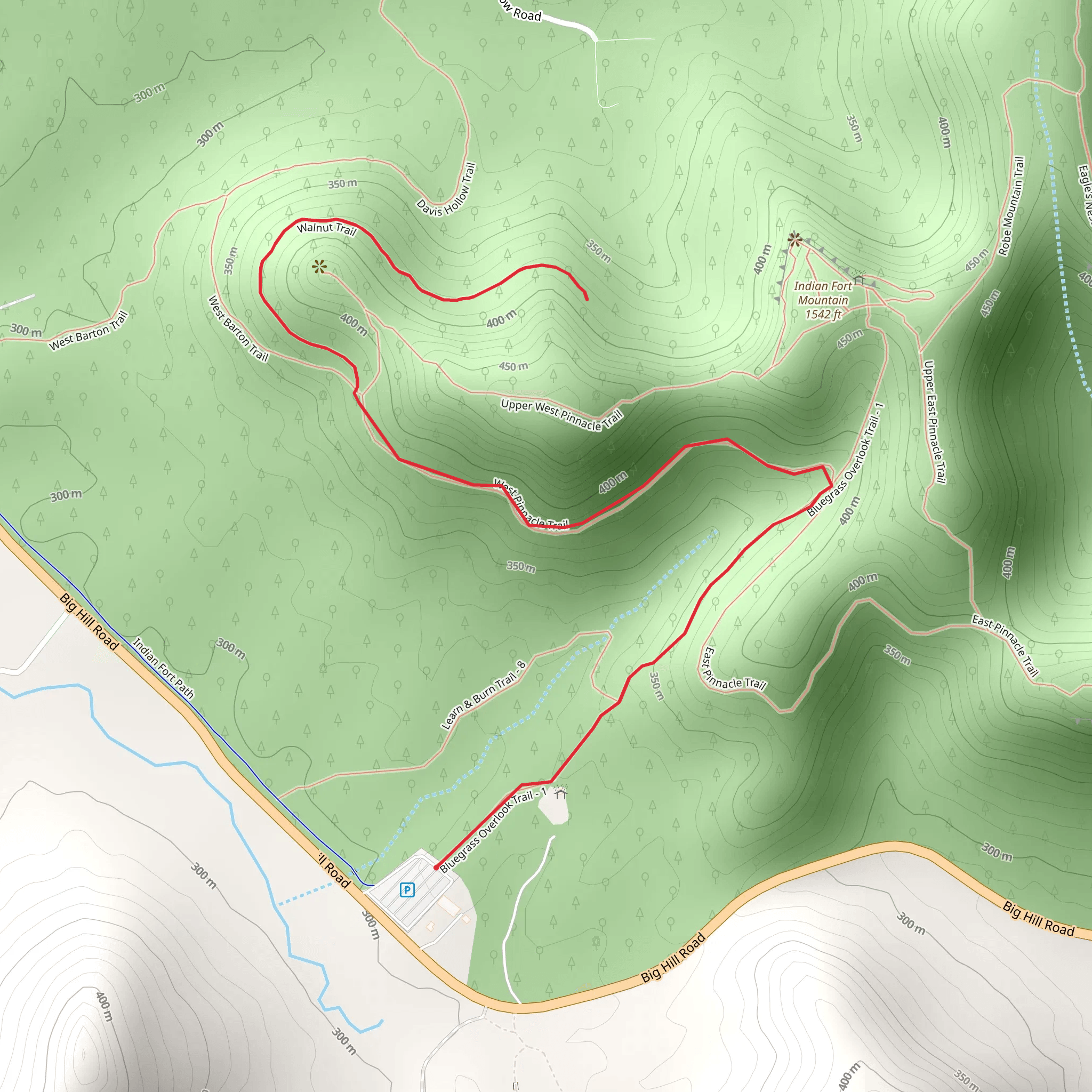
Starting your adventure near Madison County, Kentucky, the Walcut and Indian Fort Trail offers a captivating 6 km (approximately 3.7 miles) out-and-back journey with an elevation gain of around 200 meters (656 feet). This trail is rated as medium difficulty, making it suitable for moderately experienced hikers.
Getting There To reach the trailhead, you can drive or use public transport. If driving, head towards Berea, Kentucky, and follow signs to the Berea College Forest. The nearest significant landmark is the Berea College Forestry Outreach Center, located at 2047 Big Hill Rd, Berea, KY 40403. For those using public transport, Berea is accessible via Greyhound buses, and from there, a short taxi ride or local bus can take you to the trailhead.
Trail Overview The trail begins at the Berea College Forestry Outreach Center, where you can find parking and basic amenities. As you start your hike, you'll be greeted by a well-marked path that meanders through dense forest, offering a serene and shaded environment. The initial section of the trail is relatively flat, making it a good warm-up for the more challenging segments ahead.
Significant Landmarks and Nature About 1 km (0.6 miles) into the hike, you'll encounter the first significant landmark: the Indian Fort Lookout. This vantage point offers panoramic views of the surrounding forest and distant hills, making it a perfect spot for a short break and some photography. The elevation gain to this point is around 50 meters (164 feet).
Continuing along the trail, you'll pass through a variety of ecosystems, including hardwood forests and rocky outcrops. Keep an eye out for local wildlife such as white-tailed deer, wild turkeys, and a variety of bird species. The trail is also rich in plant life, featuring native species like oak, hickory, and maple trees.
Historical Significance The region holds historical significance, particularly related to the Native American tribes that once inhabited the area. The Indian Fort Lookout is believed to have been a strategic vantage point for the indigenous peoples, offering both a defensive position and a place for ceremonial activities. As you hike, you'll notice several interpretive signs that provide more information about the historical and cultural importance of the area.
Navigation and Safety The trail is well-marked, but it's always a good idea to have a reliable navigation tool. The HiiKER app is highly recommended for this purpose, offering detailed maps and real-time GPS tracking to ensure you stay on course.
Final Stretch As you approach the 3 km (1.85 miles) mark, you'll reach the highest elevation point of the trail, around 200 meters (656 feet) above the starting point. This section offers another excellent viewpoint, allowing you to take in the expansive beauty of the Kentucky landscape. From here, the trail loops back, retracing your steps to the trailhead.
Practical Tips - Wear sturdy hiking boots, as the trail can be rocky and uneven in places. - Bring plenty of water and snacks, especially during warmer months. - Check the weather forecast before heading out, as the trail can become slippery after rain. - Be mindful of local wildlife and practice Leave No Trace principles to preserve the natural beauty of the area.
This trail offers a blend of natural beauty, historical significance, and moderate physical challenge, making it a rewarding experience for those who venture out to explore it.
What to expect?
Activity types
Comments and Reviews
User comments, reviews and discussions about the Walcut and Indian Fort Trail, Kentucky.
4.54
average rating out of 5
69 rating(s)
