
Download
3D Flyover
Add to list
More
4.3 km
~1 hrs 9 min
180 m
Loop
“The Flat Hollow Connector and Bald Rock Fork Road Loop offers a moderately challenging, scenic hike through Kentucky's historical Daniel Boone National Forest.”
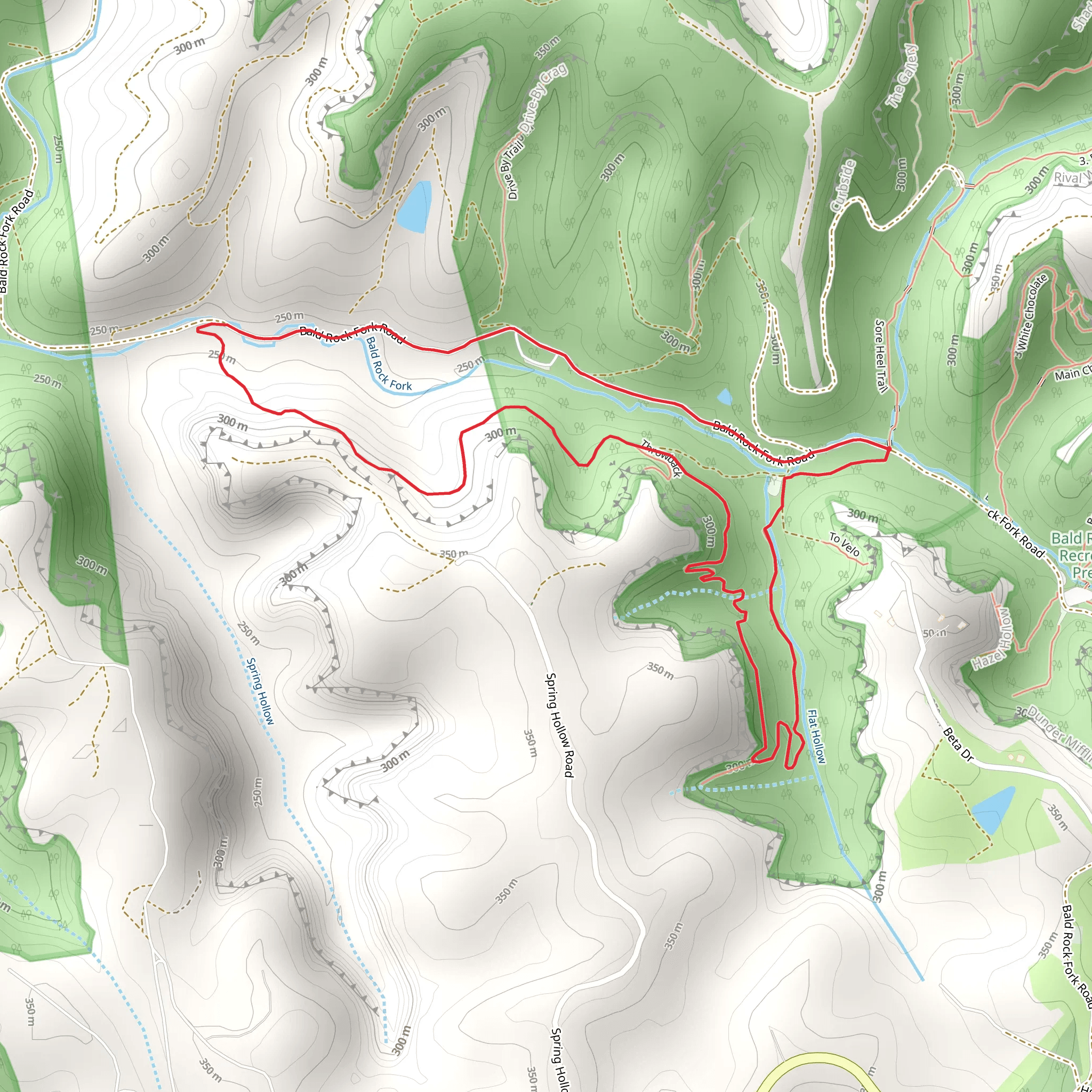
Starting near Lee County, Kentucky, the Flat Hollow Connector and Bald Rock Fork Road Loop is a captivating 4 km (2.5 miles) loop trail with an elevation gain of approximately 100 meters (328 feet). This trail is rated as medium difficulty, making it suitable for moderately experienced hikers.
Getting There
To reach the trailhead, you can drive or use public transport. If driving, head towards Beattyville, Kentucky, and follow signs to the Daniel Boone National Forest. The nearest significant landmark is the Beattyville Elementary School, located at 200 Broadway St, Beattyville, KY 41311. From there, it's a short drive to the trailhead. Public transport options are limited, so driving is recommended.
Trail Overview
The trail begins with a gentle ascent through a mixed hardwood forest, offering a serene start to your hike. As you progress, you'll encounter a variety of flora, including oak, hickory, and maple trees. The first significant landmark is a small, picturesque creek about 1 km (0.6 miles) into the hike. This is a great spot to take a short break and enjoy the natural surroundings.
Wildlife and Nature
Keep an eye out for local wildlife such as white-tailed deer, wild turkeys, and various bird species. The area is also home to smaller mammals like raccoons and squirrels. During spring and summer, the trail is adorned with wildflowers, adding a splash of color to your hike.
Historical Significance
The region has a rich history, with roots tracing back to Native American tribes who once inhabited the area. The trail itself passes through parts of the Daniel Boone National Forest, named after the famous American pioneer and explorer. This forest has been a significant part of Kentucky's history, serving as a vital resource for early settlers.
Navigation and Landmarks
Approximately 2 km (1.2 miles) into the hike, you'll reach the highest point of the trail, offering a modest but rewarding view of the surrounding forest. This is also where the trail intersects with Bald Rock Fork Road. Make sure to have the HiiKER app handy for accurate navigation, as the trail can be tricky to follow in some sections.
Final Stretch
The descent begins after the intersection, leading you back through dense forest and eventually reconnecting with the initial path. The final 1 km (0.6 miles) is relatively flat, making for a pleasant and easy finish to your hike.
Preparation Tips
Given the moderate difficulty, it's advisable to wear sturdy hiking boots and bring plenty of water. The trail can be muddy after rain, so be prepared for slippery conditions. Always check the weather forecast before heading out and consider bringing a map or using the HiiKER app for real-time navigation.
This trail offers a balanced mix of natural beauty, wildlife, and historical significance, making it a rewarding experience for those looking to explore the heart of Kentucky's wilderness.
What to expect?
Activity types
Comments and Reviews
User comments, reviews and discussions about the Flat Hollow Connector and Bald Rock Fork Road Loop, Kentucky.
4.39
average rating out of 5
44 rating(s)
