Download
Preview
Add to list
More
10.2 km
~2 hrs 15 min
130 m
Out and Back
“This 10 km trail blends natural beauty, historical intrigue, and moderate challenge near Jessamine County, KY.”
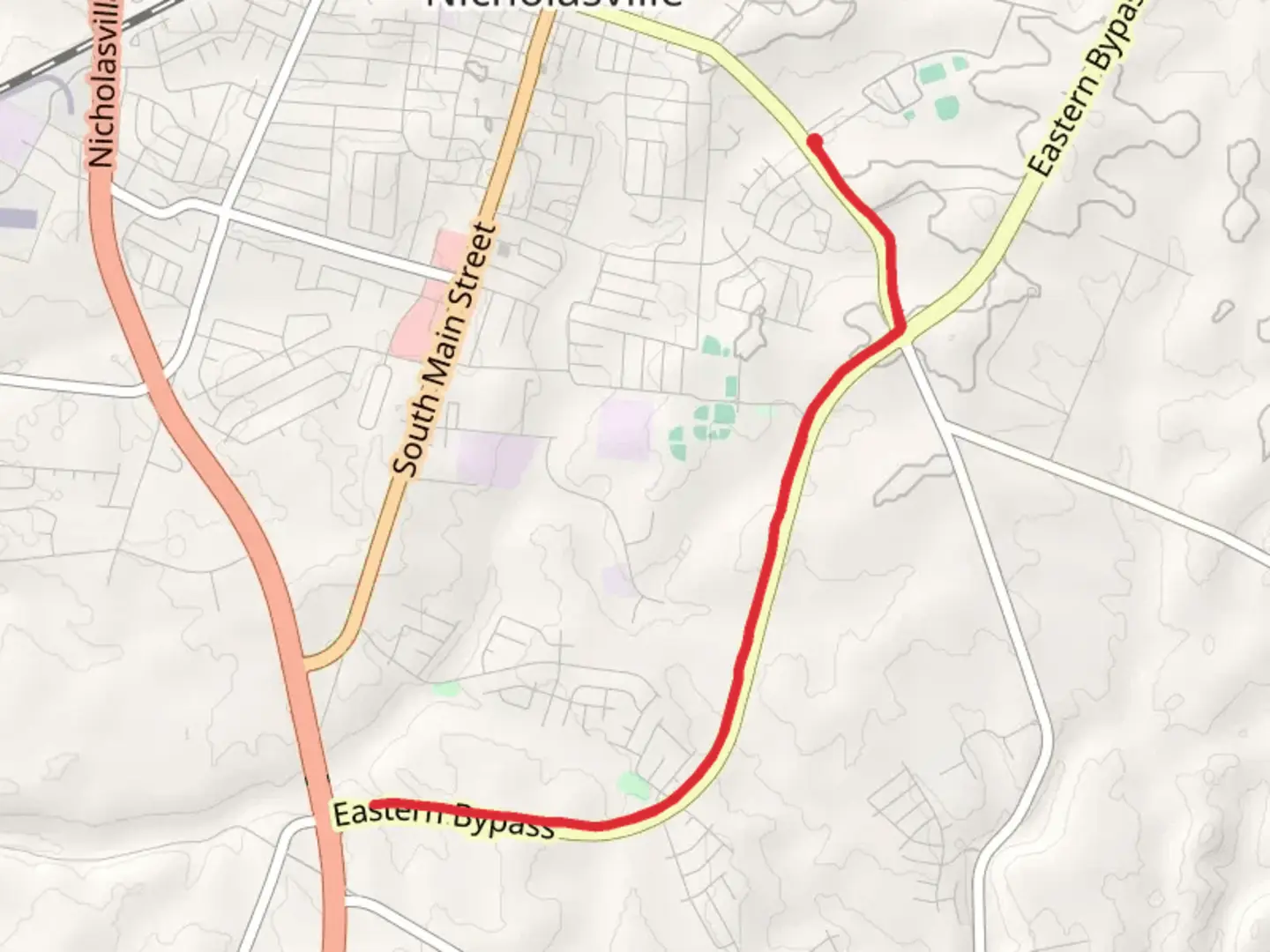
Starting near Jessamine County, Kentucky, this 10 km (approximately 6.2 miles) out-and-back trail offers a moderate challenge with an elevation gain of around 100 meters (328 feet). The trailhead is conveniently located near the intersection of Sulphur Well Road and the Eastern Bypass, making it accessible for both local and visiting hikers.### Getting There For those traveling by car, you can park near the Jessamine County Public Library, located at 600 S Main St, Nicholasville, KY 40356. From there, it's a short walk to the trailhead. If you're using public transport, the Blue Grass Community Action Partnership operates bus routes that can drop you off near the library.### Trail Overview The trail begins with a gentle ascent along Sulphur Well Road, offering a mix of paved and gravel surfaces. As you progress, you'll notice the landscape transitioning from suburban to more rural settings. The initial 2 km (1.2 miles) are relatively flat, making it an excellent warm-up for the more undulating terrain ahead.### Nature and Wildlife Around the 3 km (1.9 miles) mark, you'll enter a more wooded area. This section is rich in local flora, including oak, hickory, and maple trees. Keep an eye out for wildlife such as white-tailed deer, red foxes, and a variety of bird species like the Northern Cardinal and Eastern Bluebird. The dense foliage provides ample shade, making this part of the trail particularly pleasant during warmer months.### Historical Significance As you approach the halfway point, you'll come across remnants of old stone walls and farmsteads, dating back to the early 19th century. These structures offer a glimpse into the region's agricultural past. The area was once a thriving farming community, and these ruins serve as a testament to the hard work and resilience of early settlers.### Key Landmarks At approximately 5 km (3.1 miles), you'll reach the Eastern Bypass. Here, you can take a short detour to visit the Camp Nelson National Monument, located just a few miles away. This site played a crucial role during the Civil War, serving as a Union supply depot and recruitment center for African American soldiers.### Navigation and Safety Given the mix of terrain and the moderate difficulty rating, it's advisable to use a reliable navigation tool like HiiKER to stay on track. The trail is well-marked, but having a digital map can provide additional peace of mind. Be sure to carry enough water, especially during the summer months, and wear sturdy hiking boots to navigate the varied surfaces comfortably.### Return Journey The return journey retraces your steps back to the trailhead, offering a different perspective on the landscape. The descent is gradual, allowing you to enjoy the scenery without too much strain. As you make your way back, take the time to appreciate the changing light and the tranquility of the surroundings.This trail offers a balanced mix of natural beauty, historical intrigue, and moderate physical challenge, making it a rewarding experience for hikers of all levels.
What to expect?
Activity types
Comments and Reviews
User comments, reviews and discussions about the Walk along Sulphur Well Road and Eastern Bypass, Kentucky.
4.63
average rating out of 5
78 rating(s)
