Download
Preview
Add to list
More
433.7 km
~25 days
8789 m
Multi-Day
“Embark on the Via Domitia, a historic trek through breathtaking alpine vistas and ancient Roman footprints.”
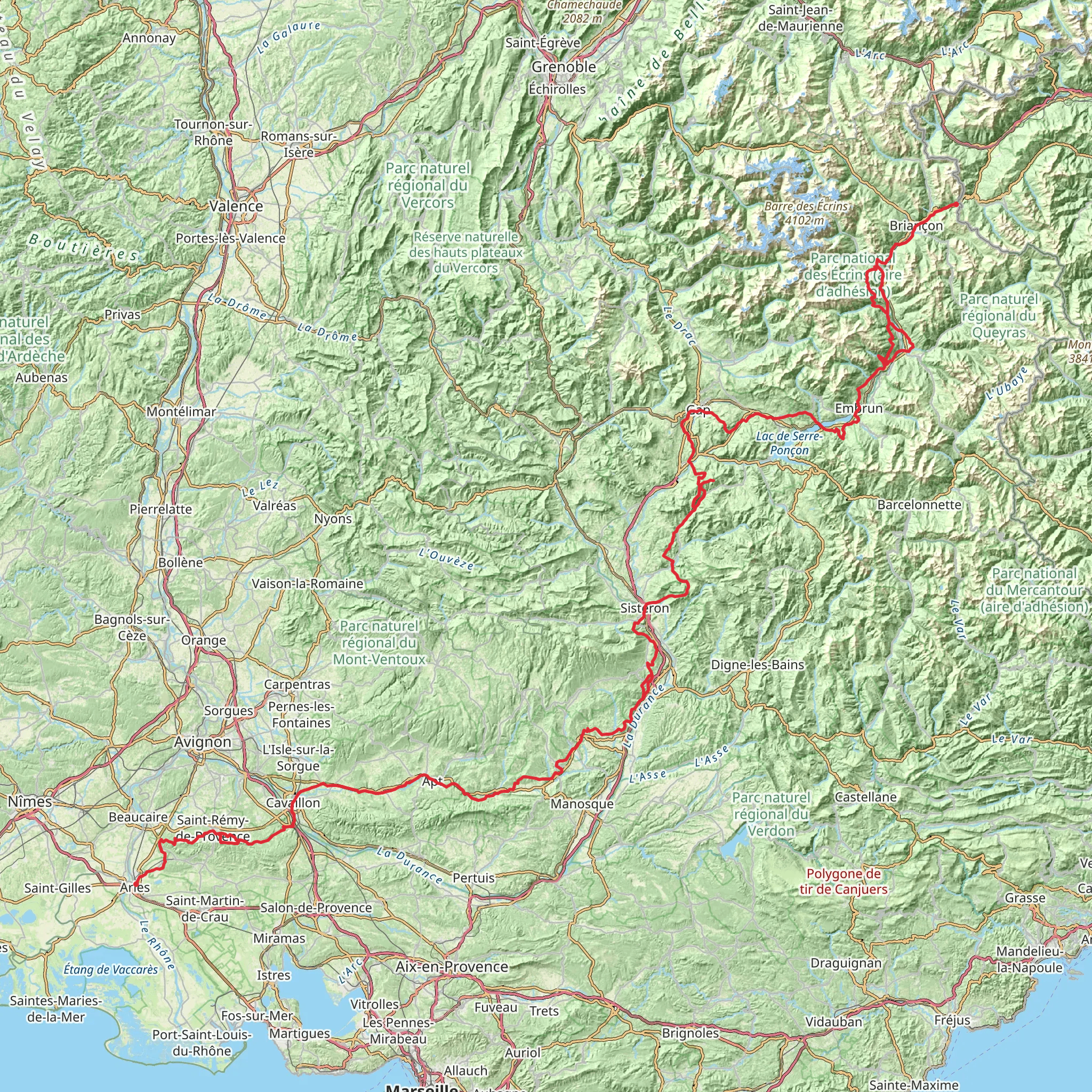
Embarking on the Via Domitia is a journey through time and nature, stretching approximately 434 kilometers (about 270 miles) with an elevation gain of around 8,700 meters (approximately 28,500 feet). This historic route, which begins near the quaint mountain town of Claviere in Italy, is a point-to-point trail that offers a challenging yet rewarding experience for seasoned hikers.
Getting to the Trailhead To reach the starting point near Claviere, hikers can drive or take public transportation. If arriving by car, Claviere is accessible via the SS24 highway, which winds through the scenic Susa Valley. For those preferring public transport, buses from nearby cities like Turin can drop you off in the vicinity of the trailhead. Once in Claviere, the trail begins just a short walk from the town center, where you can find the last-minute supplies or enjoy a traditional Italian meal before setting off.
Historical Significance The Via Domitia takes its name from the ancient Roman road that once connected Italy to Spain, traversing the scenic landscapes of the Alps. As you hike, you'll be following in the footsteps of Roman legions, merchants, and pilgrims, with the trail offering glimpses into the past through various ruins and historical sites along the way.
Navigating the Trail The trail is well-marked, but due to its length and complexity, it's advisable to use a reliable navigation tool like HiiKER to keep track of your progress and ensure you're on the right path. The app can also provide valuable information about the trail's topography and points of interest.
Landmarks and Nature The Via Domitia is rich in natural beauty, with diverse landscapes ranging from alpine meadows to rugged mountain passes. Early on, the trail ascends through the Cottian Alps, offering breathtaking views of the surrounding peaks. Approximately 100 kilometers (62 miles) in, you'll encounter the historic Montgenèvre Pass, a key crossing point since ancient times.
As you continue, the trail meanders through the picturesque Queyras Regional Natural Park, where you can expect to see a variety of wildlife, including marmots, chamois, and perhaps even golden eagles soaring above. The park is also home to charming villages like Saint-Véran, one of the highest communes in Europe.
Challenges and Considerations The Via Domitia is considered difficult due to its length, elevation gain, and some technical sections that require careful navigation. It's essential to be well-prepared with appropriate gear, including sturdy hiking boots, weather-appropriate clothing, and enough food and water. Given the trail's remoteness in certain areas, it's also wise to carry a first aid kit and emergency shelter.
Seasonal Information The best time to hike the Via Domitia is from late June to early September when the mountain passes are free from snow, and the weather is more stable. However, even in summer, the weather in the Alps can be unpredictable, so always check the forecast and be prepared for sudden changes.
Accommodation and Resupply Points Along the trail, there are various options for accommodation, ranging from mountain huts to guesthouses in the villages you'll pass through. Resupply points are also available in these villages, allowing you to stock up on provisions. It's advisable to plan your stops in advance and make reservations where possible, especially during the peak hiking season.
Conclusion The Via Domitia is more than just a hiking trail; it's a historical journey that challenges the body and enriches the soul. With careful planning and respect for the trail's natural and historical significance, hikers can expect an unforgettable adventure through one of Europe's most storied landscapes.
Comments and Reviews
User comments, reviews and discussions about the Via Domitia, Italy.
4.8
average rating out of 5
5 rating(s)

