Download
Preview
Add to list
More
25.6 km
~6 hrs 34 min
872 m
Multi-Day
“From mossy woods to wind-swept heights, this Dublin Mountains loop dazzles with ancient cairns and sweeping vistas.”
Starting from the outskirts of Glencullen, a small village nestled in the Dublin Mountains, this loop trail covers approximately 26 km (16 miles) with a total elevation gain of about 900 metres (2,950 feet). The trailhead is conveniently located near Johnnie Fox’s Pub, one of Ireland’s most famous traditional pubs, making it a recognizable landmark for navigation and a popular spot for post-hike refreshments.
Getting There
For those arriving by public transport, Dublin Bus route 44B serves Glencullen, with the nearest stop at the village center, just a short walk from the trailhead. If driving, parking is available near Johnnie Fox’s Pub, though spaces can fill quickly on weekends. The area is about a 40-minute drive from Dublin city center, following the R117 and then the R116 up into the hills.
Trail Overview and Terrain
The loop begins with a steady ascent through mixed woodland, where the path is often soft underfoot, especially after rain. Early on, hikers pass through stands of Scots pine and native oak, with the forest floor carpeted in moss and ferns. After about 4 km (2.5 miles), the trail opens onto heathland, offering sweeping views back toward Dublin Bay and the Irish Sea.
Key Sections and Landmarks
Glencullen Valley and Fairy Castle Summit
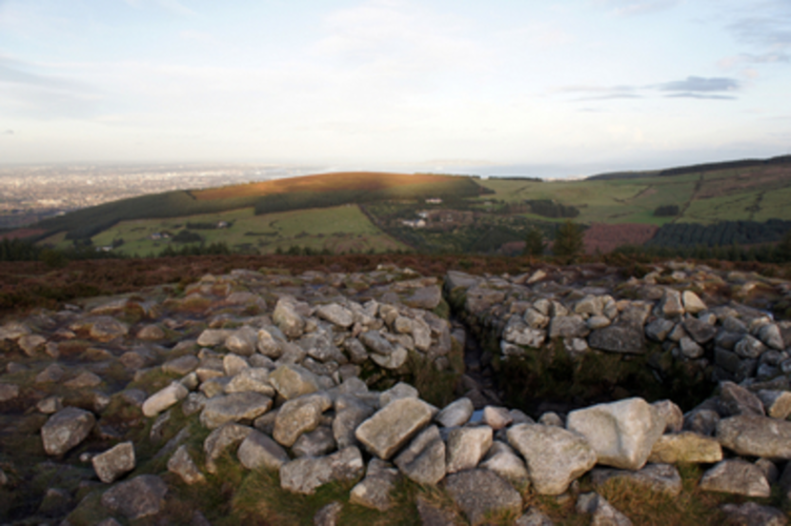
At around 7 km (4.3 miles), the route climbs toward Fairy Castle, the highest point on the Dublin Mountains Way at 536 metres (1,759 feet). This summit is marked by a Bronze Age cairn, a reminder of the region’s ancient human history. The exposed ridge here can be windy, but the panoramic views across the Wicklow Mountains and over Dublin city are a highlight.
Ticknock Forest and Three Rock Mountain
Descending from Fairy Castle, the trail enters Ticknock Forest, a popular recreation area with well-maintained paths. At approximately 12 km (7.5 miles), hikers reach the granite tors of Three Rock Mountain, named for the three large rock outcrops at its summit. This is a great spot for a break, with views stretching as far as Howth Head on clear days.
Wildlife and Flora
Throughout the loop, keep an eye out for red deer, foxes, and a variety of birdlife including kestrels and skylarks. In spring and summer, the hillsides are dotted with wildflowers such as heather, gorse, and bluebells.
Return via Glencullen River
The final section follows the Glencullen River valley, where the path meanders through lush meadows and past old stone walls, remnants of 19th-century farming. The gentle descent brings you back toward the village, completing the loop.
Navigation and Safety
The route is well-marked but can be challenging in poor weather due to fog and exposed sections. Waterproof boots and layers are recommended, as conditions can change rapidly. For navigation, HiiKER provides detailed maps and GPS tracks, which are especially useful for the less-defined sections near the summits.
Water sources are limited along the route, so carry sufficient supplies. Mobile phone coverage is generally good, but some remote sections may have patchy signal. Always let someone know your plans before setting out, and check local weather forecasts for the Dublin Mountains before your hike.

Comments and Reviews
User comments, reviews and discussions about the Run The Line Long Course 2025, Ireland.
5.0
average rating out of 5
10 rating(s)