Download
Preview
Add to list
More
7.2 km
~1 hrs 50 min
239 m
Loop
“Experience the serene allure of the Knocknagun trail, a moderate trek through Ireland's historic, wildlife-rich Garden.”
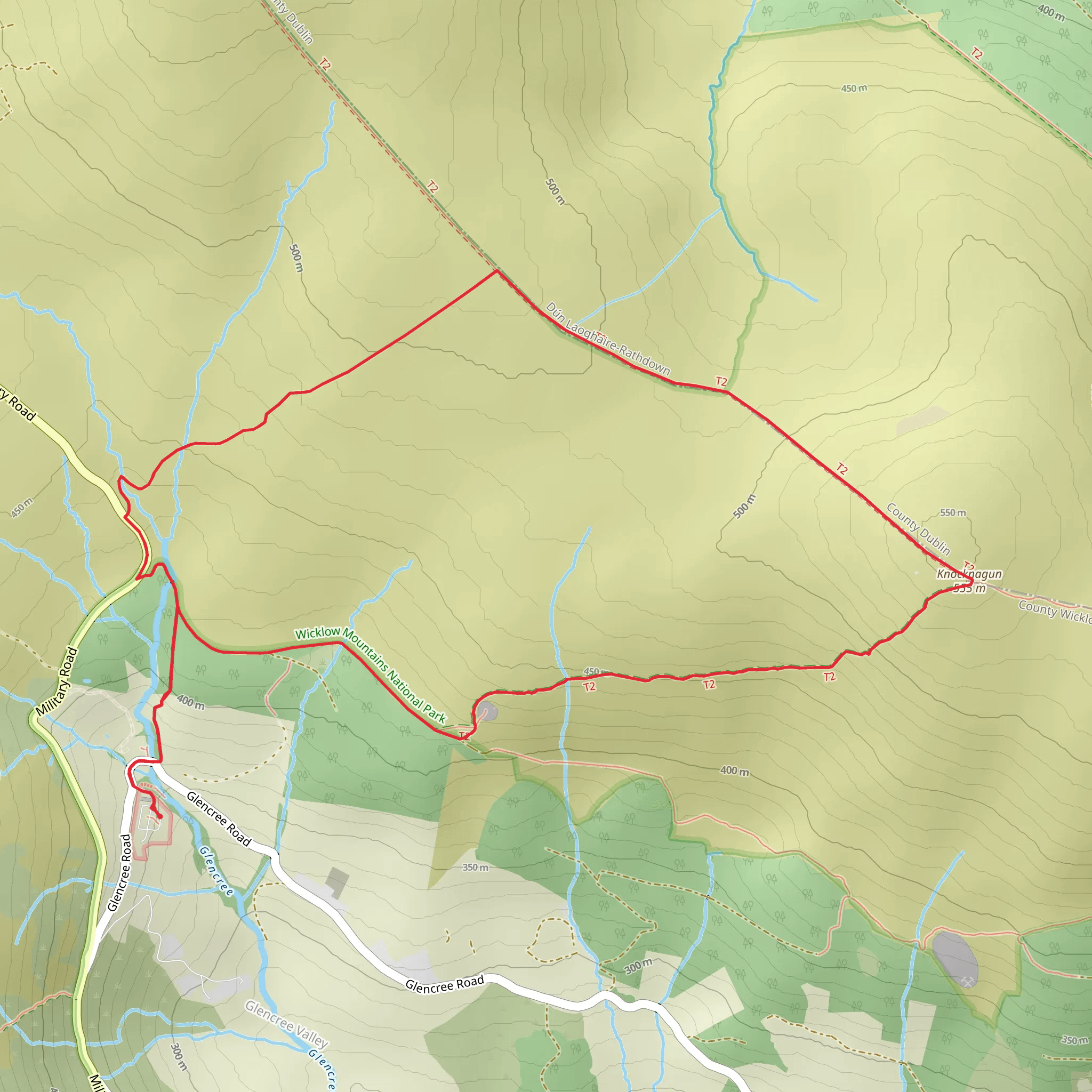
Embarking on the Knocknagun trail from Glencree, hikers will find themselves traversing approximately 7 kilometers (about 4.3 miles) with an elevation gain of roughly 200 meters (656 feet), offering a moderately challenging experience. The loop trail is nestled in the scenic County Wicklow, known as the "Garden of Ireland," and is renowned for its breathtaking landscapes and rich history.Getting to the TrailheadThe trailhead is accessible by car, located near the Glencree Centre for Peace and Reconciliation, which is a significant landmark in the area. For those relying on public transport, Dublin Bus services can take you to Enniskerry village, from where you can catch a local taxi to the trailhead. There is a small parking area near the start of the trail for those driving, which is typically uncrowded.The Hike ItselfAs you begin your hike, the initial ascent is gradual, taking you through a mix of heathland and boggy terrain. Waterproof hiking boots are recommended due to the often wet conditions underfoot. The trail is not always clearly marked, so having the HiiKER app handy for navigation is advisable to stay on track.Flora and FaunaThe area is rich in wildlife and plant species, with the Wicklow Mountains being a sanctuary for native flora such as heather, gorse, and bog cotton. Keep an eye out for the Sika deer, which are commonly sighted along the trail, as well as various bird species that call this habitat home.Historical SignificanceAs you hike, you'll be walking through an area steeped in history. Glencree has been a site of human settlement since the Neolithic era. The Glencree Centre for Peace and Reconciliation, near the trailhead, was originally built as a barracks by the British Army during the Napoleonic Wars. It later served as a reformatory school and now works to promote peace and reconciliation in Ireland and beyond.Summit and ViewsThe ascent to the summit of Knocknagun is where you'll encounter the majority of the elevation gain. Upon reaching the top, you'll be rewarded with panoramic views of the surrounding countryside, including the Great Sugar Loaf to the north and the deep blue of Lough Tay to the south.Descent and Loop CompletionThe descent is more gentle and takes you back towards the starting point, completing the loop. The trail can be rocky and uneven in places, so careful footing is necessary. As you make your way down, the landscape opens up, offering more stunning vistas of the Wicklow Mountains.Preparation and SafetyWeather in the Wicklow Mountains can be unpredictable, so it's wise to pack layers, rain gear, and sufficient water and snacks. A map and compass, alongside the HiiKER app, are essential for navigation, even for those with experience in the area.Remember to leave no trace, respect the natural environment, and enjoy the serene beauty that the Knocknagun trail from Glencree has to offer.
Comments and Reviews
User comments, reviews and discussions about the Knocknagun from Glencree, Ireland.
4.53
average rating out of 5
17 rating(s)

