Download
Preview
Add to list
More
27.8 km
~2 days
944 m
Multi-Day
“Embark on a scenic Wicklow trek, blending historical paths, diverse wildlife, and Ireland's majestic Lugnaquilla peak.”
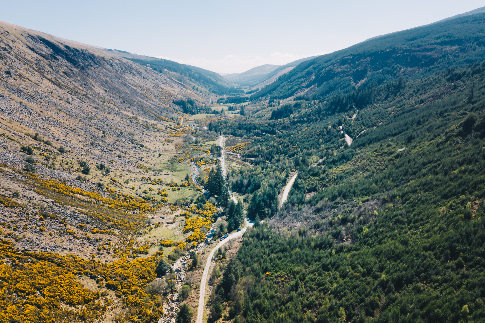
Embarking on the Drumgoff Forest to Lugnaquilla and Glenmalure trail, hikers will traverse a diverse landscape that spans approximately 28 kilometers (about 17.4 miles) with an elevation gain of around 900 meters (nearly 2953 feet). This loop trail, nestled in the scenic County Wicklow, Ireland, is rated as medium difficulty, offering a rewarding challenge for both seasoned and intermediate hikers.
Getting to the Trailhead
The trailhead is accessible by car, located near the village of Laragh, which is a short drive from the town of Rathdrum. For those relying on public transport, buses serve the nearby areas, and from there, a taxi can be taken to the starting point. Parking is available at the Drumgoff Forest car park, which serves as the commencement point for this hiking adventure.
Navigating the Trail
As you set out from Drumgoff Forest, the path leads you through a coniferous woodland, gradually ascending towards the open mountain. Hikers can utilize the HiiKER app for detailed navigation, ensuring they stay on the correct path as they approach the higher ground.
Ascending Lugnaquilla
The centerpiece of the hike is Lugnaquilla, the highest peak in the Wicklow Mountains and the highest in Ireland outside of County Kerry. The ascent is steady, and as you climb, the landscape opens up to reveal panoramic views of the surrounding countryside. The peak itself sits at an elevation of 925 meters (3035 feet), and reaching it provides a sense of accomplishment along with stunning vistas.
Historical Significance
The region is steeped in history, with the Wicklow Mountains playing a significant role during the Irish War of Independence. The area's remote valleys and rugged terrain provided ideal hideouts for Irish rebels, known as the "Wicklow Mountain Boys." As you hike, you're treading paths that were once used by these historical figures.
Flora and Fauna
The trail offers an opportunity to observe the rich biodiversity of the area. The lower forested sections are home to native species such as sika deer and red foxes, while the higher ground provides a habitat for upland birds, including the peregrine falcon and the rare red grouse. The vegetation transitions from dense forest to heathland, with heathers, gorse, and bog cotton adding color to the landscape.
Descending into Glenmalure
After summiting Lugnaquilla, the trail descends into the Glenmalure Valley, Ireland's longest glacial valley, offering a different perspective and a gentler terrain. The descent is marked by the impressive sight of the Glenmalure Waterfall, especially after heavy rains.
Completing the Loop
The final stretch of the hike loops back towards Drumgoff Forest. This section is characterized by a mix of forest tracks and mountain paths, leading you back to the starting point where the journey began.
Preparation and Planning
Hikers should be prepared for changeable weather conditions and bring appropriate gear, including waterproof clothing, sturdy hiking boots, and sufficient food and water. It's also advisable to carry a map and compass, despite the availability of digital navigation tools like HiiKER, as a backup for safety.
The trail offers a comprehensive experience of the Wicklow Mountains, combining physical challenge, natural beauty, and historical intrigue. Whether you're drawn to the allure of Lugnaquilla, the tranquility of the forests, or the rugged charm of Glenmalure, this trail promises a memorable adventure in the heart of the Irish countryside.

What to expect?
Activity types
Comments and Reviews
User comments, reviews and discussions about the Drumgoff Forest to Lugnaquilla and Glenmalure, Ireland.
4.52
average rating out of 5
23 rating(s)