Download
Preview
Add to list
More
79.0 km
~3 days
954 m
Multi-Day
“Embark on the Sligo Way, a scenic trek through Ireland's historic landscapes, offering diverse natural beauty and medium-grade hiking challenges.”
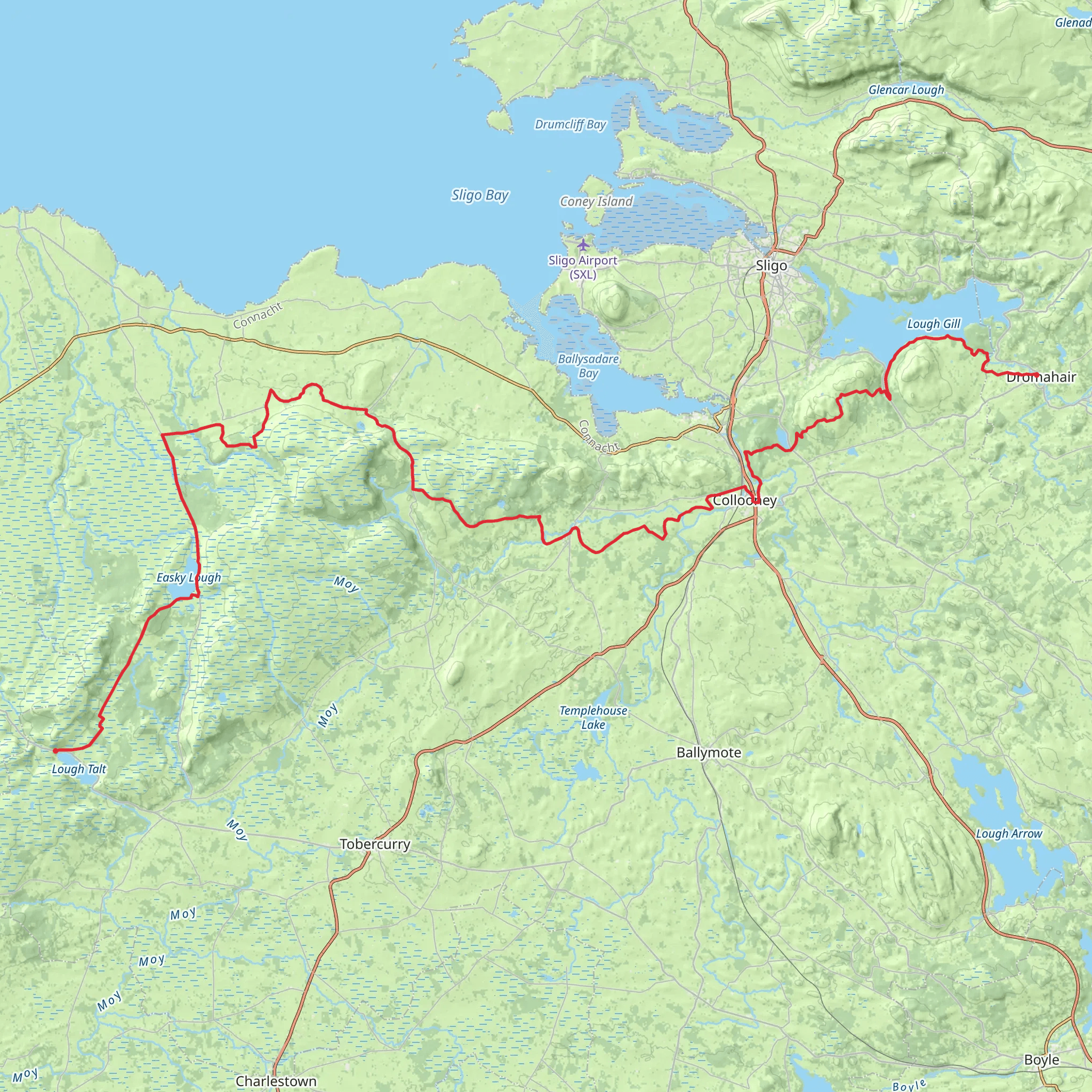
The Sligo Way is a captivating long-distance trail that stretches approximately 79 kilometers (about 49 miles) across the scenic landscape of County Sligo, Ireland. With an elevation gain of around 900 meters (nearly 2953 feet), the trail offers a medium difficulty rating, making it accessible to hikers with a reasonable level of fitness.
Starting near the village of Lough Talt, which lies to the southwest of Sligo town, the trail head is accessible by car via the N59 road. For those relying on public transport, buses from Sligo town can drop you near the starting point, but it's important to check the latest schedules for the most accurate information.
Navigating the Trail
As you embark on the Sligo Way, you'll traverse a variety of landscapes, including quiet country roads, forested paths, and open moorland. The use of a navigation tool like HiiKER can be invaluable for staying on track and anticipating changes in terrain.
Landmarks and Scenery
One of the early highlights is the passage by Lough Talt itself, a picturesque glacial lake surrounded by the Ox Mountains. The trail then winds through the dense forests of the area, offering a serene hiking experience accompanied by the sounds of local birdlife.
Further along, the trail ascends into the Ox Mountains, where the landscape opens up to reveal panoramic views of the surrounding countryside. The elevation here is gradual, but the ascent can be challenging, so pacing yourself is key.
Historical Significance
The region is steeped in history, with the trail passing near megalithic tombs and ancient sites that date back thousands of years. The Sligo Way also takes hikers close to the Carrowkeel Passage Tombs, a series of neolithic tombs that are among the oldest structures in Ireland.
Flora and Fauna
The natural beauty of the Sligo Way is enhanced by its diverse flora and fauna. The trail cuts through areas of blanket bog and heather, which are home to a variety of wildlife, including the elusive Irish hare and numerous bird species such as the skylark and the peregrine falcon.
Preparation and Planning
Hikers should be well-prepared with appropriate clothing, as the weather in Ireland can be unpredictable, with the potential for rain and wind even during the summer months. Sturdy hiking boots are a must, as the terrain can be rough and boggy in places.
It's advisable to carry a detailed map and a compass, in addition to using HiiKER for digital navigation. Make sure to pack enough water and food for the journey, as there are limited facilities along the trail.
Access to the Trail
To reach the start of the Sligo Way, if driving, set your sights on Lough Talt, which is situated near the townland of Curry in County Sligo. For those using public transportation, Sligo town serves as the nearest hub with bus services that can get you within reach of the trail head.
Remember, the Sligo Way is a point-to-point trail, so planning for transportation at the end of your hike is essential. The trail concludes near the town of Dromahair, from where you can arrange for a pickup or use local transport services to return to Sligo town or your next destination.
What to expect?
Activity types
Comments and Reviews
User comments, reviews and discussions about the Sligo Way, Ireland.
4.57
average rating out of 5
37 rating(s)

