Download
Preview
Add to list
More
169.0 km
~7 days
266 m
Multi-Day
“Embark on the National Famine Way, a poignant trek through Ireland's lush history and serene landscapes.”
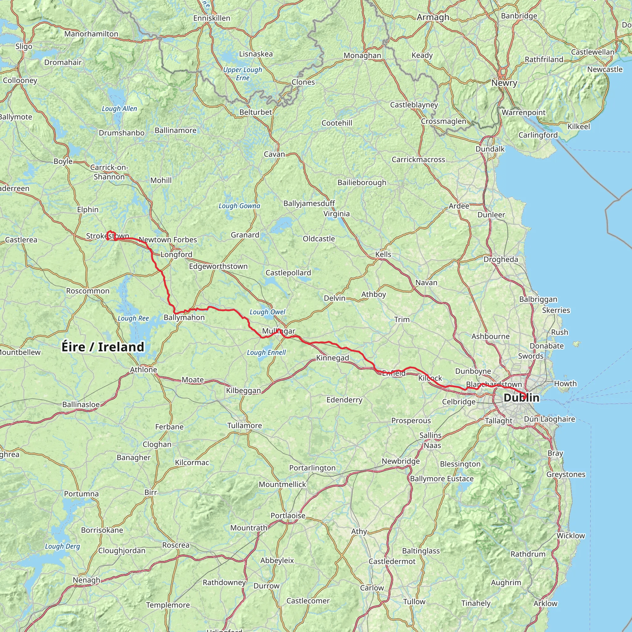
The National Famine Way is a historically rich and scenically varied trail that stretches approximately 169 kilometers (about 105 miles) with a minimal elevation gain of around 200 meters (approximately 656 feet), making it a journey of medium difficulty. The trailhead is situated near Strokestown, County Roscommon, Ireland, and the route concludes at the Irish Sea in County Dublin, offering a point-to-point experience that takes you through the heart of Ireland's countryside and its poignant past.
Getting to the Trailhead To begin your hike at the National Famine Way, you can reach the trailhead by public transport or car. The nearest significant landmark is Strokestown Park House, which is also home to the National Famine Museum. Buses from major cities like Dublin can drop you in nearby towns, from where local transport or taxis can be taken to Strokestown. If driving, you can navigate to Strokestown Park House, where parking is available before you embark on your journey.
Historical Significance The National Famine Way is steeped in history, tracing the harrowing journey of the 1,490 tenants who were forced to emigrate during the Irish Famine in 1847. As you walk, you'll be following in the footsteps of these individuals, with the trail punctuated by 30 bronze shoe sculptures representing their stories.
Route and Landmarks The trail meanders through the Irish countryside, along canal towpaths, rural roads, and through small villages. After leaving Strokestown, the path takes you to the banks of the Royal Canal, which you will follow for much of the route. The canal path offers a flat and often sheltered walking experience, with the waterway guiding you eastward.
As you progress, you'll pass through the counties of Longford and Westmeath, encountering landmarks such as Clondra Harbour, Abbeyshrule, and the bustling town of Mullingar. Each of these locations offers a glimpse into local life and the opportunity to rest, refuel, and if needed, find accommodation.
Nature and Wildlife The National Famine Way is not only a journey through history but also a chance to immerse yourself in Irish nature. The trail offers a variety of landscapes, from pastoral fields to the peat bogs of the midlands. Birdwatchers will appreciate the diversity of species along the canal, including swans, herons, and kingfishers. The changing seasons bring different hues to the countryside, with lush greens in spring and summer, and rich golds and browns in autumn.
Navigation and Planning To navigate the trail, HiiKER is an excellent tool for planning your hike, offering detailed maps and waypoints. It's advisable to download the map for offline use, as some rural sections may have limited mobile reception. The trail is well-marked, but having a digital map ensures you can stay on track.
Preparation Given the length of the National Famine Way, it's important to plan for multiple days of hiking, with the average walker completing the trail in about 6 to 8 days. Ensure you have suitable walking shoes, rain gear, and layered clothing to adapt to Ireland's changeable weather. Accommodations along the way range from B&Bs to hotels, and it's wise to book these in advance, especially during peak seasons.
Remember to carry enough water and snacks for each day's walk, although there are opportunities to replenish supplies in the towns and villages you'll pass through. Lastly, always leave no trace, respecting the natural environment and the historical significance of the trail.
What to expect?
Activity types
Comments and Reviews
User comments, reviews and discussions about the National Famine Way, Ireland.
4.52
average rating out of 5
23 rating(s)

