Download
Preview
Add to list
More
10.9 km
~2 hrs 24 min
131 m
Loop
“The Faulmore Loop in County Mayo offers breathtaking coastal views, historical landmarks, and moderate hiking challenges.”
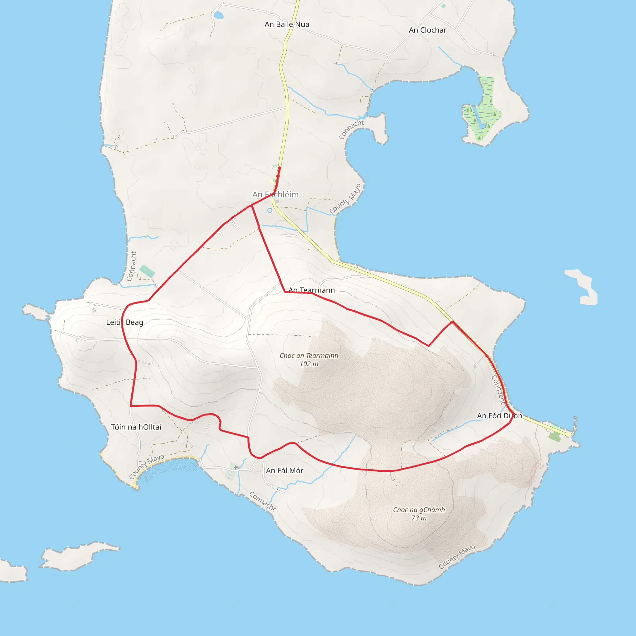
Starting near County Mayo, Ireland, the Faulmore Loop is a captivating 11 km (approximately 6.8 miles) trail with an elevation gain of around 100 meters (328 feet). This loop trail offers a medium difficulty rating, making it suitable for moderately experienced hikers.
Getting There To reach the trailhead, you can drive or use public transport. If driving, set your GPS to the nearest known landmark, which is the village of Belmullet. From Belmullet, follow the R313 road towards Blacksod. Public transport options include buses from major cities like Galway or Dublin to Belmullet, and from there, you can take a local taxi to the trailhead.
Trail Overview The Faulmore Loop begins near the scenic coastline of County Mayo, offering breathtaking views of the Atlantic Ocean. The trail is well-marked and navigable using the HiiKER app, which provides detailed maps and real-time navigation.
Key Landmarks and Points of Interest - **Blacksod Bay**: At approximately 2 km (1.2 miles) into the hike, you'll encounter stunning views of Blacksod Bay. This area is known for its rich marine life and is a great spot for birdwatching. - **Faulmore Cliffs**: Around the 5 km (3.1 miles) mark, the trail takes you along the dramatic Faulmore Cliffs. These cliffs offer panoramic views of the Atlantic and are a perfect place for a rest stop. - **Historical Sites**: The region is steeped in history. Near the 7 km (4.3 miles) point, you'll pass by ancient stone ruins that date back to early settlements in the area. These ruins offer a glimpse into the lives of the people who once inhabited this rugged landscape.
Flora and Fauna The trail is abundant with native Irish flora, including heather, gorse, and wildflowers that bloom in the spring and summer months. Wildlife enthusiasts will appreciate the variety of birds, such as puffins and razorbills, especially near the coastal sections of the trail.
Trail Conditions and Safety The Faulmore Loop features a mix of terrains, including coastal paths, grassy meadows, and rocky sections. The elevation gain is gradual, making it manageable for most hikers. However, the coastal sections can be windy and slippery, so sturdy hiking boots are recommended. Always check the weather forecast before setting out, as conditions can change rapidly.
Navigation and Amenities Using the HiiKER app is highly recommended for navigation. The app provides detailed maps and real-time updates, ensuring you stay on the right path. There are no facilities directly on the trail, so bring sufficient water and snacks. The nearest amenities, including restrooms and cafes, are in Belmullet.
Final Stretch As you near the end of the loop, the trail descends gently back towards the starting point, offering one last look at the stunning coastal scenery. The entire hike typically takes around 3-4 hours, depending on your pace and how often you stop to take in the views.
This trail offers a perfect blend of natural beauty, historical intrigue, and moderate physical challenge, making it a must-visit for hikers exploring County Mayo.
Comments and Reviews
User comments, reviews and discussions about the Faulmore Loop, Ireland.
4.57
average rating out of 5
14 rating(s)

