Download
3D Flyover
Add to list
More
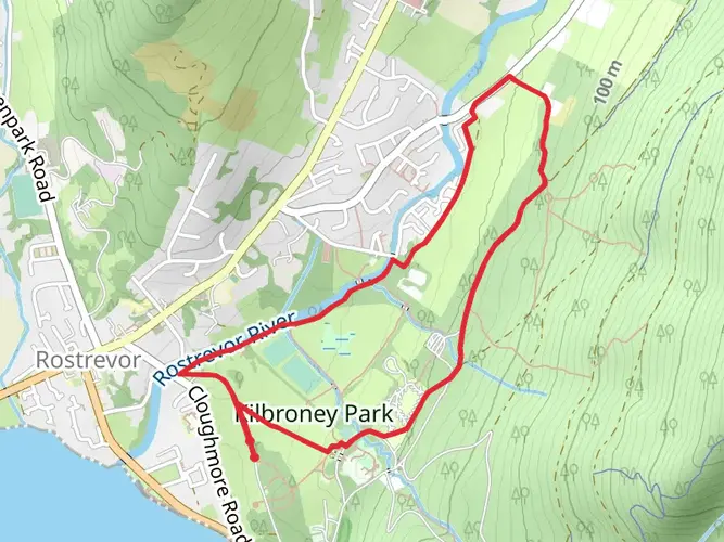
40.1 km
~2 days
1202 m
Multi-Day
“Embark on the Tain Way, where mythic history and Ireland's rugged beauty converge in an epic 40km loop.”
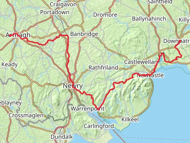
The Tain Way is a captivating loop trail that spans approximately 40 kilometers (about 25 miles) with an elevation gain of roughly 1200 meters (close to 3937 feet), offering hikers a medium difficulty level trek. This trail is nestled in the scenic Cooley Peninsula, near County Louth, Ireland, and is steeped in rich history and natural beauty.
Getting to the Trailhead
To reach the trailhead, which is conveniently located near the village of Carlingford, hikers can drive or take public transportation. If driving, Carlingford is about an hour's drive from both Dublin and Belfast, making it easily accessible. For those opting for public transport, there are bus services from Dundalk, which is well-connected by train from Dublin and Belfast. Once in Carlingford, the trailhead is found just on the outskirts of the village, and it's well-marked, so you'll be able to start your hike without any hassle.
Navigating the Trail
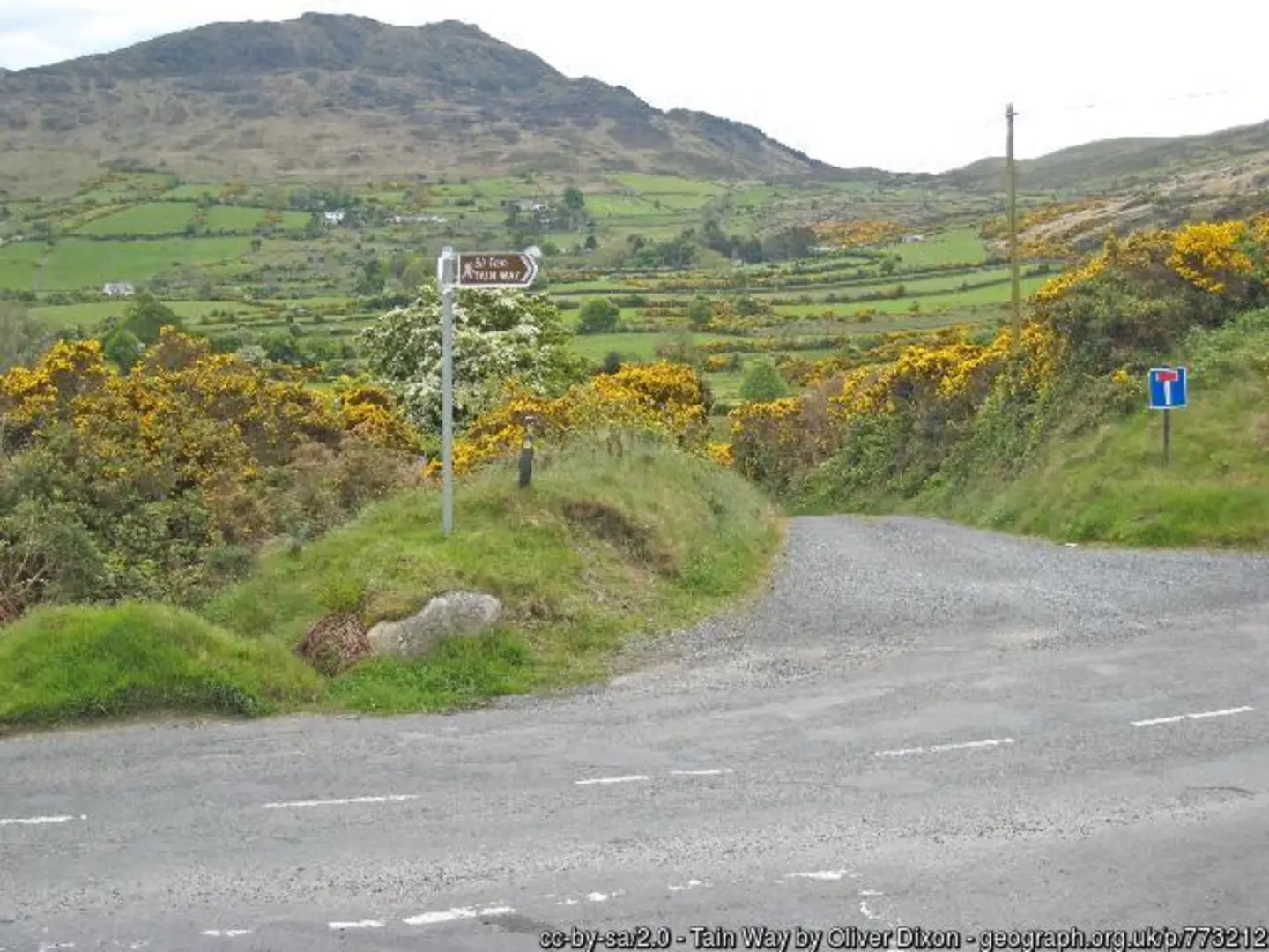
As you embark on the Tain Way, it's advisable to use a reliable navigation tool like HiiKER to keep track of your location and the trail's route. The trail is well-signed, but having a digital map can be invaluable, especially in areas where the path may be less defined.
Historical Significance and Landmarks
The Tain Way is named after the epic Irish tale, Táin Bó Cúailnge, or The Cattle Raid of Cooley, which features legendary heroes such as Cú Chulainn. As you traverse the trail, you'll be walking in the footsteps of ancient warriors and experiencing landscapes that have remained largely unchanged since those mythic times.
One of the significant landmarks you'll encounter is the Proleek Dolmen, a megalithic tomb dating back to the Neolithic period. This impressive structure is a testament to the area's ancient human activity and is located just a short detour off the main trail.
Natural Beauty and Wildlife
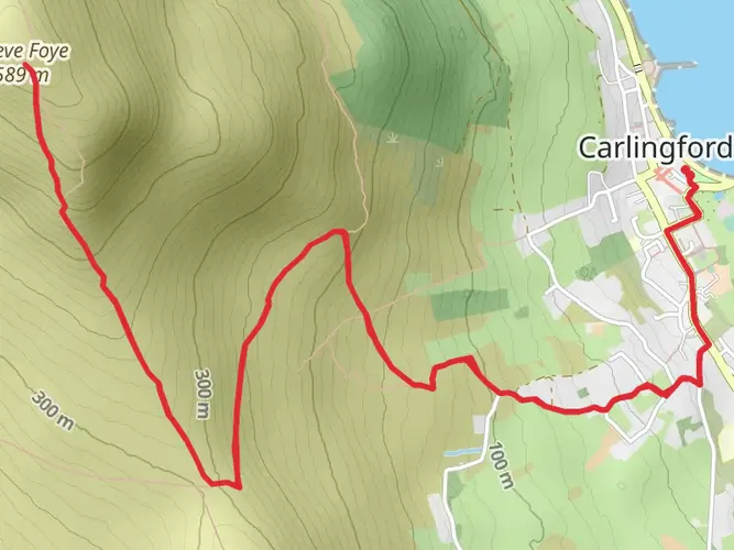
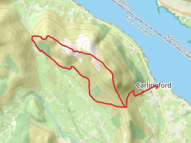
The Tain Way offers a diverse range of scenery, from the tranquil shores of Carlingford Lough to the rugged slopes of Slieve Foye, the highest peak in the Cooley Mountains. The ascent of Slieve Foye is a highlight of the hike, providing panoramic views of the surrounding landscape.
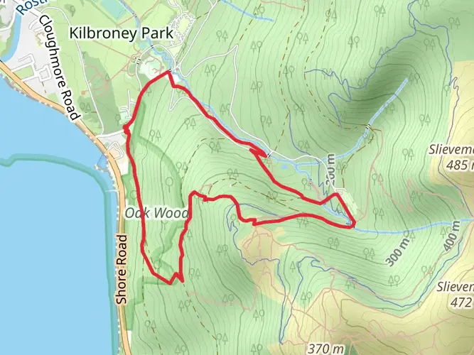
The area is rich in biodiversity, with a variety of flora and fauna. Keep an eye out for the rare hen harrier and the Irish hare, as well as a multitude of plant species that thrive in the heath and bogland. The trail also winds through serene woodlands and past glistening streams, adding to the overall enchantment of the hike.
Preparation and Planning
Given the trail's length and elevation gain, it's important to be well-prepared. Ensure you have adequate water, food, and clothing for the Irish weather, which can be unpredictable. Sturdy hiking boots are a must, as the terrain can be rough in places. It's also wise to check the weather forecast and plan your hike accordingly, as conditions in the mountains can change rapidly.
Access and Amenities
The Tain Way is accessible year-round, but the best time to hike is from spring to autumn when the weather is milder. There are several access points along the trail, allowing for shorter hikes if you're not up for the full loop. Carlingford, the start and end point of the trail, offers a range of amenities including accommodation, restaurants, and shops, making it a convenient base for your hiking adventure.

What to expect?
Activity types
Comments and Reviews
User comments, reviews and discussions about the Tain Way, Ireland.
4.54
average rating out of 5
35 rating(s)