Download
Preview
Add to list
More
13.6 km
~3 hrs 57 min
749 m
Loop
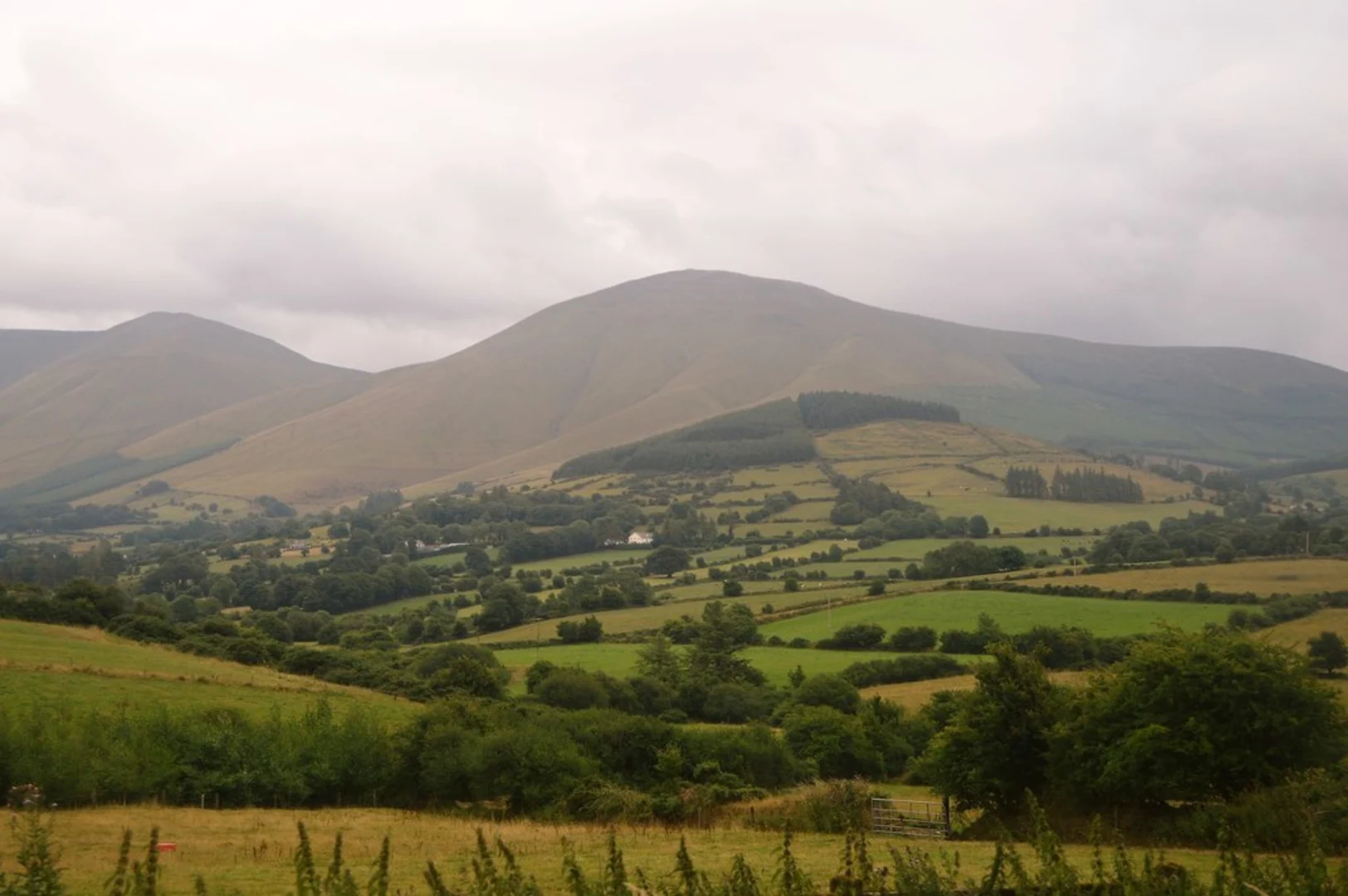
“The Galtee Loop offers a scenic 14 km hike with diverse landscapes, abundant wildlife, and rich history.”
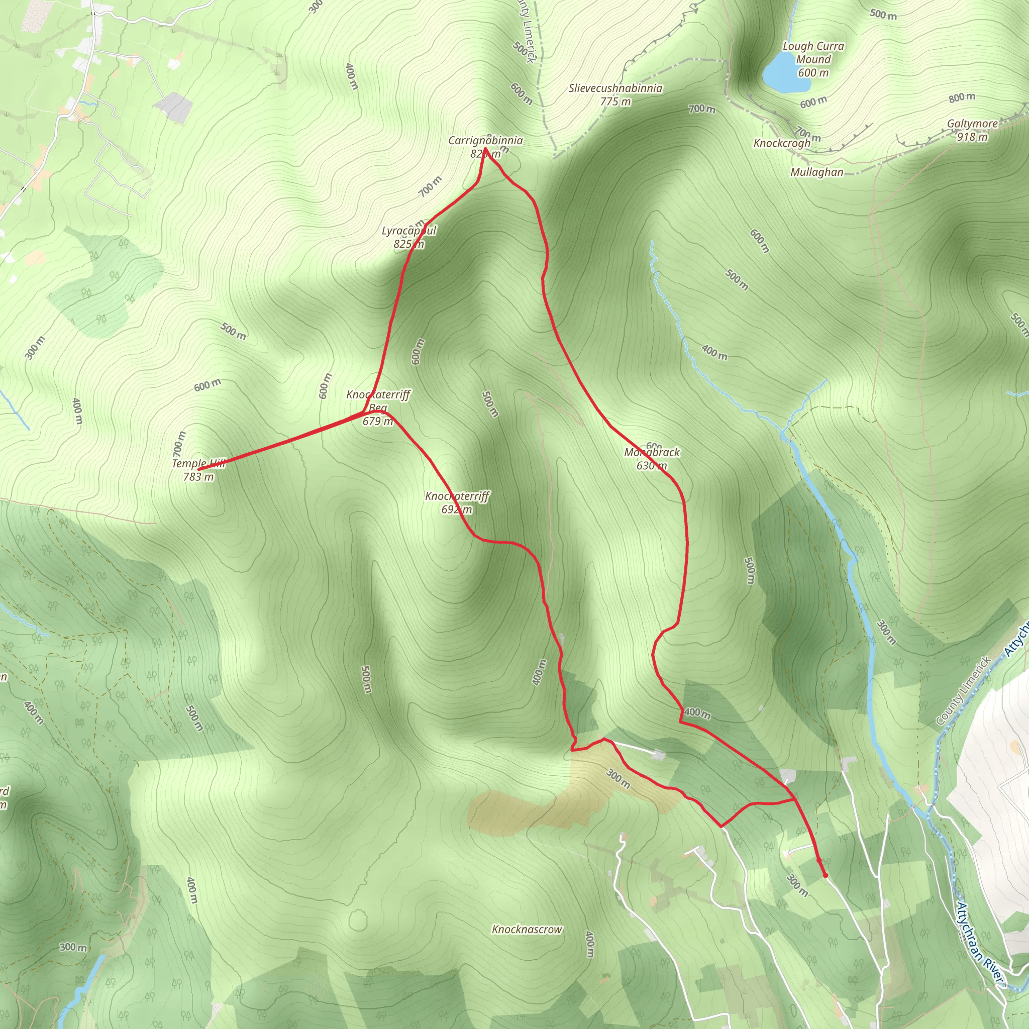
Starting near County Limerick, Ireland, the Galtee Loop is a captivating 14 km (8.7 miles) trail with an elevation gain of approximately 700 meters (2,297 feet). This loop trail offers a medium difficulty rating, making it suitable for moderately experienced hikers.### Getting There To reach the trailhead, you can drive or use public transport. If driving, set your GPS to the nearest known address, which is the village of Anglesborough, County Limerick. From there, follow local signage to the trailhead. For those using public transport, take a bus to Mitchelstown, County Cork, and then a taxi or local bus to Anglesborough.### Trail Overview The Galtee Loop begins with a gentle ascent through lush, green pastures and woodlands. Early on, you’ll encounter the serene Blackrock River, which you’ll follow for a short distance. This section is relatively flat and provides a good warm-up for the more challenging parts ahead.### Key Landmarks and Elevation At around the 3 km (1.9 miles) mark, you’ll start a steeper climb towards the Galtee Mountains. The trail here becomes rockier and more rugged, so sturdy hiking boots are essential. As you ascend, you’ll gain approximately 300 meters (984 feet) in elevation over the next 2 km (1.2 miles).### Nature and Wildlife The Galtee Mountains are home to a variety of flora and fauna. Keep an eye out for red deer, which are often seen grazing in the higher elevations. Birdwatchers will also enjoy spotting species like the peregrine falcon and the red grouse. The trail is lined with heather, gorse, and native Irish wildflowers, adding vibrant colors to your hike.### Historical Significance The Galtee Mountains have a rich history, with evidence of ancient settlements and agricultural practices dating back thousands of years. As you hike, you may come across old stone walls and ruins of farmhouses, remnants of a bygone era. The area was also a hideout for Irish rebels during the 17th and 18th centuries, adding a layer of historical intrigue to your journey.### Reaching the Summit Around the 7 km (4.3 miles) mark, you’ll reach the highest point of the trail, Galtymore, standing at 919 meters (3,015 feet). From here, you’ll be rewarded with panoramic views of the surrounding counties, including Tipperary, Limerick, and Cork. On a clear day, you can even see as far as the Slieve Bloom Mountains.### Descent and Return The descent begins after you’ve soaked in the views from Galtymore. The trail loops back down through a different route, offering new scenery and perspectives. This section is less steep but can be slippery, especially after rain, so take your time and use trekking poles if you have them.### Navigation For navigation, it’s highly recommended to use HiiKER, which provides detailed maps and real-time tracking to ensure you stay on the right path. The trail is well-marked, but having a reliable navigation tool can enhance your hiking experience.### Final Stretch As you approach the final 3 km (1.9 miles) of the loop, the trail flattens out and meanders through more pastoral landscapes, eventually leading you back to the trailhead near Anglesborough. This section is a great opportunity to cool down and reflect on the diverse terrains and rich history you’ve just experienced.The Galtee Loop offers a well-rounded hiking experience with its mix of natural beauty, wildlife, and historical significance. Whether you’re a seasoned hiker or looking to challenge yourself, this trail provides a memorable adventure in the heart of Ireland.
Comments and Reviews
User comments, reviews and discussions about the Galtee Loop, Ireland.
4.31
average rating out of 5
16 rating(s)

