Download
Preview
Add to list
More
14.1 km
~3 hrs 26 min
368 m
Loop
“Experience the Ballyhoura - Slieve Reagh Loop: a medium-difficulty, scenic 14 km trail rich in history and nature.”
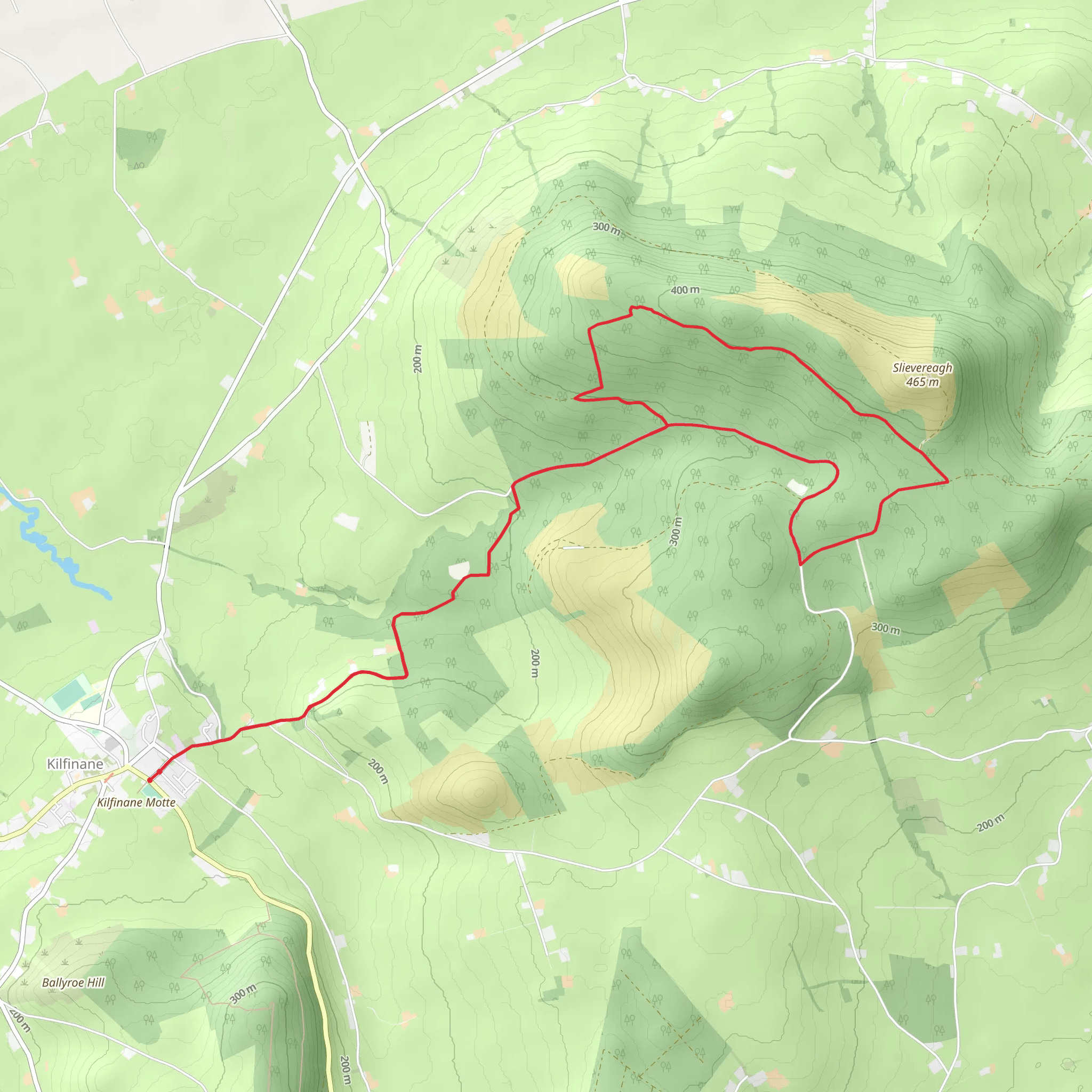
Starting near County Limerick, Ireland, the Ballyhoura - Slieve Reagh Loop is a captivating 14 km (approximately 8.7 miles) trail with an elevation gain of around 300 meters (about 984 feet). This loop trail is rated as medium difficulty, making it suitable for moderately experienced hikers.
Getting There To reach the trailhead, you can drive or use public transport. If driving, head towards the Ballyhoura Mountains, specifically near the village of Kilfinane, County Limerick. For those using public transport, the nearest significant town is Kilmallock, which is serviced by buses from Limerick City. From Kilmallock, a taxi or local bus can take you to Kilfinane, where the trailhead is located.
Trail Overview The trail begins with a gentle ascent through lush, green woodlands, offering a serene start to your hike. As you progress, the path becomes steeper, leading you through a mix of forested areas and open moorlands. The initial 3 km (1.9 miles) will see you gaining about 100 meters (328 feet) in elevation, providing a good warm-up for the more challenging sections ahead.
Key Landmarks and Nature Around the 5 km (3.1 miles) mark, you'll encounter the first significant landmark: the ruins of an old stone cottage, a remnant of Ireland's rural past. This spot offers a great opportunity for a short break and some photography.
Continuing on, the trail opens up to panoramic views of the Ballyhoura Mountains. The highest point of the trail, Slieve Reagh, is reached at approximately 7 km (4.3 miles) into the hike. Here, you'll be at an elevation of around 300 meters (984 feet), offering stunning vistas of the surrounding countryside. On a clear day, you can see as far as the Galtee Mountains to the east.
Flora and Fauna The Ballyhoura region is rich in biodiversity. As you hike, keep an eye out for native wildlife such as red deer, foxes, and a variety of bird species including kestrels and skylarks. The flora is equally diverse, with heather, gorse, and native Irish wildflowers adding splashes of color to the landscape.
Historical Significance The Ballyhoura Mountains have a rich history, with evidence of human activity dating back to the Bronze Age. The area was historically significant for its role in the agrarian economy, and remnants of ancient farming practices can still be seen along the trail. The ruins of old cottages and stone walls are a testament to the region's past.
Navigation and Safety Given the varied terrain, it's advisable to use a reliable navigation tool like HiiKER to stay on track. The trail is well-marked, but weather conditions can change rapidly, so always be prepared with appropriate gear. Waterproof clothing, sturdy hiking boots, and sufficient water and snacks are essential.
Final Stretch The final 4 km (2.5 miles) of the loop take you through a mix of forest and open fields, gradually descending back towards the trailhead. This section is less strenuous, allowing you to enjoy the natural beauty of the area at a more relaxed pace.
By the time you complete the loop, you'll have experienced a diverse range of landscapes and gained a deeper appreciation for the natural and historical richness of the Ballyhoura Mountains.
Comments and Reviews
User comments, reviews and discussions about the Ballyhoura - Slieve Reagh Loop, Ireland.
4.32
average rating out of 5
25 rating(s)

