Download
Preview
Add to list
More
7.3 km
~2 hrs 1 min
334 m
Loop
“The Brandon Hill Summit Walk is a 7 km loop offering lush landscapes, historical sites, and stunning panoramic views.”
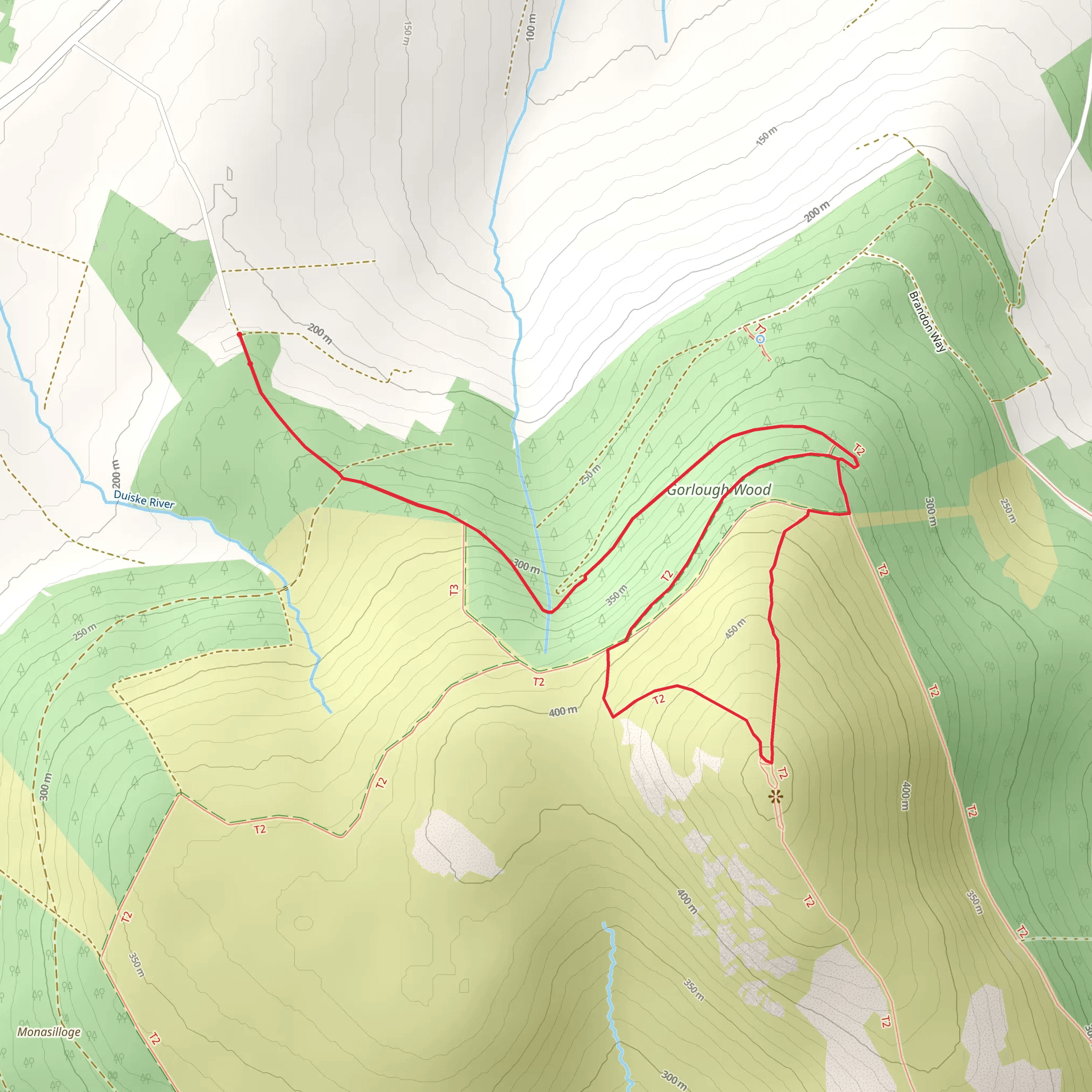
Starting near County Kilkenny, Ireland, the Brandon Hill Summit Walk is a captivating loop trail that spans approximately 7 km (4.3 miles) with an elevation gain of around 300 meters (984 feet). This medium-difficulty hike offers a blend of natural beauty, historical significance, and panoramic views, making it a rewarding experience for hikers.
Getting There To reach the trailhead, you can drive or use public transport. If driving, head towards Graiguenamanagh, a charming town in County Kilkenny. From there, follow the signs to the Brandon Hill car park, which is well-marked and provides ample parking space. For those using public transport, buses from Kilkenny city to Graiguenamanagh are available, and from the town, you can either walk or take a short taxi ride to the trailhead.
Trail Overview The trail begins at the Brandon Hill car park, located near the picturesque village of Graiguenamanagh. As you start your ascent, you'll be greeted by lush greenery and a well-maintained path. The initial section is relatively gentle, allowing you to ease into the hike while enjoying the surrounding flora.
Key Landmarks and Nature At approximately 1.5 km (0.9 miles) into the hike, you'll encounter the first significant landmark: the Ballyogan Wood. This dense forest area is home to a variety of native Irish trees, including oak, ash, and birch. Keep an eye out for local wildlife such as red squirrels and various bird species.
Continuing your ascent, around the 3 km (1.9 miles) mark, you'll reach a clearing that offers stunning views of the Barrow Valley and the Blackstairs Mountains. This is an excellent spot for a short break and some photography.
Historical Significance As you approach the summit, you'll come across remnants of ancient stone walls and old farmsteads, hinting at the area's rich history. Brandon Hill itself has historical significance, with its name derived from Saint Brendan, one of Ireland's early Christian saints. The hill has been a site of pilgrimage and local folklore for centuries.
Reaching the Summit The final push to the summit is the most challenging part of the hike, with a steeper incline and rocky terrain. However, the effort is well worth it. At the summit, standing at 515 meters (1,690 feet) above sea level, you'll be rewarded with 360-degree views that stretch as far as the Wicklow Mountains to the northeast and the Slieve Bloom Mountains to the west.
Descent and Return The descent follows a different path, completing the loop. This section is less steep but equally scenic, taking you through open moorland and back into forested areas. The trail eventually leads you back to the car park, completing the 7 km (4.3 miles) loop.
Navigation and Safety For navigation, it's highly recommended to use the HiiKER app, which provides detailed maps and real-time GPS tracking to ensure you stay on course. The trail is well-marked, but having a reliable navigation tool adds an extra layer of security.
Final Tips Wear sturdy hiking boots, as the terrain can be uneven and rocky, especially near the summit. Bring water and snacks, as there are no facilities along the trail. Weather in this region can be unpredictable, so pack a waterproof jacket and layers to adjust to changing conditions. Enjoy the hike and take your time to soak in the natural beauty and historical richness of the Brandon Hill Summit Walk.
Comments and Reviews
User comments, reviews and discussions about the Brandon Hill Summit Walk, Ireland.
4.54
average rating out of 5
37 rating(s)

