Download
Preview
Add to list
More
10.2 km
~3 hrs 22 min
803 m
Loop
“Embark on a historic hike through Ireland's highest peaks, embracing the wild beauty of Kerry's Glencappul Top trail.”
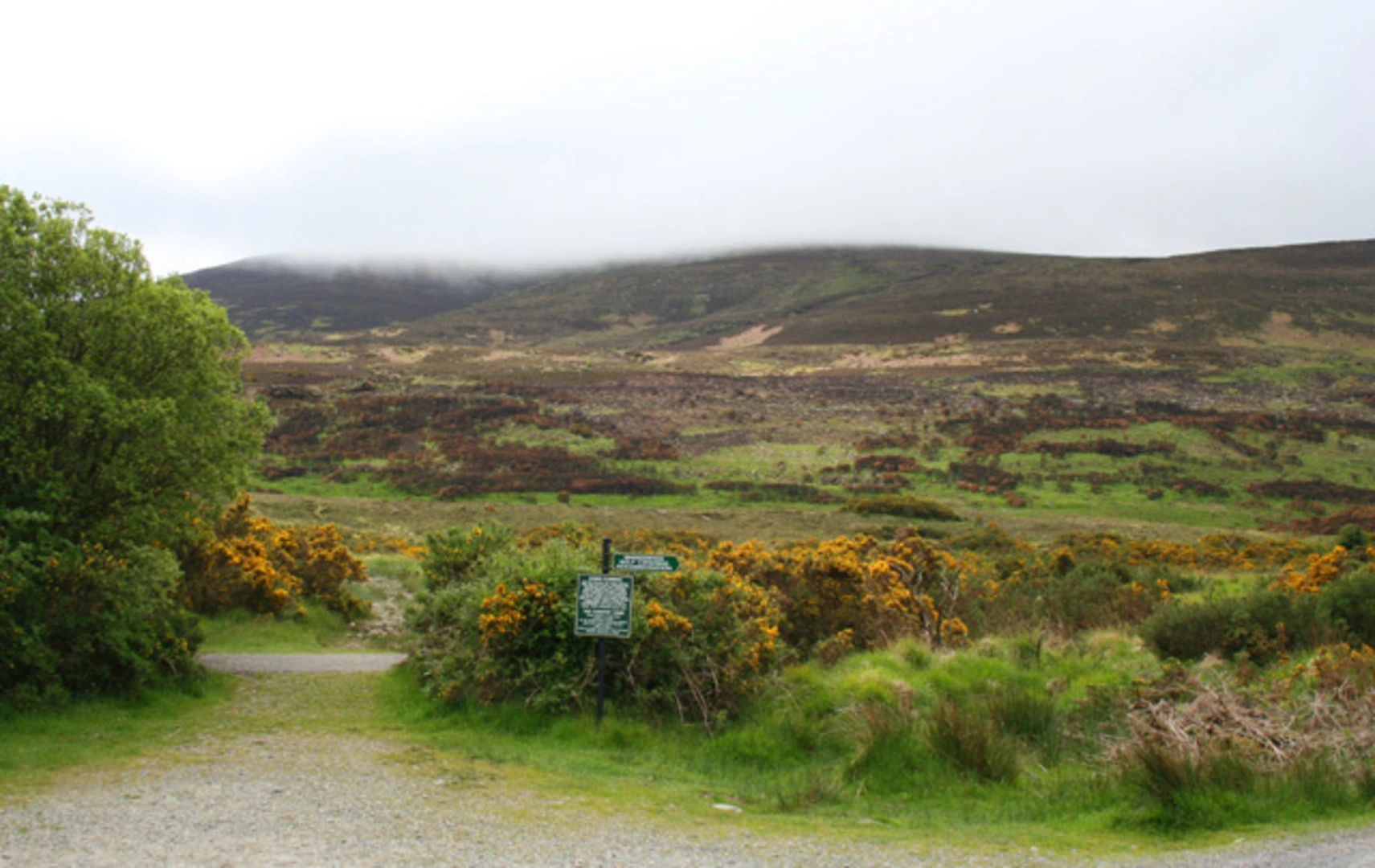
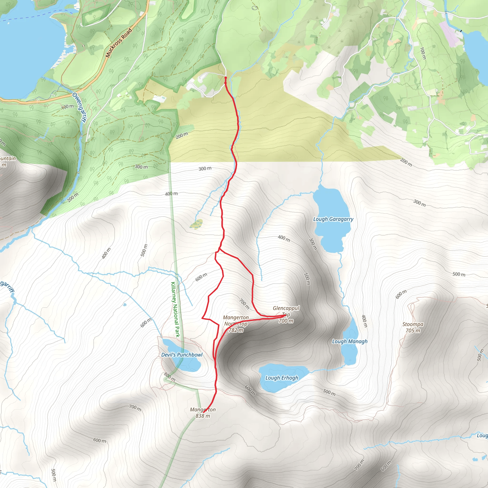
The Glencappul Top trail, nestled in the majestic MacGillycuddy's Reeks in County Kerry, Ireland, offers hikers a moderately challenging loop that spans approximately 10 kilometers (about 6.2 miles) with an elevation gain of roughly 800 meters (around 2625 feet). This trail is renowned for its breathtaking scenery, encompassing rolling hills, serene lakes, and the chance to witness the highest peaks in Ireland.
Getting to the Trailhead
To reach the starting point of the Glencappul Top trail, hikers can drive to the vicinity of the picturesque town of Killarney. The trailhead is accessible by following the N71 road towards Muckross House and continuing towards the Bridia Valley. For those relying on public transport, Killarney serves as a hub with bus and train services connecting to major Irish cities. From Killarney, local taxi services can transport hikers to the trailhead.
The Hike
Embarking on the trail, hikers will traverse through a landscape steeped in history, with the MacGillycuddy's Reeks holding tales of ancient folklore and providing a habitat for a variety of wildlife, including native red deer and diverse bird species. The initial section of the hike involves a gradual ascent, allowing hikers to warm up as they take in the surrounding vistas.
As the trail progresses, the incline becomes more pronounced, leading to the heart of the Reeks. The path weaves through rugged terrain, with the possibility of encountering sheep grazing on the mountainside. Hikers should be prepared for changeable weather conditions, as the area is known for its microclimates.
Landmarks and Scenery
One of the most significant landmarks along the Glencappul Top trail is the view of Carrauntoohil, Ireland's highest peak, which stands at 1,038 meters (3,406 feet). The trail does not summit Carrauntoohil but offers stunning perspectives of its imposing stature.
Approximately halfway through the hike, the trail reaches its highest point, providing panoramic views of the surrounding landscape, including the Gap of Dunloe and the Lakes of Killarney. This is an ideal spot for a rest and photo opportunities.
Flora and Fauna
The trail is rich in biodiversity, with the chance to observe a variety of plant life, including heather, bog cotton, and the unique alpine flora that thrives in the higher altitudes. The area is also home to birds of prey, such as the peregrine falcon, which may be spotted soaring above.
Navigation and Safety
Navigating the Glencappul Top trail requires a moderate level of fitness and experience in hill walking. Hikers should be equipped with appropriate footwear, clothing, and navigational tools. The HiiKER app can be a valuable resource for trail maps and navigation, ensuring that hikers stay on the correct path.
Historical Significance
The MacGillycuddy's Reeks have a rich history, with evidence of human activity dating back to the Bronze Age. The region's name itself is derived from the Irish clan Mac Giolla Mochuda, who were once the land's custodians. Hikers walking these paths tread in the footsteps of countless generations, adding to the trail's sense of timelessness.
Conclusion
The Glencappul Top trail is a journey through both natural beauty and historical depth. It offers a rewarding experience for those looking to explore the Irish landscape and test their hiking abilities amidst the splendor of County Kerry's mountainous terrain.
Comments and Reviews
User comments, reviews and discussions about the Glencappul Top, Ireland.
4.54
average rating out of 5
13 rating(s)

