Download
3D Flyover
Add to list
More
183.1 km
~7 days
3483 m
Multi-Day
“Embark on the Dingle Way for 183 kilometers of stunning landscapes, rich history, and diverse wildlife.”
Starting near County Kerry, Ireland, the Dingle Way is a captivating loop trail that spans approximately 183 kilometers (114 miles) with an elevation gain of around 3400 meters (11,155 feet). This trail offers a medium difficulty rating, making it accessible for moderately experienced hikers.
Getting There
To reach the trailhead, you can travel to Tralee, a town well-connected by public transport. From Dublin, you can take a train or bus to Tralee, which takes about 4-5 hours. If you prefer driving, Tralee is accessible via the N21 from Limerick or the N22 from Cork. Parking is available in Tralee for those arriving by car.
Trail Overview
The Dingle Way takes you through a variety of landscapes, from coastal paths and sandy beaches to mountainous terrain and lush green valleys. The trail is well-marked, but it's advisable to use HiiKER for navigation to ensure you stay on track.
Key Sections and Landmarks
Tralee to Camp (18 km / 11 miles)
Starting in Tralee, the trail heads west towards the village of Camp. This section is relatively flat, with an elevation gain of about 200 meters (656 feet). You'll pass through farmland and small villages, offering a glimpse into rural Irish life.
Camp to Annascaul (17 km / 10.5 miles)
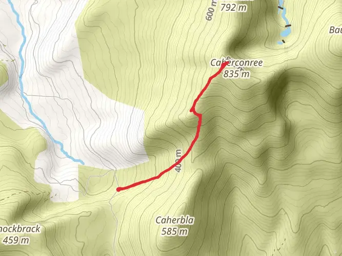
From Camp, the trail ascends towards the Slieve Mish Mountains, reaching an elevation of around 400 meters (1,312 feet). The descent into Annascaul offers stunning views of the Dingle Peninsula. Annascaul is known for its connection to Antarctic explorer Tom Crean, and you can visit the South Pole Inn, a pub he once owned.
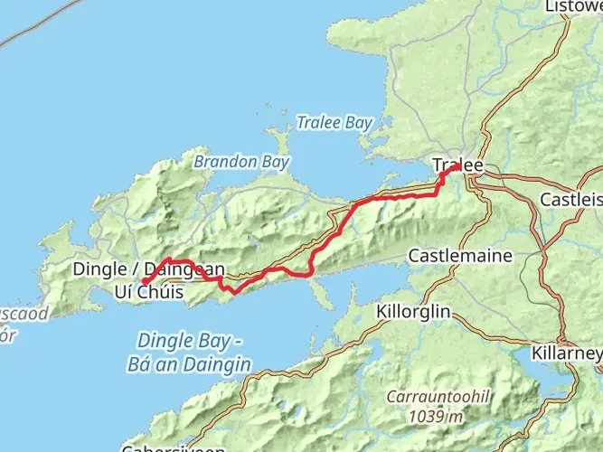
Annascaul to Dingle (22 km / 13.7 miles)
This section takes you through more varied terrain, including the beautiful Inch Beach. The trail then climbs to around 200 meters (656 feet) before descending into the vibrant town of Dingle. Dingle is famous for its lively music scene and the friendly dolphin, Fungie, who has been a local attraction for years.
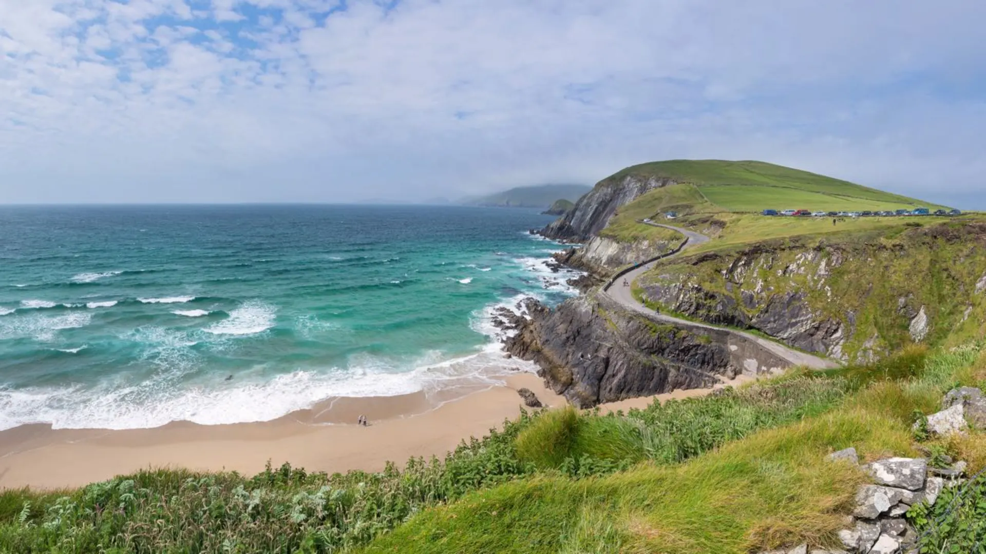
Dingle to Dunquin (20 km / 12.4 miles)
Leaving Dingle, the trail follows the coast, offering breathtaking views of the Atlantic Ocean. You'll pass by the ancient Dunbeg Fort and the Blasket Islands Visitor Centre. The elevation gain here is moderate, around 300 meters (984 feet).
Dunquin to Ballydavid (23 km / 14.3 miles)
This section is one of the most scenic, with rugged cliffs and panoramic ocean views. The trail climbs to around 250 meters (820 feet) before descending into the quaint village of Ballydavid. Keep an eye out for seabirds and marine wildlife along this coastal stretch.
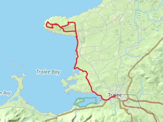
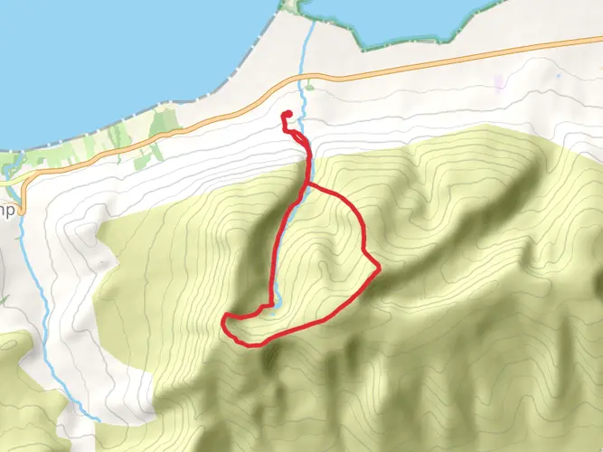
Ballydavid to Cloghane (29 km / 18 miles)
The trail heads inland, ascending towards Mount Brandon, the highest point on the Dingle Way at 952 meters (3,123 feet). This challenging climb is rewarded with spectacular views. The descent into Cloghane is steep, so take care.
Cloghane to Castlegregory (21 km / 13 miles)
From Cloghane, the trail follows the coastline again, passing through the Maharees Peninsula. This section is relatively flat, with an elevation gain of about 150 meters (492 feet). The sandy beaches and dunes are a highlight here.
Castlegregory to Tralee (33 km / 20.5 miles)
The final stretch takes you back to Tralee, passing through farmland and small villages. The elevation gain is minimal, around 100 meters (328 feet), making for a gentle end to your journey.
Historical Significance
The Dingle Peninsula is rich in history, with numerous archaeological sites, including ancient ring forts, standing stones, and early Christian churches. The region has been inhabited for thousands of years, and the trail offers a unique opportunity to explore this historical tapestry.
Nature and Wildlife
The Dingle Way is a haven for nature lovers. The coastal sections are home to a variety of seabirds, including puffins and gannets. You might also spot seals and dolphins along the shoreline. The inland sections offer lush greenery and the chance to see native Irish wildlife such as red deer and foxes.
Preparation Tips
Given the varied terrain and weather conditions, it's essential to pack appropriately. Waterproof clothing, sturdy hiking boots, and a reliable navigation tool like HiiKER are must-haves. The trail passes through several villages, so you can replenish supplies and find accommodation along the way. However, carrying some snacks and water is advisable, especially for the more remote sections.
Embarking on the Dingle Way promises an unforgettable adventure through one of Ireland's most picturesque regions.

What to expect?
Activity types
Frequently asked questions
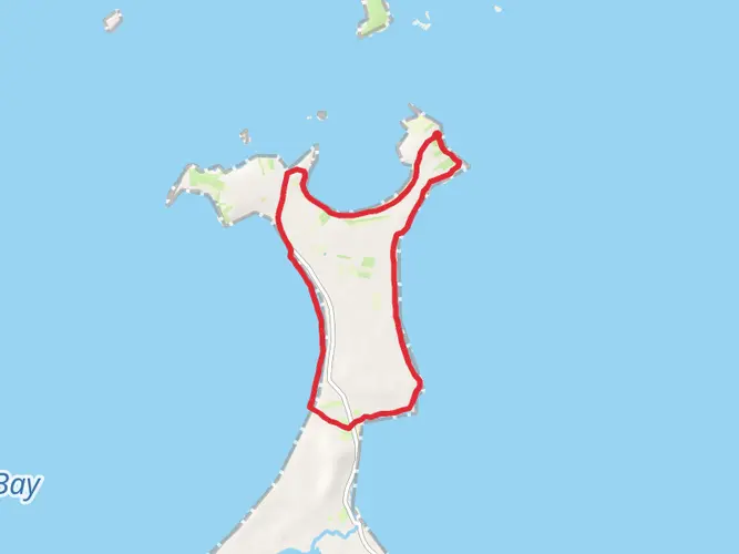
Where does the Dingle Way start and finish in County Kerry?
The Dingle Way is a loop that starts and finishes in Tralee, County Kerry. The official trailhead is at the Town Park Gate on the west side of Ashe Hall at the end of Denny Street, so walkers return to the same town after completing the circuit around the Dingle Peninsula.
How long is the Dingle Way and how many stages does the Dingle Way usually take?
The Dingle Way is 183.11 km long in this route listing, with 3,483 m of total elevation gain. Most walkers break it into about 7 to 9 days, using overnight stops such as Camp, Annascaul, Dingle, Cloghane, Castlegregory, and Tralee to divide the loop into manageable stages.
How hard is the Dingle Way compared with other long-distance walks in Ireland?
The Dingle Way is a difficult multi-day hike with 3,483 m of climbing over 183.11 km. It combines long daily distances with a mix of quiet roads, mountain paths, field tracks, cliffside sections, and more than 20 km of beach walking, so it suits hikers with solid fitness and experience over several consecutive days.
What is the best time of year to walk the Dingle Way?
The best time to walk the Dingle Way is usually late spring through early fall, especially May to September, when daylight is longer and trail conditions are generally more favorable. Conditions on the Dingle Peninsula can still change quickly because of Atlantic weather, and exposed coastal and mountain sections around Mount Brandon can feel much tougher in wind and rain.
Is the Dingle Way a loop trail, and is the Dingle Way easy to follow?
Yes, the Dingle Way is a loop trail, so there is no separate finish transfer to arrange if the walk begins in Tralee. The route is waymarked with yellow arrows on a black background, which helps on the ground, but the mix of roads, open country, and remote sections means navigation still matters on a 183.11 km route.
Can dogs go on the Dingle Way?
No. The Dingle Way is listed as not allowing dogs, which is important on a route that passes through farmland and grazing areas as well as open countryside on the peninsula.
Can the Dingle Way be reached by public transport from Tralee?
Yes. Tralee is the main access point for the Dingle Way and is connected by rail and bus, making it the practical place to begin the loop. Bus Éireann route 275 also links Tralee with Dingle via Camp, which is useful for reaching or leaving intermediate stage towns on the peninsula.
Comments and Reviews
User comments, reviews and discussions about the Dingle Way, Ireland.
4.76
average rating out of 5
59 rating(s)